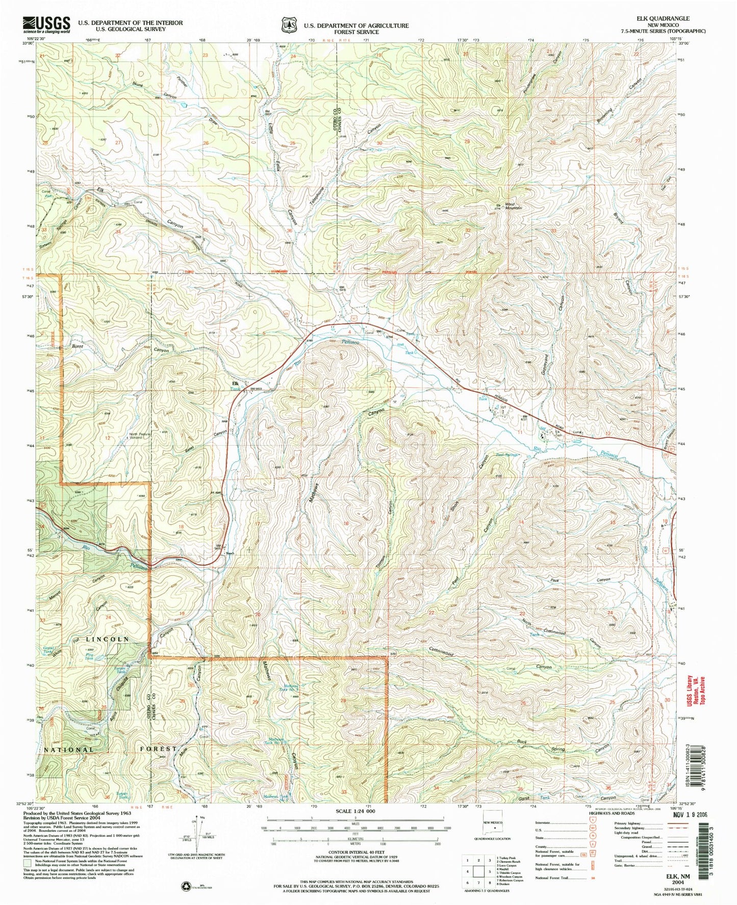
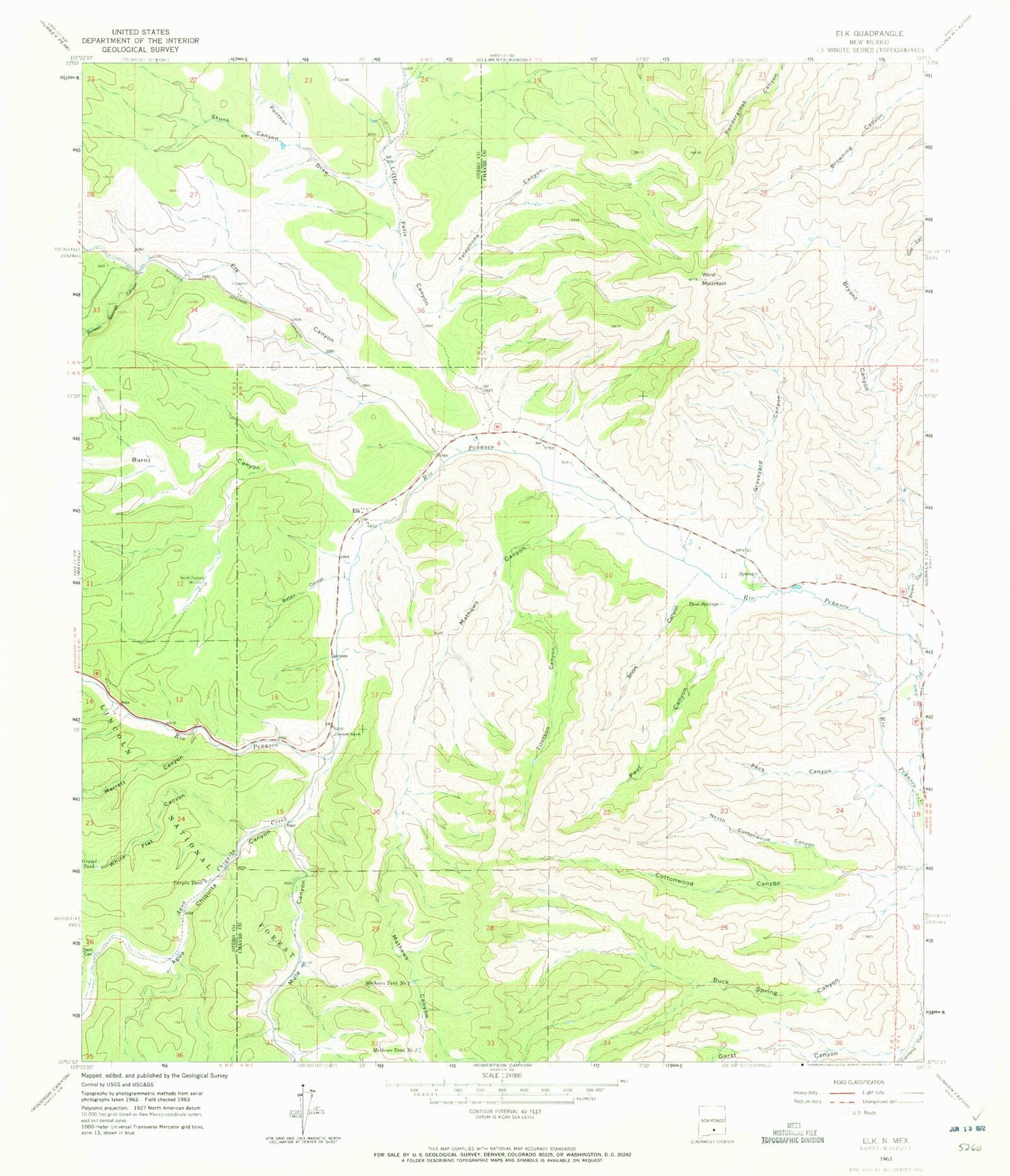
MyTopo
Classic USGS Elk New Mexico 7.5'x7.5' Topo Map
Couldn't load pickup availability
Historical USGS topographic quad map of Elk in the state of New Mexico. Map scale may vary for some years, but is generally around 1:24,000. Print size is approximately 24" x 27"
This quadrangle is in the following counties: Chaves, Otero.
The map contains contour lines, roads, rivers, towns, and lakes. Printed on high-quality waterproof paper with UV fade-resistant inks, and shipped rolled.
Contains the following named places: 10356 Water Well, 10357 Water Well, 10358 Water Well, 10359 Water Well, 10360 Water Well, 10361 Water Well, 10362 Water Well, 10636 Water Well, 10637 Water Well, 10638 Water Well, 10639 Water Well, 10640 Water Well, 10641 Water Well, 10642 Water Well, 10643 Water Well, 10644 Water Well, 10645 Water Well, 12770 Water Well, Agua Chiquita Canyon, Agua Chiquita Creek, Bates Canyon, Bryant Canyon, Burnt Canyon, Crockett Ranch, Dam Canyon, Elk, Elk Canyon, Elk Cemetery, Elk Post Office, Elk Weather Station, Garst Canyon, Gravel Tank, Graveyard Canyon, J B Runyan Ranch, Little Felix Canyon, Mathews Canyon, Mathews Tank Number 1, Mathews Tank Number 2, Mathews Tank Number Three, Merrett Canyon, Mule Canyon, North Cottonwood Canyon, North Pasture Windmill, Panther Draw, Paul Canyon, Paul Springs, Peck Canyon, Penasco Volunteer Fire Department Station 2, Pine Tank, Short Canyon, Sixteen Springs Canyon, Skunk Canyon, Telephone Canyon, Tilotson Canyon, Turpin Tank, White Flat Canyon, Wind Mountain