MyTopo
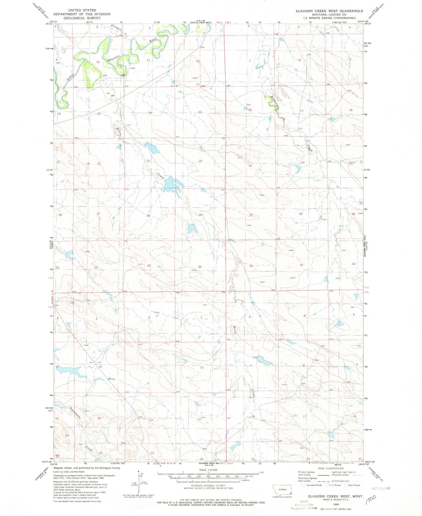
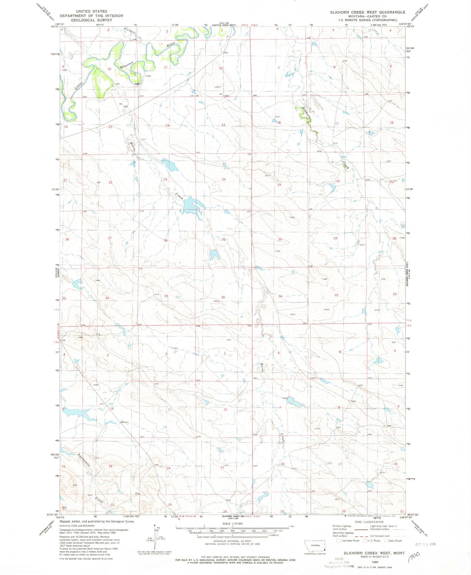
Classic USGS Elkhorn Creek West Montana 7.5'x7.5' Topo Map
Regular price
$16.95
Regular price
Sale price
$16.95
Unit price
per
Couldn't load pickup availability
Historical USGS topographic quad map of Elkhorn Creek West in the state of Montana. Map scale may vary for some years, but is generally around 1:24,000. Print size is approximately 24" x 27"
This quadrangle is in the following counties: Carter.
The map contains contour lines, roads, rivers, towns, and lakes. Printed on high-quality waterproof paper with UV fade-resistant inks, and shipped rolled.
Contains the following named places: 07S61E01DCAB01 Well, 07S61E10CDDA01 Well, 08S61E13DDDA01 Well, Blacktail Creek, Courtney Herefords Number 3 Dam, Horse Creek, J Oliver Number 1 Dam, J Oliver Reservoir, Little Boy Blue Dam