MyTopo
Classic USGS Elkhorn Wisconsin 7.5'x7.5' Topo Map
Couldn't load pickup availability
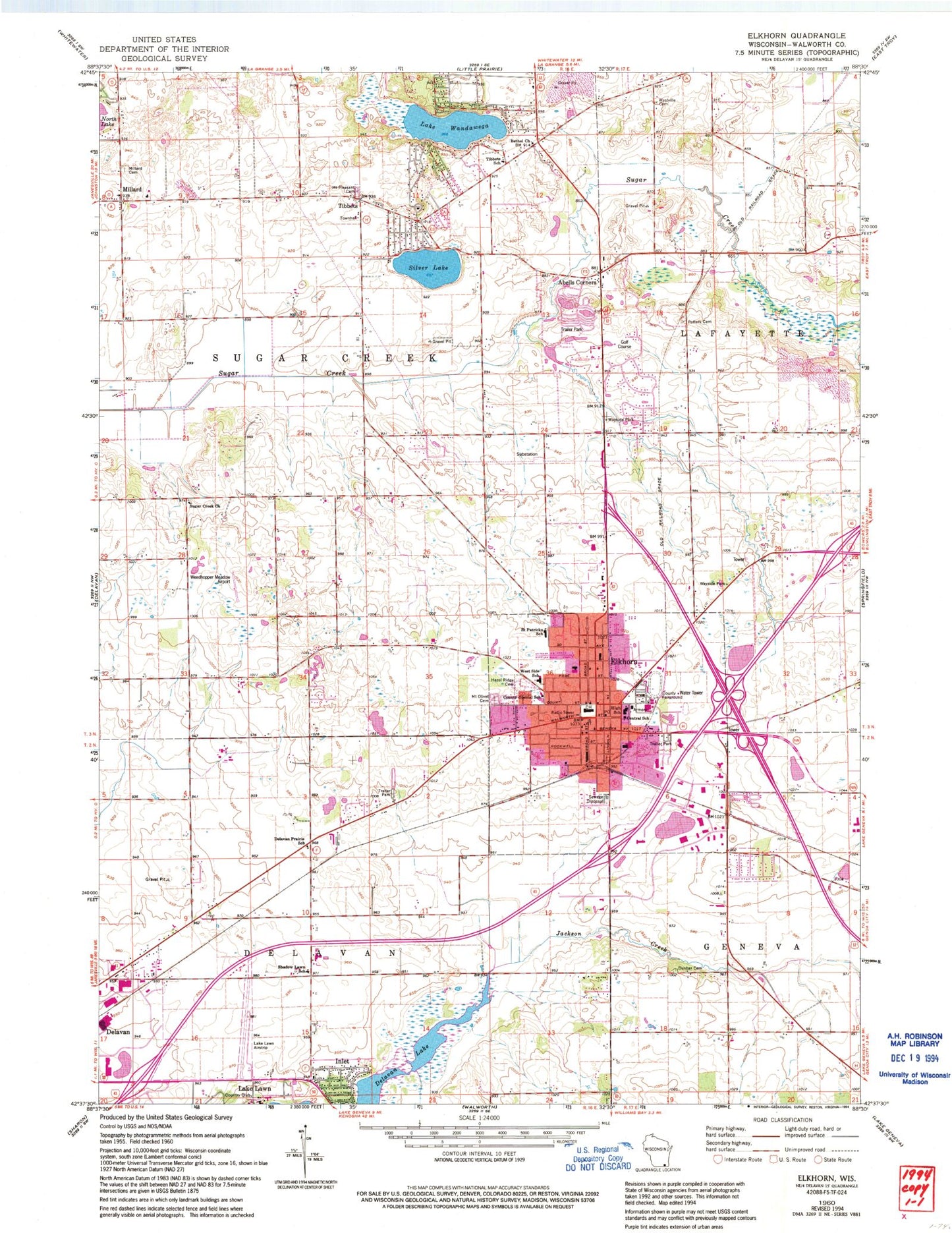
Historical USGS topographic quad map of Elkhorn in the state of Wisconsin. Map scale may vary for some years, but is generally around 1:24,000. Print size is approximately 24" x 27"
This quadrangle is in the following counties: Walworth.
The map contains contour lines, roads, rivers, towns, and lakes. Printed on high-quality waterproof paper with UV fade-resistant inks, and shipped rolled.
Contains the following named places: Abells Corners, Apple Barn Orchard And Winery, Bethel United Methodist Church, Career and College Academy, City of Elkhorn, Columbus Hall, Congdon Pond, Delavan Prairie School, Dunbar Cemetery, Elkhorn, Elkhorn Area Fire Department, Elkhorn Area High School, Elkhorn Area Middle School, Elkhorn City Hall, Elkhorn Lake, Elkhorn Police Department, Elkhorn Post Office, First Baptist Church, First Congregational Church, First Evangelical Lutheran Church, First Lutheran School, First United Methodist Church, Hartwell Cemetery, Hazel Ridge Cemetery, Inlet, Jackson Creek, Jackson Elementary School, Lake Lawn, Lake Lawn Airport, Lake Wandawega, Land O Lakes Mobile Home Park, Matheson Memorial Library, Millard, Millard Cemetery, Millard Community Church, Mount Olivet Cemetery, Mount Pleasant Cemetery, Paddock Field, Paddock Pit, Pecks Station, Saint John in the Wilderness Episcopal Church, Saint Johns Lutheran Church, Saint Patrick Parish School, Saint Patricks Catholic Church, Shadow Lawn School, Silver Lake, Sprague Theater, Sugar Creek Lutheran Cemetery, Sugar Creek Lutheran Church, Tibbets, Tibbets Elementary School, Town of Sugar Creek, Walworth County, Walworth County Courthouse, Walworth County Fair Grounds, Weedhopper Meadow Airport, West Side Elementary School, Westville Cemetery, ZIP Code: 53121