MyTopo
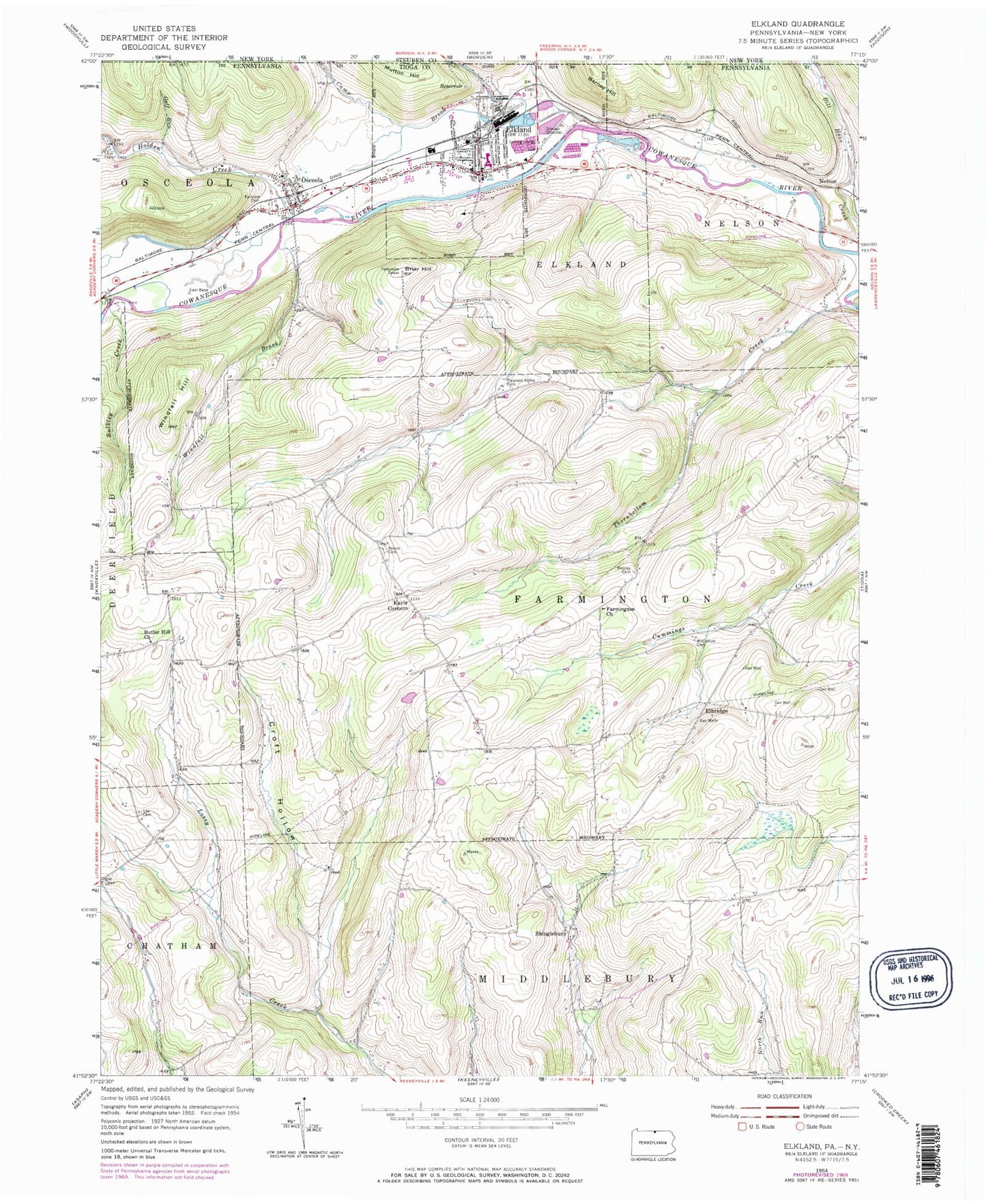
Classic USGS Elkland Pennsylvania 7.5'x7.5' Topo Map
Couldn't load pickup availability
Historical USGS topographic quad map of Elkland in the states of Pennsylvania, New York. Map scale may vary for some years, but is generally around 1:24,000. Print size is approximately 24" x 27"
This quadrangle is in the following counties: Steuben, Tioga.
The map contains contour lines, roads, rivers, towns, and lakes. Printed on high-quality waterproof paper with UV fade-resistant inks, and shipped rolled.
Contains the following named places: Baker Airport, Barney Hill, Borough of Elkland, Briar Hill, Bulkley Creek, Butler Hill Cemetery, Butler Hill Church, Camp Brook, Clark Wood Elementary School, Croft Hollow, East Chatham, Elbridge, Elkland, Elkland Area High School, Elkland Boro Courthouse, Elkland Boro Police Department, Elkland Boro Volunteer Fire Department, Elkland Library, Elkland Police Department, Elkland Post Office, Fairview Cemetery, Farmington Church, Free Methodist Church, Gulf Run, Highland Cemetery, Holden Creek, Jehovah's Witness Kingdom Hall, Karls Corners, Lee Cemetery, McCollum Cemetery, Mourey Cemetery, Mutton Hill, Odle Corners, Osceola, Osceola Post Office, Osceola Presbyterian Church, Osceola Township Police Department, Osceola United Methodist Church, Osceola Volunteer Fire Department, Peters Cemetery, Pleasant Valley Cemetery, Redhouse Run, Saint Thomas the Apostle Church, Shinglebury, Taylor Cemetery, Thornbottom Creek, Township of Elkland, Township of Farmington, Township of Nelson, Township of Osceola, United Christian Ministries Church, United Methodist Church, Valley Community Ambulance Association, Westly Chapel, Windfall Brook, Windfall Hill, ZIP Codes: 16920, 16935, 16942