MyTopo
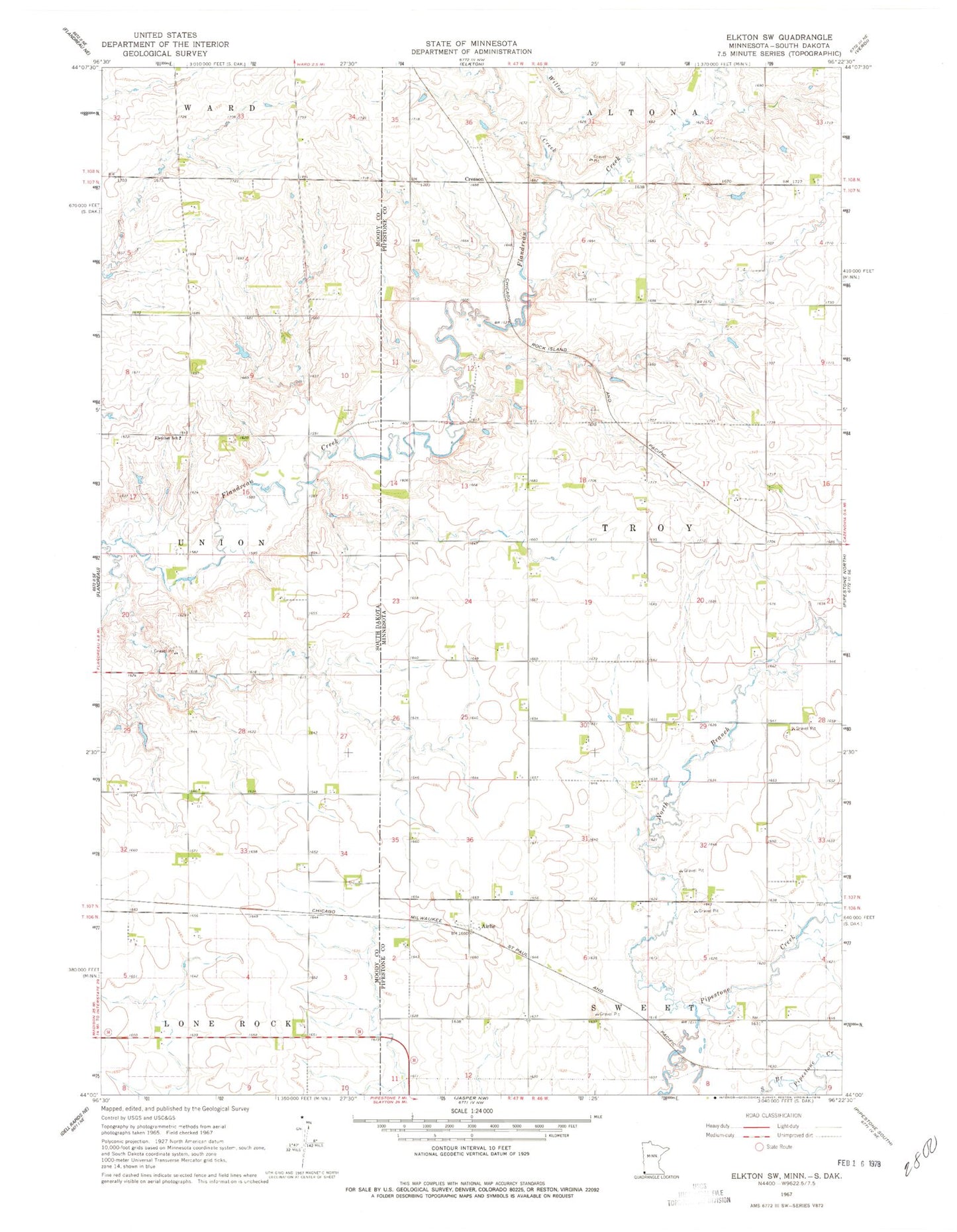
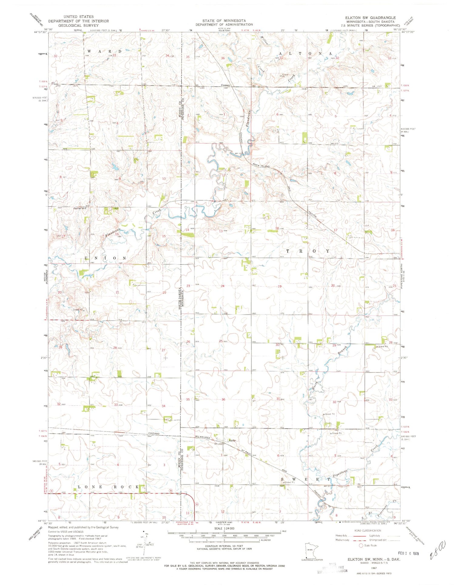
Classic USGS Elkton SW Minnesota 7.5'x7.5' Topo Map
Couldn't load pickup availability
Historical USGS topographic quad map of Elkton SW in the states of Minnesota, South Dakota. Map scale may vary for some years, but is generally around 1:24,000. Print size is approximately 24" x 27"
This quadrangle is in the following counties: Moody, Pipestone.
The map contains contour lines, roads, rivers, towns, and lakes. Printed on high-quality waterproof paper with UV fade-resistant inks, and shipped rolled.
Contains the following named places: Airlie, Airlie Post Office, Cottonwood Angus Farms, Cresson, Eagle Island, Fletcher School, North Branch Pipestone Creek, Pleasant Valley Colony, Pleasant Valley Colony Census Designated Place, Pleasant Valley Colony Elementary School, State Line Wayside Park, Township of Troy, Township of Union, Willow Creek