MyTopo
Classic USGS Elkton Michigan 7.5'x7.5' Topo Map
Couldn't load pickup availability
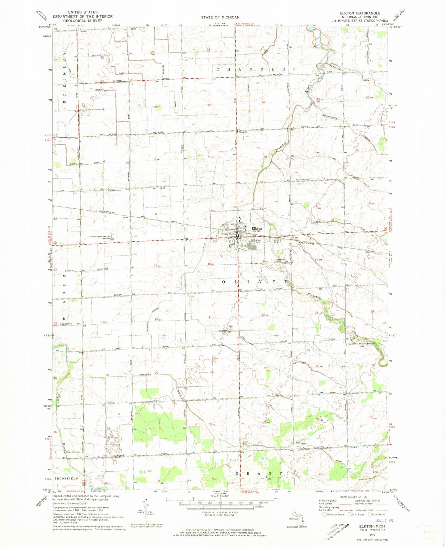
Historical USGS topographic quad map of Elkton in the state of Michigan. Map scale may vary for some years, but is generally around 1:24,000. Print size is approximately 24" x 27"
This quadrangle is in the following counties: Huron.
The map contains contour lines, roads, rivers, towns, and lakes. Printed on high-quality waterproof paper with UV fade-resistant inks, and shipped rolled.
Contains the following named places: Beaubien Drain, Bechler Drain, Century Oaks Golf Course, Elkton, Elkton Church, Elkton Drain, Elkton Fair Drain, Elkton Family Medicine Clinic, Elkton Police Department, Elkton Post Office, Elkton Station, Elkton United Methodist Church, Fluegge Drain, Fritz Farms, Grant Cemetery, Hill Drain, Kasserman Farms, Laker Elementary School, Laker High School, Nettle Run, Oliver Drain, Oliver Township Fire Department, Renn Farms, Riverside Cemetery, Schuette Dairy Farm, Schultz Drain, Silver Creek, Squarno Drain, Township of Oliver, Trinity Evangelical Lutheran Church, Village of Elkton, Wesleyan Church, Whipple Tree Farm, Wolfton Post Office, ZIP Codes: 48731, 48755