MyTopo
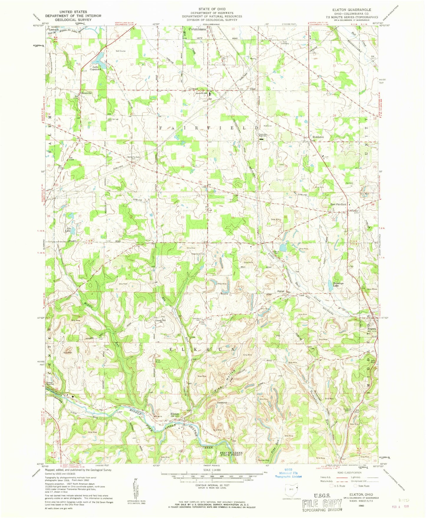
Classic USGS Elkton Ohio 7.5'x7.5' Topo Map
Couldn't load pickup availability
Historical USGS topographic quad map of Elkton in the state of Ohio. Map scale may vary for some years, but is generally around 1:24,000. Print size is approximately 24" x 27"
This quadrangle is in the following counties: Columbiana.
The map contains contour lines, roads, rivers, towns, and lakes. Printed on high-quality waterproof paper with UV fade-resistant inks, and shipped rolled.
Contains the following named places: Als Lake, Bethel - Fairfield Cemetery, Bowman Cemetery, Church Hill Cemetery, Church Hill Church, Cool Springs Cemetery, Copeland Hills Golf Course, East Fairfield, East Fairfield Post Office, East Fairfield United Methodist Church, Elk Run, Elkrun Cemetery, Elkton, Elkton Post Office, Federal Correctional Institution Elkton, Hays Orchard, Heston, Hum Cemetery, Kembles Cemetery, Lake Copeland, Lake Copeland Dam, Middle Run, Middleton, Mints Pine Acres Lake Dam, Newhouse, Ohio State Highway Patrol - Lisbon Patrol Post, Peterson Pond, Peterson Pond Dam, Pine Hollow, Rogers, Rogers Post Office, Saratoga, Shiveleys Lake, Signal, Signal Post Office, Sunshine Mobile Home Park, Township of Elkrun, Township of Fairfield, Unionville, Unkefer Dairy Farn, Village of Rogers, York Aerodrome, Zeppernick Cemetery, ZIP Code: 44431