MyTopo
Classic USGS Elkville Illinois 7.5'x7.5' Topo Map
Couldn't load pickup availability
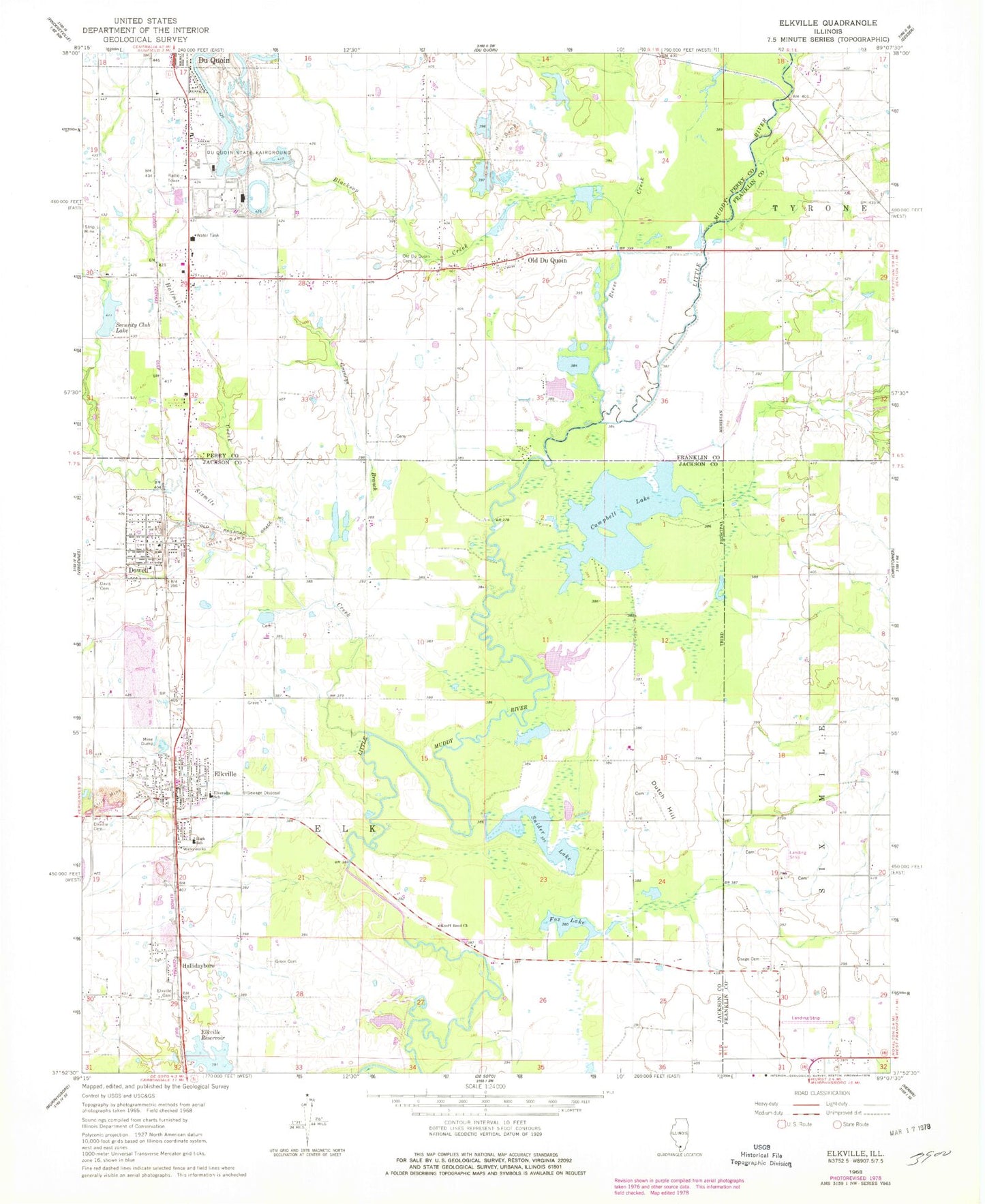
Historical USGS topographic quad map of Elkville in the state of Illinois. Map scale may vary for some years, but is generally around 1:24,000. Print size is approximately 24" x 27"
This quadrangle is in the following counties: Franklin, Jackson, Perry.
The map contains contour lines, roads, rivers, towns, and lakes. Printed on high-quality waterproof paper with UV fade-resistant inks, and shipped rolled.
Contains the following named places: Adams Private Airport, Arkansas School, Blacksop Creek, Campbell Lake, Davis Cemetery, Davis Number 1 Cemetery, Davis School, Dowell, Dowell Post Office, Dowell Village Police Department, Dowell Volunteer Fire Department, Du Quoin Number 10 Election Precinct, Du Quoin Number 12 Election Precinct, Du Quoin Number 3 Election Precinct, Du Quoin State Fairground, Duquoin Fire Department Station 2, Dutch Hill, Dutch Hill Cemetery, Elkville, Elkville Cemetery, Elkville Post Office, Elkville Reservoir, Elkville Volunteer Fire Department, Elverado School, Fox Lake, Gill Cemetery, Grannys Branch, Greer Cemetery, Halfmile Creek, Hallidayboro, Hallidayboro Cemetery, Hemmer RLA Airport, Highbank School, Illinois State Police Department District 13, Knoff Bend Church, Lancaster School, North School, Old Du Quoin, Old Du Quoin Cemetery, Osage Cemetery, Purdy School, Reese Creek, Security Club Lake, Sixmile Creek, Snider Lake, South School, Township of Elk, Village of Dowell, Village of Elkville, ZIP Codes: 62927, 62932