MyTopo
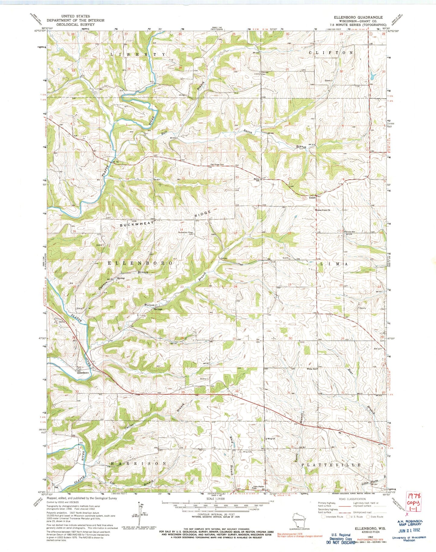
Classic USGS Ellenboro Wisconsin 7.5'x7.5' Topo Map
Couldn't load pickup availability
Historical USGS topographic quad map of Ellenboro in the state of Wisconsin. Map scale may vary for some years, but is generally around 1:24,000. Print size is approximately 24" x 27"
This quadrangle is in the following counties: Grant.
The map contains contour lines, roads, rivers, towns, and lakes. Printed on high-quality waterproof paper with UV fade-resistant inks, and shipped rolled.
Contains the following named places: Bacon Branch, Baker Ford Bridge, Bevan Farms, Bren - Mar Farms, Buck Wheat Ridge Cemetery, Buckwheat Farm, Buckwheat Ridge, Bull Branch, Cannon Branch, Culver Branch, Ellenboro, Fairview Cemetery, Hall Farm, Henry School, Lee Branch, Lima-Union Church, Martin Fierro Airport, Nobland Farms, Oak Ridge Cemetery, Pheasant Ridge Farm, Shea Dairy, Town of Ellenboro, Triple H Farm, Twin Platte School, Union, Union School, Whig Cemetery, Whig Church, White School, Willow Branch, Wilsons Creek