MyTopo
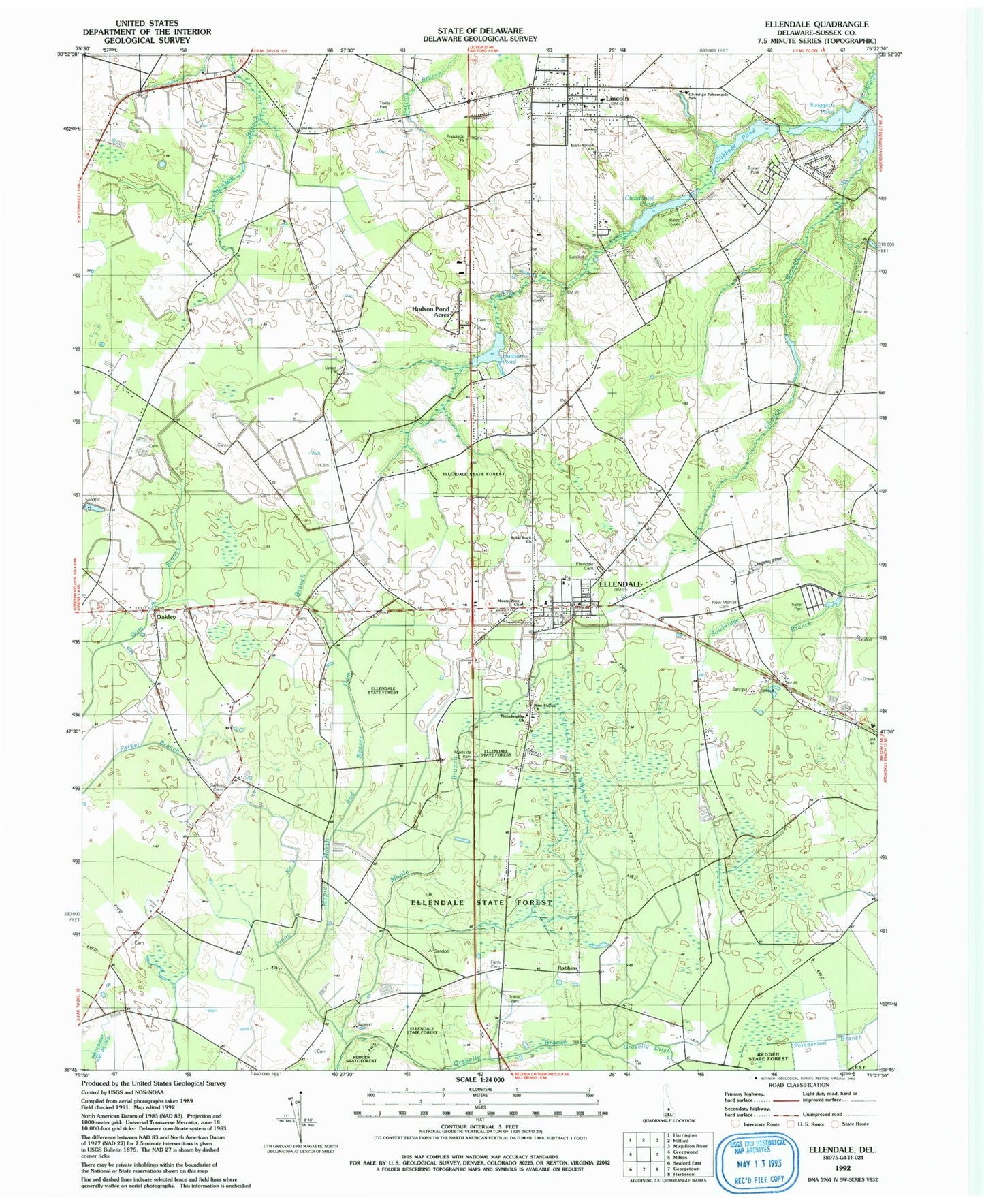
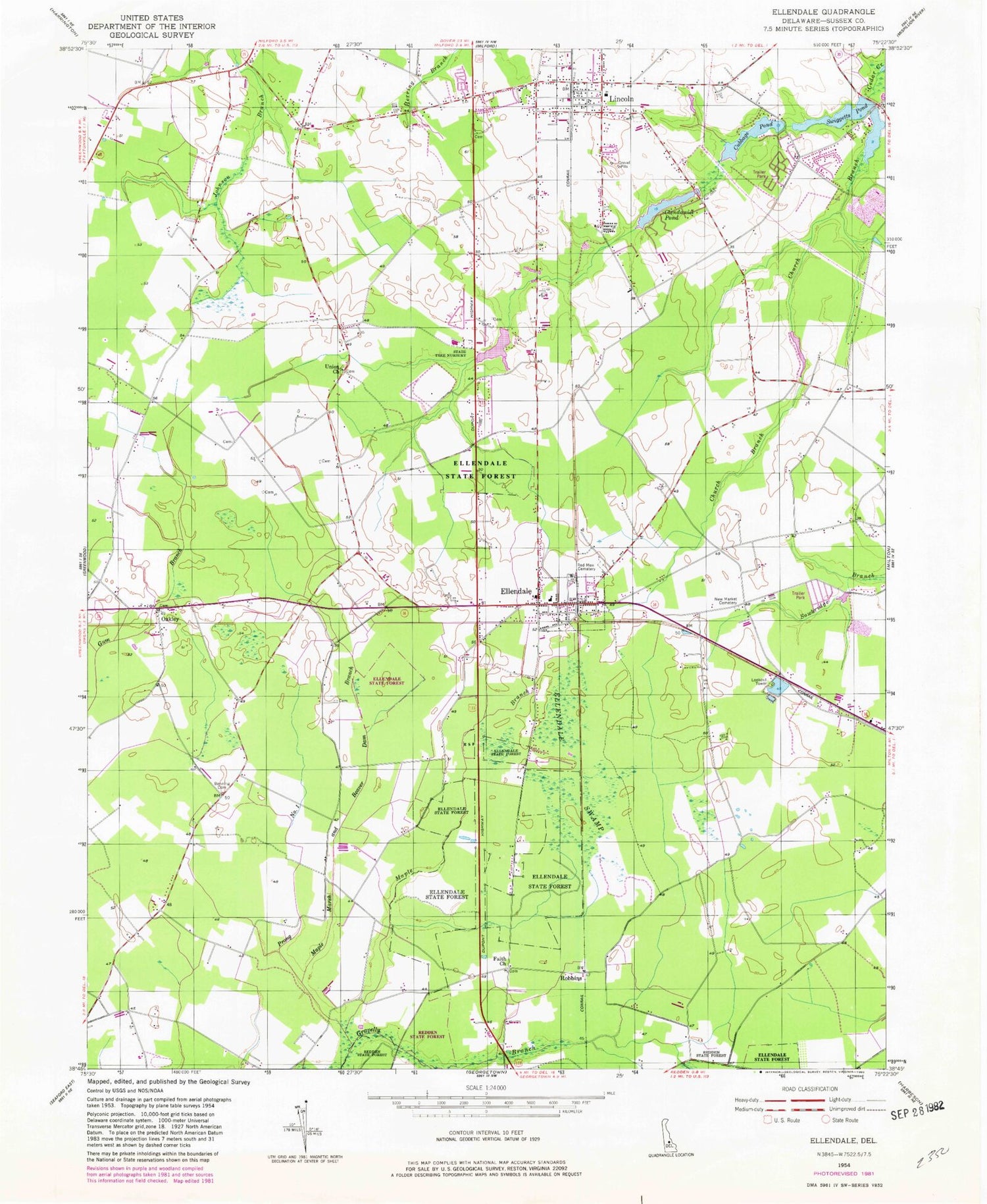
Classic USGS Ellendale Delaware 7.5'x7.5' Topo Map
Couldn't load pickup availability
Historical USGS topographic quad map of Ellendale in the state of Delaware. Map scale may vary for some years, but is generally around 1:24,000. Print size is approximately 24" x 27"
This quadrangle is in the following counties: Sussex.
The map contains contour lines, roads, rivers, towns, and lakes. Printed on high-quality waterproof paper with UV fade-resistant inks, and shipped rolled.
Contains the following named places: Banning Cemetery, Christian Tabernacle, Christian Tabernacle Academy, Church Branch, Church Tabernacle, Clendaniel Pond, Clendaniel Pond Dam, Cubbage Pond, Cubbage Pond Dam, Ellendale, Ellendale Cemetery, Ellendale Police Department, Ellendale Post Office, Ellendale State Forest, Ellendale Swamp, Ellendale Town Hall, Ellendale Volunteer Fire Company, Faith Cemetery, Faith Church, Federalsburg, Gravelly Ditch, Greentop, Hilltop Acres, Holly Hill, Hudson Pond, Hudson Pond Acres, Kent - Sussex Detoxification Center, Lincoln, Lincoln Census Designated Place, Lincoln Post Office, Lincoln United Methodist Church, Lincoln Village, Little Union Baptist Church, Maple Branch, Maple Marsh and Beaver Dam Branch, Metropolitan United Methodist Church, Mount Zion African Methodist Episcopal Church, New Market, New Market Cemetery, New Market Village Mobile Home Park, New Shiloh F B H Church of God, Oakley, Oakley Church, Philadelphia Pentecostal Holiness Church, Pondside Acres, Prong Number One, Robbins, Solid Rock Church, Sussex Woods, Swiggetts Pond, Swiggetts Pond Dam, Tessie-Maringola Estates, The United Methodist Church, Town of Ellendale, Union Church, Walkers Acres, ZIP Codes: 19941, 19960