
MyTopo
Classic USGS Ellenton Georgia 7.5'x7.5' Topo Map
Couldn't load pickup availability
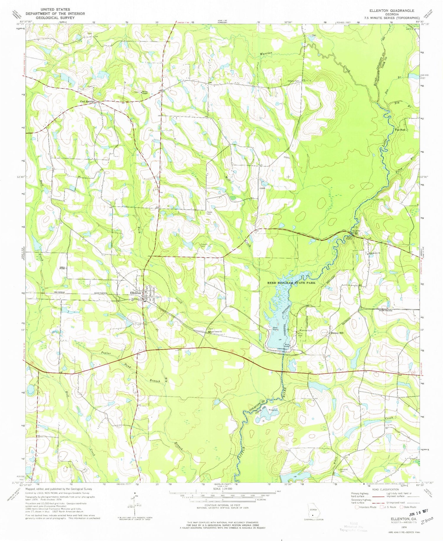
Historical USGS topographic quad map of Ellenton in the state of Georgia. Map scale may vary for some years, but is generally around 1:24,000. Print size is approximately 24" x 27"
This quadrangle is in the following counties: Colquitt, Cook.
The map contains contour lines, roads, rivers, towns, and lakes. Printed on high-quality waterproof paper with UV fade-resistant inks, and shipped rolled.
Contains the following named places: Baker Cemetery, Bayboro, Bayboro School, Berlin-Ellenton Division, Big Branch, Buck Creek, Buck Creek Church, Burney Hill, Colquitt County Volunteer Firefighters Association Fire Station 71 Ellenton, Cool Springs, Cool Springs Church, Doe Branch, Ellenton, Ellenton Post Office, Evergreen Church, Flat Branch, Flat Ford, Folsom Cemetery, Grist Lake, Grist Lake Dam, Gum Creek, Lone Star School, Mill Creek, Nola, Oak Grove School, Pervis Lake, Pervis Lake Dam, Poley Branch, Poplar Head Branch, Reed Bingham Park Lake, Reed Bingham Park Lake Dam, Reed Bingham State Park, Rountree Bridge, Saunders Lake, Saunders Lake Dam, Sylvester Cemetery, Town of Ellenton, Vickers Cemetery, Vickers Lake, Vickers Lake Dam, Warrior Creek, Weeks Chapel, Whitehurst Bridge, ZIP Code: 31747


