
MyTopo
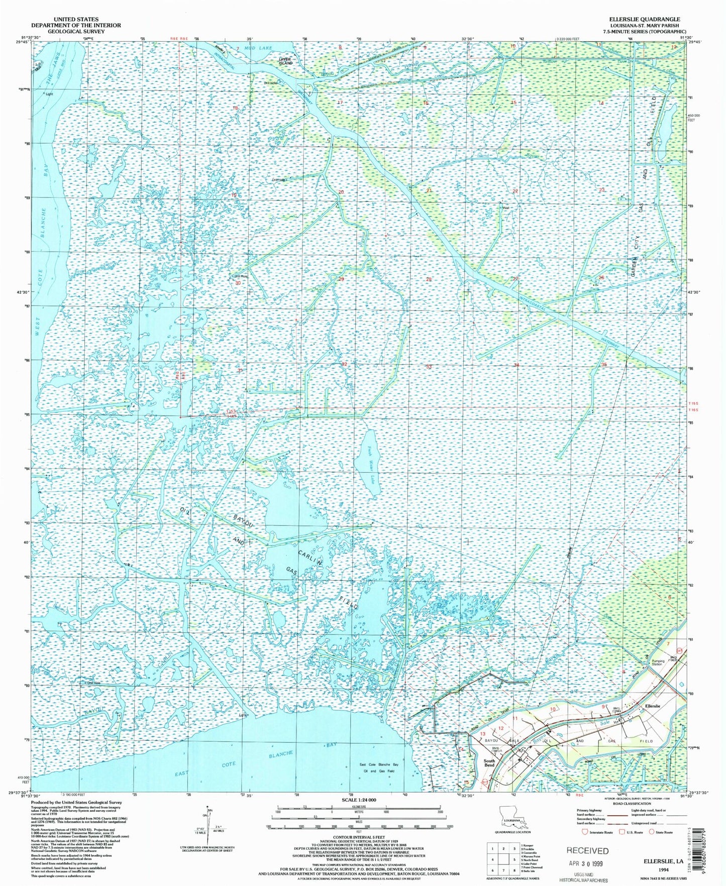
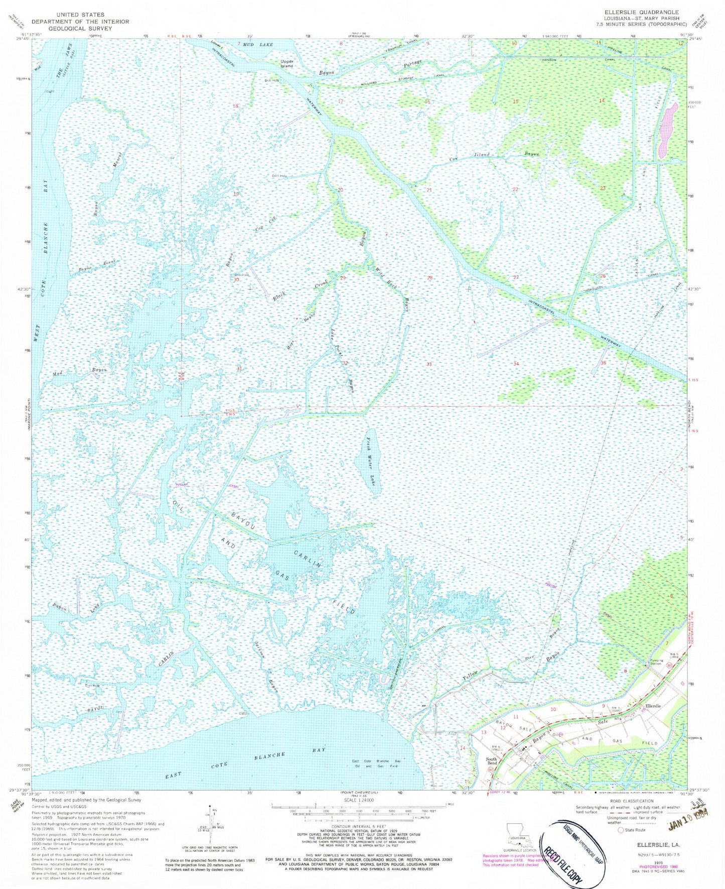
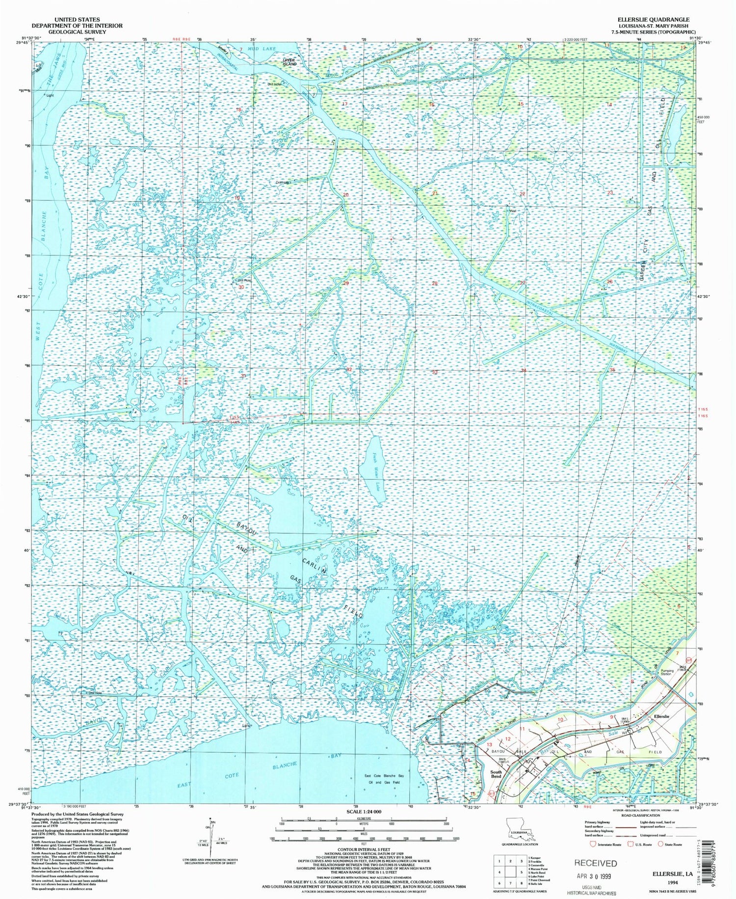
Classic USGS Ellerslie Louisiana 7.5'x7.5' Topo Map
Couldn't load pickup availability
Historical USGS topographic quad map of Ellerslie in the state of Louisiana. Map scale may vary for some years, but is generally around 1:24,000. Print size is approximately 24" x 27"
This quadrangle is in the following counties: St. Mary.
The map contains contour lines, roads, rivers, towns, and lakes. Printed on high-quality waterproof paper with UV fade-resistant inks, and shipped rolled.
Contains the following named places: Bayou Carlin, Bayou Carlin Oil and Gas Field, Bayou Cop Cop, Bayou Long, Bayou Mascot, Bayou Portage, Bayou Zenor, Black Crook Bayou, British-American Canal, Cow Island Bayou, Ellerslie, Fresh Water Lake, Hanson Canal, Jackson Bayou, Jaws Bay, Lake Point Bayou, Moss Bayou, Mud Bayou, Rice Bayou, South Bend, Thorguson Canal, Upper Island, Wild Buck Bayou, Williams Storage Canal, Yellow Bayou