MyTopo
Classic USGS Ellery Center New York 7.5'x7.5' Topo Map
Couldn't load pickup availability
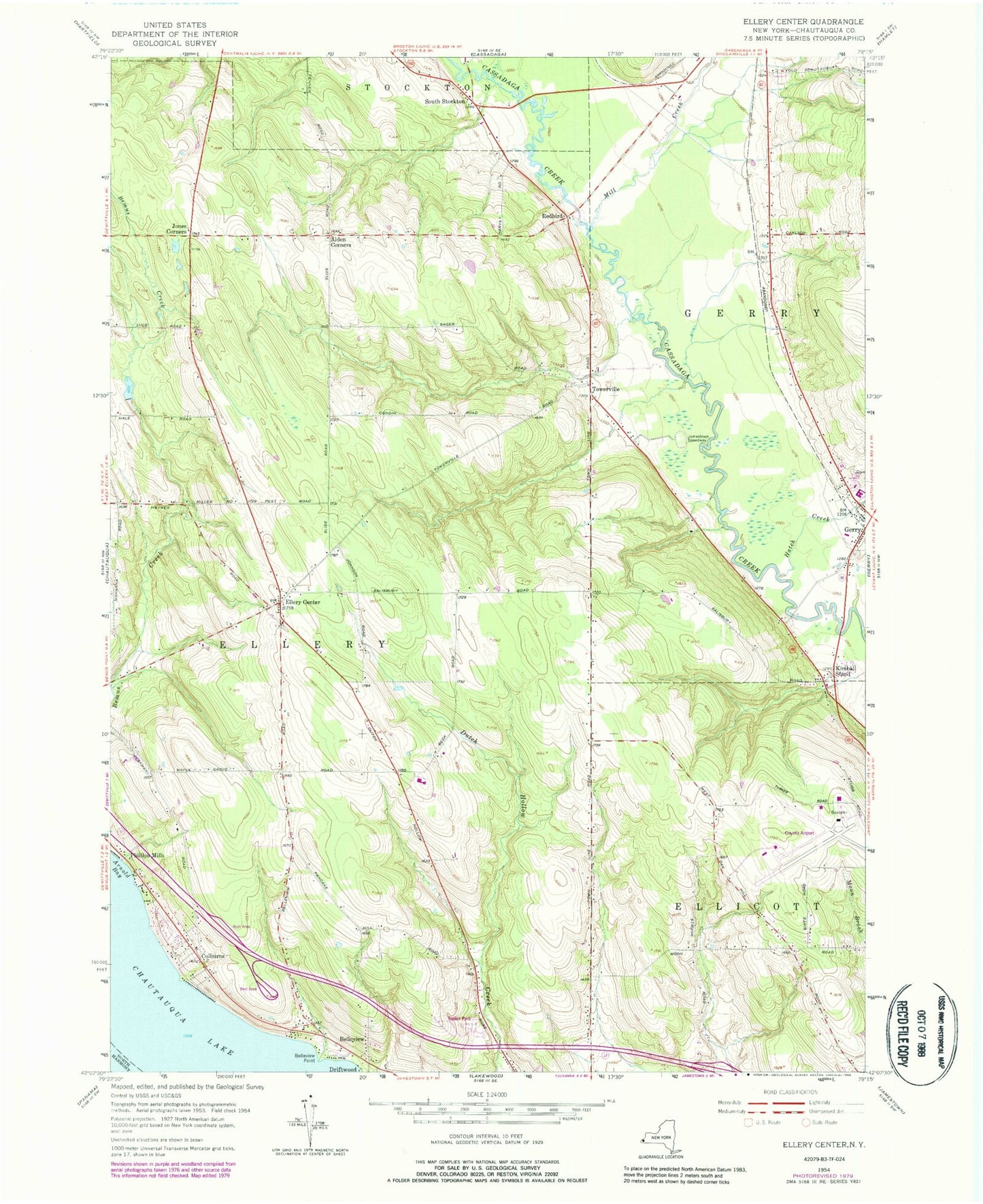
Historical USGS topographic quad map of Ellery Center in the state of New York. Typical map scale is 1:24,000, but may vary for certain years, if available. Print size: 24" x 27"
This quadrangle is in the following counties: Chautauqua.
The map contains contour lines, roads, rivers, towns, and lakes. Printed on high-quality waterproof paper with UV fade-resistant inks, and shipped rolled.
Contains the following named places: Arnold Bay, Belleview, Belleview Point, Colburns, Ellery Center, Hatch Creek, Jones Corners, Kimball Stand, Mill Creek, Phillips Mills, South Stockton, Towerville, Redbird, Jamestown Speedway, Chautauqua County/Jamestown Airport, Town of Ellery, Chautauqua County Landfill, Peterson Farm, Gerry Cemetery, Red Bird Cemetery, Bergquist Adult Home, Ellery Baptist Church, Free Methodist Church of Gerry, Saint Timothy Lutheran Church, Maple Grove Junior - Senior High School, Ellery Center Volunteer Fire Department, Wolcott Dairy, New York State Police Troop A Zone 3 Ellery Station