MyTopo
Classic USGS Ellicottville New York 7.5'x7.5' Topo Map
Couldn't load pickup availability
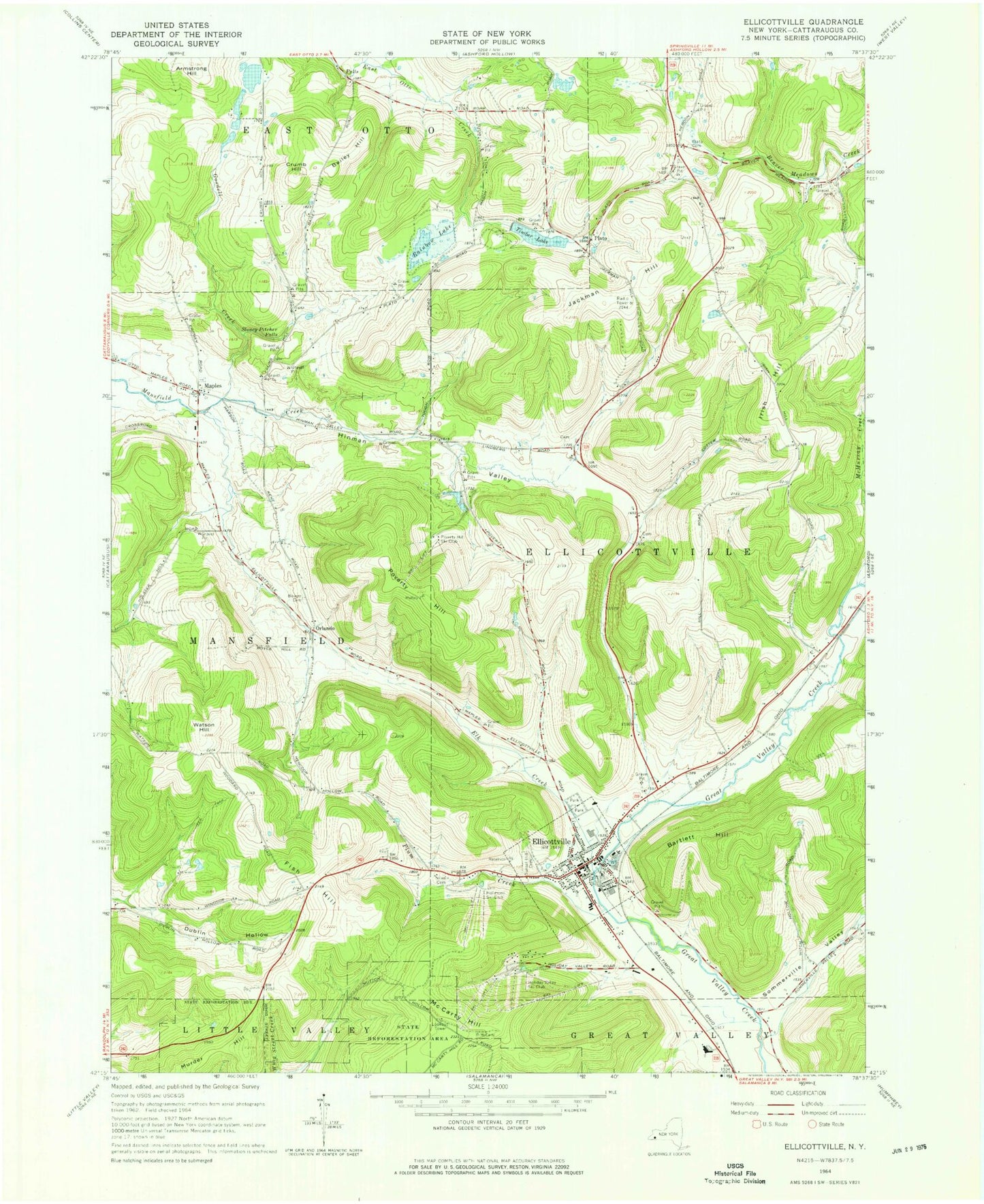
Historical USGS topographic quad map of Ellicottville in the state of New York. Map scale may vary for some years, but is generally around 1:24,000. Print size is approximately 24" x 27"
This quadrangle is in the following counties: Cattaraugus.
The map contains contour lines, roads, rivers, towns, and lakes. Printed on high-quality waterproof paper with UV fade-resistant inks, and shipped rolled.
Contains the following named places: Armstrong Hill, Bailey Hill, Bartlett Hill, Bowen Cemetery, Crumb Hill, Elk Creek, Ellicottville, Ellicottville / Great Valley Ambulance Service, Ellicottville Elementary School, Ellicottville Fire Department, Ellicottville Memorial Library, Ellicottville Middle High School, Ellicottville Police Department, Ellicottville Post Office, Ellicottville School, Ellicottville Town Hall, First Methodist Episcopal Church, Fish Hill, Goodell Creek, Hinman Valley, Holiday Valley Ski Club, Holimont Ski Club, Holy Cross Cemetery, Holy Name of Mary Roman Catholic Church, Irish Hill, Jackman Hill, Jefferson Street Cemetery, Mansfield Volunteer Fire Company, Maples, Maples Cemetery, McCarty Hill, McMurray Creek, Murder Hill, New York State Police Troop A Zone 4 Ellicottville Station, Niles Cemetery, Orlando, Plato, Plum Creek, Poverty Hill, Poverty Hill Ski Club, Rainbow Lake, Saint John's Episcopal Church, Saint Pauls Lutheran Cemetery, Saint Paul's Lutheran Church, Sommerville Valley, Stoney Pitcher Falls, Sunset Hill Cemetery, Timber Lake, Town of Ellicottville, Union Public School, United Church of Ellicottville, Village of Ellicottville, Watson Hill, Zion Evangelical Church, ZIP Code: 14731