MyTopo
Classic USGS Ellinwood Kansas 7.5'x7.5' Topo Map
Couldn't load pickup availability
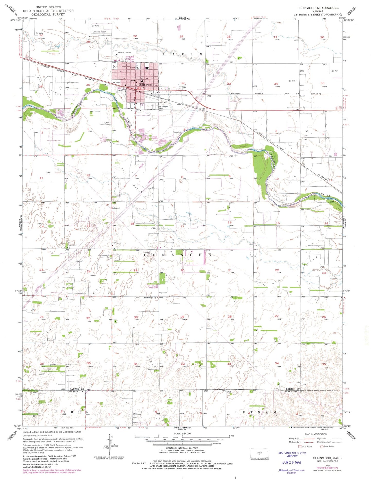
Historical USGS topographic quad map of Ellinwood in the state of Kansas. Map scale may vary for some years, but is generally around 1:24,000. Print size is approximately 24" x 27"
This quadrangle is in the following counties: Barton, Stafford.
The map contains contour lines, roads, rivers, towns, and lakes. Printed on high-quality waterproof paper with UV fade-resistant inks, and shipped rolled.
Contains the following named places: Calvary Baptist Church, City of Ellinwood, Ellinwood, Ellinwood City Hall, Ellinwood District Hospital, Ellinwood Emergency Medical Services, Ellinwood Fire Department, Ellinwood First Baptist Church, Ellinwood Grade School, Ellinwood High School, Ellinwood Middle School, Ellinwood Municipal Airport, Ellinwood Police Department, Ellinwood Post Office, Ellinwood School Community Library, Ellinwood United Methodist Church, Ellinwood Wastewater Plant, Great Bend Co - Operative Association Grain Elevator Number 5, Grove Park Golf Course, Immanuel United Church of Christ, Lakin - Comanche Cemetery, Lakin Comanche Cemetery, Pleasant Valley School, Saint John's Lutheran Church, Saint Joseph Catholic School, Saint Joseph's Catholic Church, South Side Mobile Court, Township of Comanche, ZIP Code: 67526