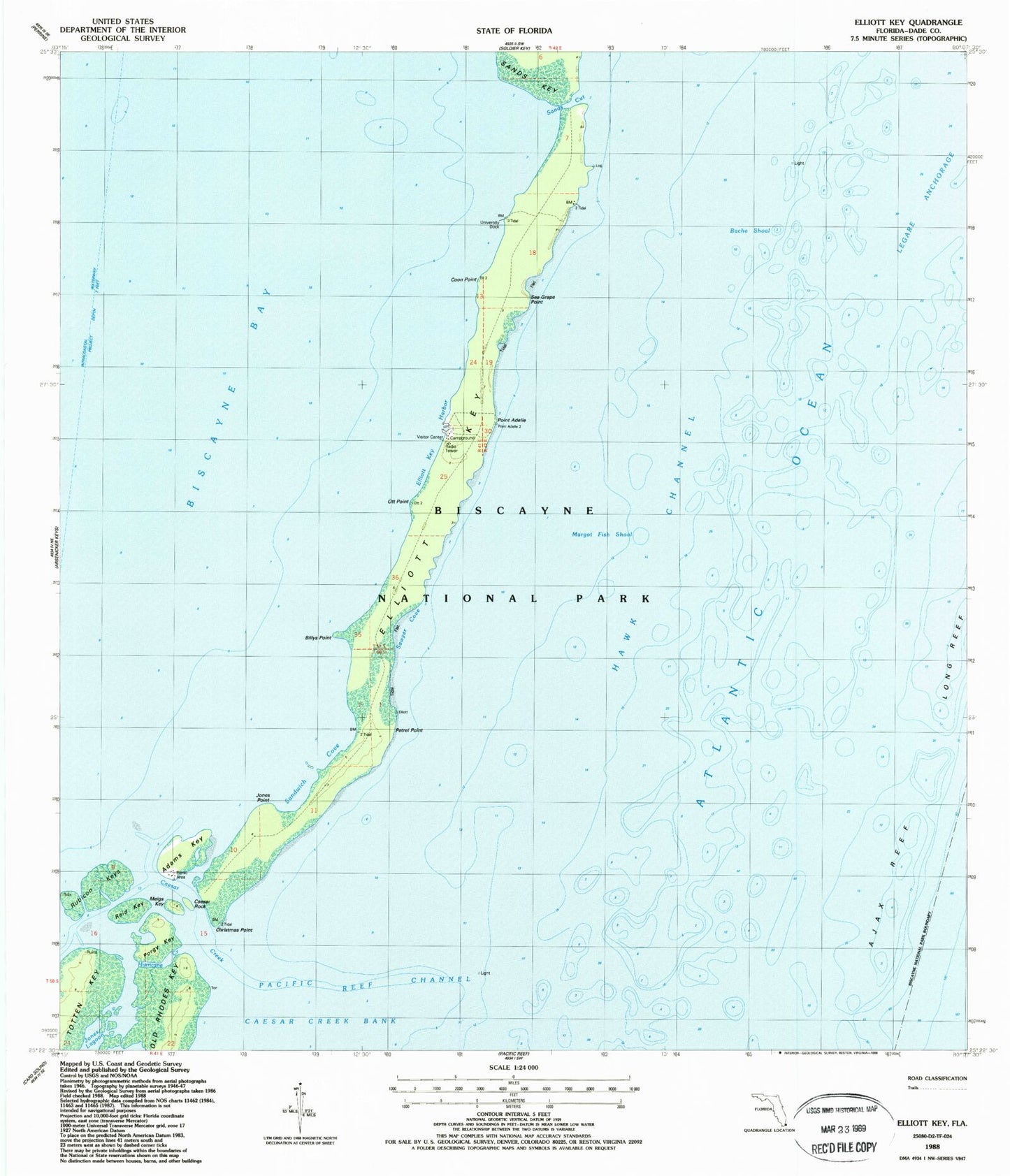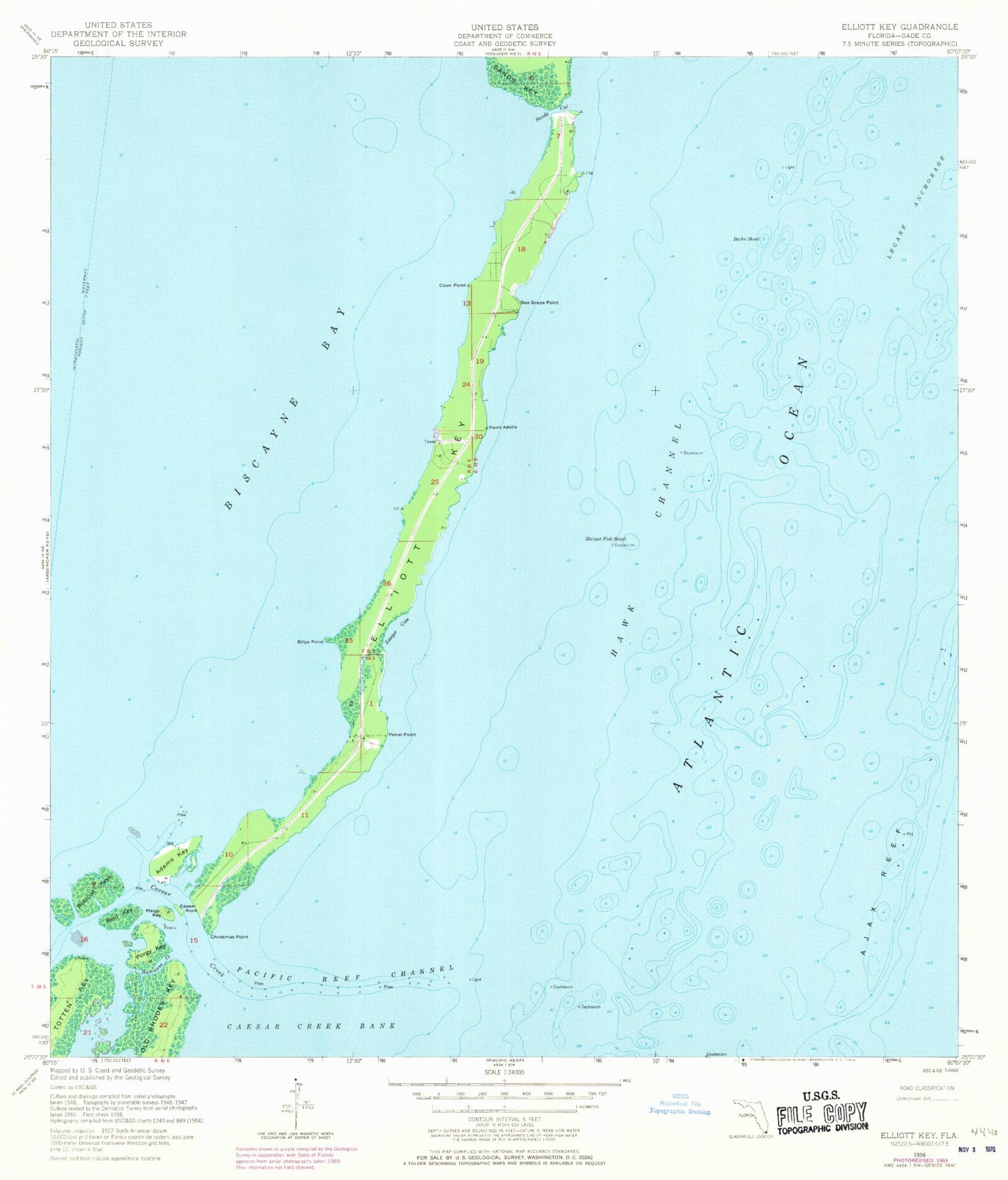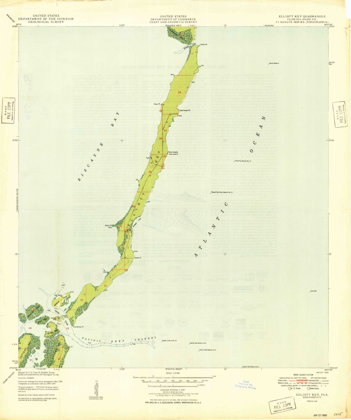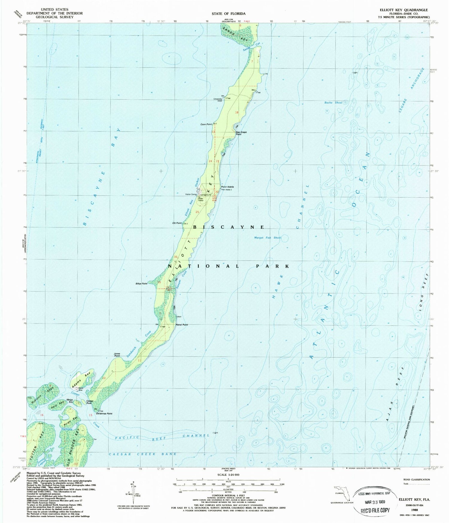

MyTopo
Classic USGS Elliott Key Florida 7.5'x7.5' Topo Map
Couldn't load pickup availability
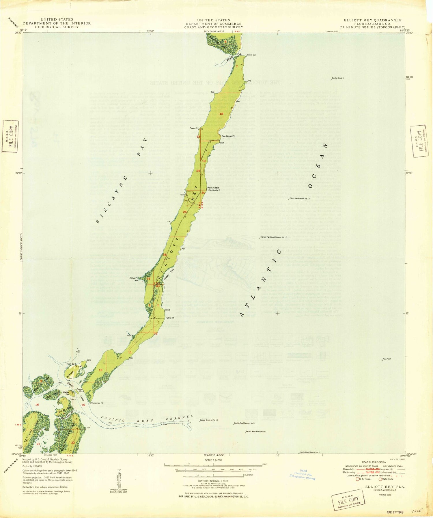
Historical USGS topographic quad map of Elliott Key in the state of Florida. Map scale may vary for some years, but is generally around 1:24,000. Print size is approximately 24" x 27"
This quadrangle is in the following counties: Miami-Dade.
The map contains contour lines, roads, rivers, towns, and lakes. Printed on high-quality waterproof paper with UV fade-resistant inks, and shipped rolled.
Contains the following named places: Adams Key, Ajax Reef, Bache Shoal, Billys Point, Biscayne National Park, Caesar Creek, Caesar Creek Bank, Caesar Rock, Christmas Point, City of Islandia, Coon Point, Elliott Key, Elliott Key Harbor, Elliott Key Park Harbor Light 2, Elliott Key Visitor Center, Hurricane Creek, Jones Point, Legare Anchorage, Log Point, Long Reef, Margot Fish Shoal, Meigs Key, Ott Point, Pacific Reef Channel, Petrel Point, Point Adelle, Porgy Key, Reid Key, Rubicon Keys, Sands Cut, Sandwich Cove, Sawyer Cove, Sea Grape Point, Totten Key, University Dock