MyTopo
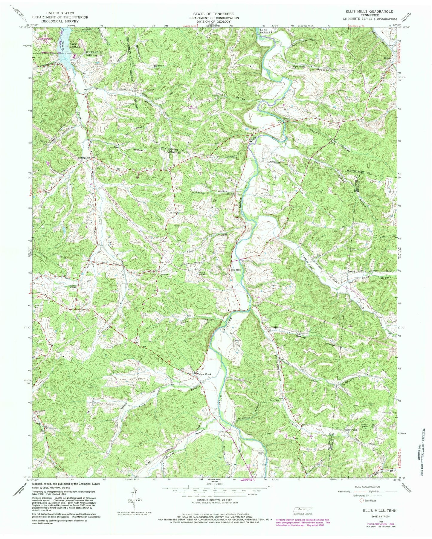
Classic USGS Ellis Mills Tennessee 7.5'x7.5' Topo Map
Couldn't load pickup availability
Historical USGS topographic quad map of Ellis Mills in the state of Tennessee. Map scale may vary for some years, but is generally around 1:24,000. Print size is approximately 24" x 27"
This quadrangle is in the following counties: Dickson, Houston, Montgomery, Stewart.
The map contains contour lines, roads, rivers, towns, and lakes. Printed on high-quality waterproof paper with UV fade-resistant inks, and shipped rolled.
Contains the following named places: Adkins Branch, Albright Cemetery, Averitt Cemetery, Baggett Branch, Bailey Hollow, Beech Grove Church, Boaz Branch, Bushwhacker Hollow, Cave Spring, Cave Spring Branch, Cave Spring School, Commissioner District 7, Coon Hollow, Crossroad Church, District 20, Dortch Chapel, Dry Branch, Dunbar School, Ellis Mills, Ellis Mills Cemetery, Ellis Mills Church, Gin Hollow, Griffin Chapel, Houston County Fire Department Erin Station, Indian Branch, Leatherwood Creek, Lyle Cemetery, Mint Hollow, Moore Branch, Moore Cemetery, Opossum Branch, Oppossum Hollow, Parchman Cemetery, Patterson Chapel, Raney Camp Branch, Raney Camp Hollow, Rye Cemetery, Sailors Rest, Sailors Rest Furnace, Salmon Branch, Shelton Cemetery, Shiloh, Shiloh School, Spring Hill, Spring Hill Church, Spring Hollow, Stony Point, Stony Point School, Story Point Church, Sullivan Branch, Tanbark Hollow, Thorne Hollow, Town Branch, Wallace Hollow, Williamson Branch, Yellow Creek, Yellow Creek High School