MyTopo
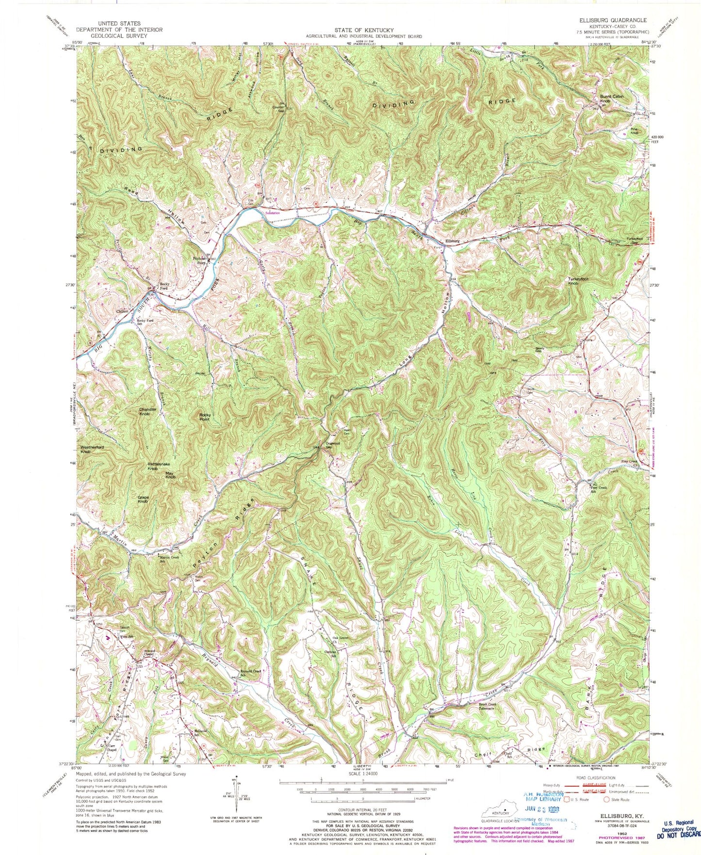
Classic USGS Ellisburg Kentucky 7.5'x7.5' Topo Map
Couldn't load pickup availability
Historical USGS topographic quad map of Ellisburg in the state of Kentucky. Map scale may vary for some years, but is generally around 1:24,000. Print size is approximately 24" x 27"
This quadrangle is in the following counties: Casey.
The map contains contour lines, roads, rivers, towns, and lakes. Printed on high-quality waterproof paper with UV fade-resistant inks, and shipped rolled.
Contains the following named places: Adam Cemetery, Atwood Chapel, Bark Ridge, Brush Creek Tabernacle, Burnt Cabin Knob, Carr Cemetery, Carr Chapel First Church of God, Chandler Knob, Chelf Ridge, Chelf School, Chilton, Chilton Post Office, Cochran School, Coffman Branch, Coulter Gap, Cox Elementary School, Cox Graveyard, Dividing Ridge Division, Dogwood, Dogwood Gap, Dogwood Gap School, Douglas Elementary School, Ellis Branch, Ellis Cemetery, Ellisburg, Ellisburg Baptist Church, Ellisburg Post Office, Ellisburg School, Frey Creek, Frey Creek Church, Frey Creek School, Grape Knob, Gusty Branch, Hill Branch, Horse Lick Creek, Long Hollow, Martin Creek, Martin Creek School, Maxey Valley, May Knob, McDaniel School, Murphy Branch, Neely Gap, Neely Gap School, Neelys Gap, Nuby Post Office, Oak Grove Church, Peyton Branch, Peyton Cemetery, Peyton Ridge, Peytons Store, Pine Knob, Powers Post Office, Pruitt Branch, Rattlesnake Knob, Reed Hollow, Reynold Creek School, Robin Lick Creek, Rocky Ford Post Office, Rocky Ford School, Rocky Point, Shuck Creek, Shuck Creek School, Smith Cemetery, Snake Ridge, Spraggen School, Tabscott Cemetery, Turkeyfoot Gap, Turkeyfoot Knob, Weatherford Knob, Wess School, Wilson Cemetery