MyTopo
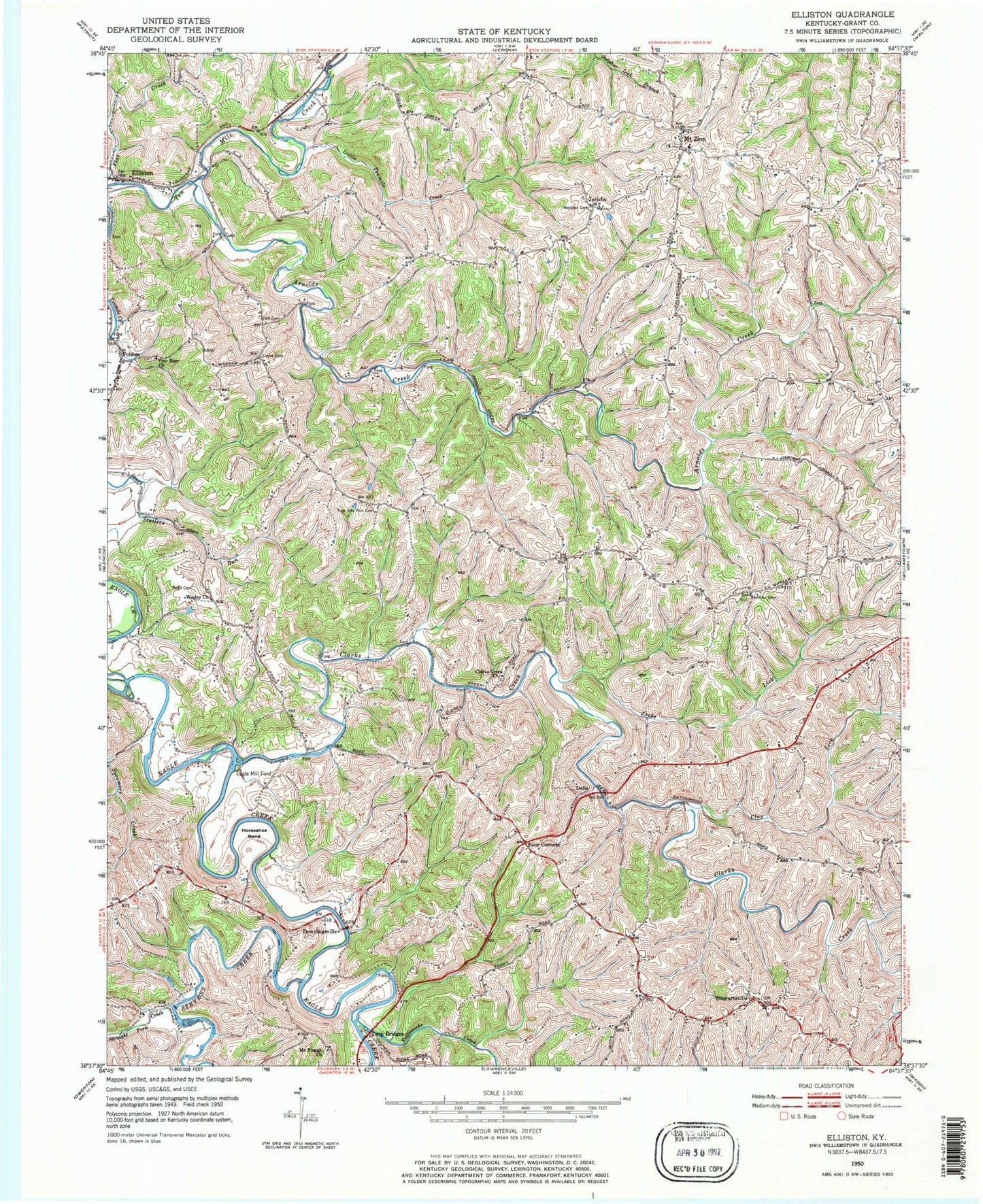
Classic USGS Elliston Kentucky 7.5'x7.5' Topo Map
Couldn't load pickup availability
Historical USGS topographic quad map of Elliston in the state of Kentucky. Map scale may vary for some years, but is generally around 1:24,000. Print size is approximately 24" x 27"
This quadrangle is in the following counties: Grant.
The map contains contour lines, roads, rivers, towns, and lakes. Printed on high-quality waterproof paper with UV fade-resistant inks, and shipped rolled.
Contains the following named places: Arnolds Creek, Childers School, Clarks Creek, Clarks Creek Church, Clay Lick, Delf Cemetery, Delia, Downingsville, Dry Ridge Fire Department Station 2, Eagle Mill Ford, Elliston, Folsom, Four Corners, Horseshoe Bend, Jacks Lick, Jericho, Little Ten Mile Creek, Mount Pisgah Church, Mount Zion, Napoleon Branch, New Vine Run Cemetery, Pettit Cemetery, Rattlesnake Creek, Redman Cemetery, Sipple Cemetery, Stevens Creek, Stewartsville, Straight Fork Creek, Sycamore Creek, Twin Bridges, Vine Run Baptist Church, Webster Cemetery, Wesley Church, Williams Branch, Williamstown-Dry Ridge Division, ZIP Code: 41035