MyTopo
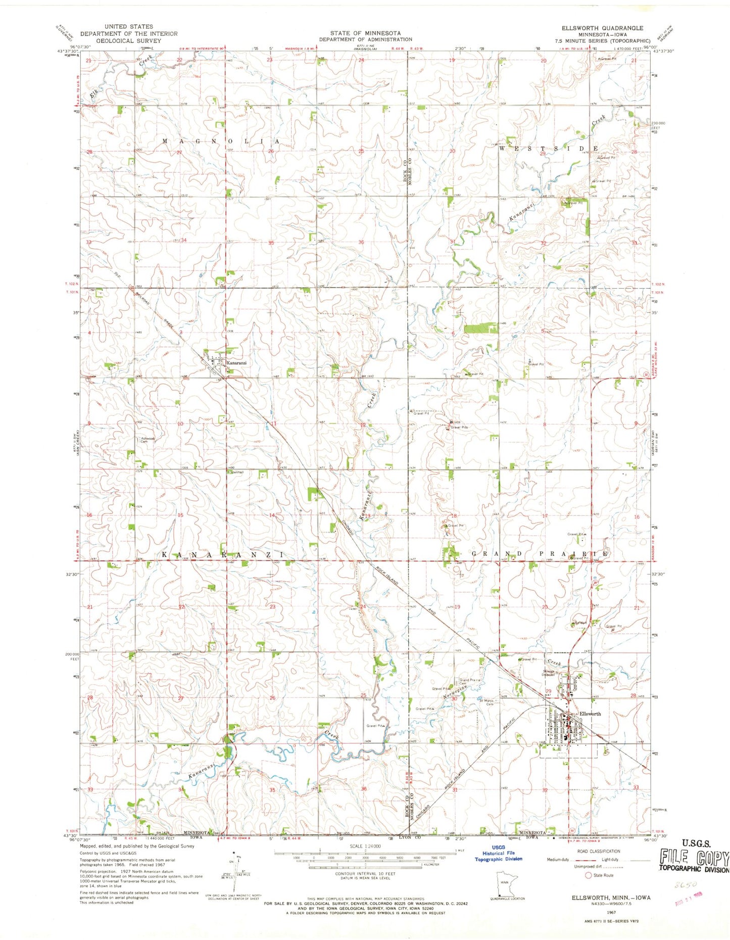
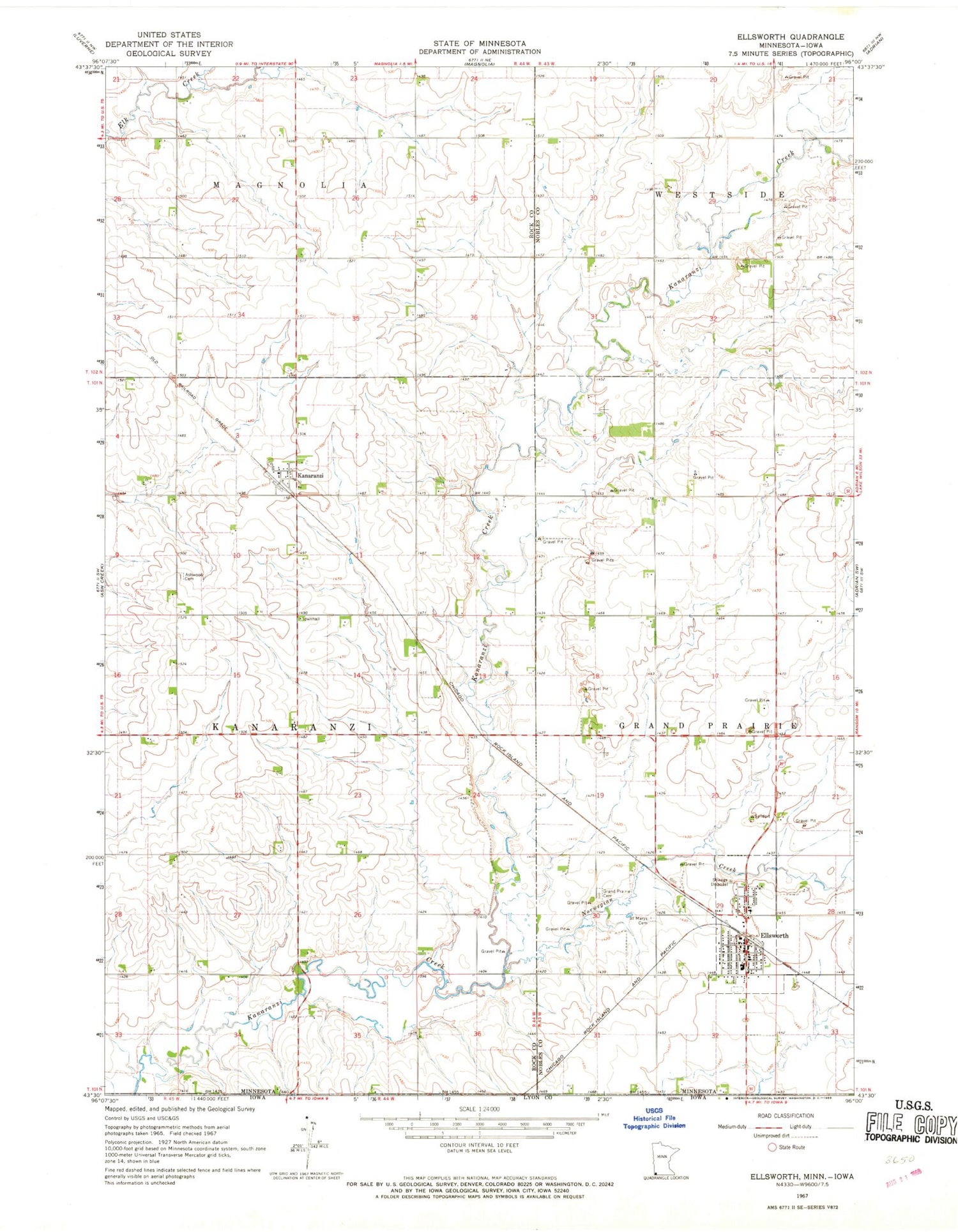
Classic USGS Ellsworth Minnesota 7.5'x7.5' Topo Map
Couldn't load pickup availability
Historical USGS topographic quad map of Ellsworth in the state of Minnesota. Map scale may vary for some years, but is generally around 1:24,000. Print size is approximately 24" x 27"
This quadrangle is in the following counties: Lyon, Nobles, Rock.
The map contains contour lines, roads, rivers, towns, and lakes. Printed on high-quality waterproof paper with UV fade-resistant inks, and shipped rolled.
Contains the following named places: Aid Pit State Wildlife Management Area, Ashwood Cemetery, City of Ellsworth, Ells Pit State Wildlife Management Area, Ellsworth, Ellsworth City Park, Ellsworth Fire Department, Ellsworth High School, Ellsworth Post Office, Grand Prairie Cemetery, Kanaranzi, Kanaranzi Post Office, Norwegian Creek, Parkview Manor, Saint Mary's Catholic Church, Saint Mary's Cemetery, Sherwood State Wildlife Management Area, Township of Kanaranzi, Zion Presbyterian Church, ZIP Codes: 56129, 56146