MyTopo
Classic USGS Ellsworth Wisconsin 7.5'x7.5' Topo Map
Couldn't load pickup availability
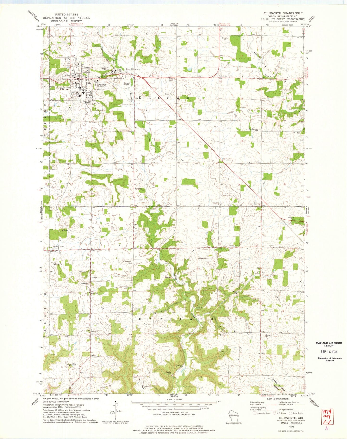
Historical USGS topographic quad map of Ellsworth in the state of Wisconsin. Map scale may vary for some years, but is generally around 1:24,000. Print size is approximately 24" x 27"
This quadrangle is in the following counties: Pierce.
The map contains contour lines, roads, rivers, towns, and lakes. Printed on high-quality waterproof paper with UV fade-resistant inks, and shipped rolled.
Contains the following named places: 0.5 Reservoir, 54010, 54011, Bethlehem Lutheran Cemetery, Bethlehem Lutheran Church, Clayfield Catholic Cemetery, Clayfield Church, Clayfield School, Conroy School, Coulson H2047 Dam, Cudd School, Drake School, East Ellsworth, East Ellsworth Post Office, East End Park, Ellsworth, Ellsworth Area Ambulance Service, Ellsworth High School, Ellsworth Middle School, Ellsworth Police Department, Ellsworth Post Office, Ellsworth Public Library, Ellsworth Village Hall, Ellsworth Volunteer Fire Department, Elm Grove School, Esdaile Cemetery, Evergreen Estates, First Presbyterian Church, Hartland Church, Herbert School, Hill and Dale School, Hillcrest Elementary School, Kingdom Hall, Lantz School, Maple Grove Cemetery, Mission Church, Murphy School, Oak Center School, Old Clayfield Cemetery, Pierce County, Pierce County Courthouse, Pierce County Fairgrounds, Pierce County Jail, Pierce County Sheriff's Office, Saint Francis Catholic Church, Saint Francis School, Saint Pauls Cemetery, Saint Pauls Church, Sleepy Hollow School, Snows Corner, Summit Hill Park, Town of Ellsworth, Town of Hartland, Ulvin Hill, Village of Ellsworth, Zion Covenant Cemetery, Zion Covenant Church