MyTopo
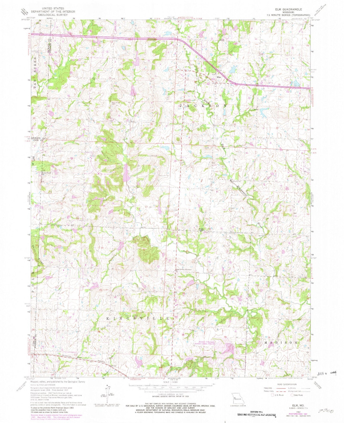
Classic USGS Elm Missouri 7.5'x7.5' Topo Map
Couldn't load pickup availability
Historical USGS topographic quad map of Elm in the state of Missouri. Map scale may vary for some years, but is generally around 1:24,000. Print size is approximately 24" x 27"
This quadrangle is in the following counties: Cass, Jackson, Johnson.
The map contains contour lines, roads, rivers, towns, and lakes. Printed on high-quality waterproof paper with UV fade-resistant inks, and shipped rolled.
Contains the following named places: Basin Knob Cemetery, Basin Knob School, Bluff Springs Cemetery, Burk School, Carey Mims Dam, Carey Mims Lake, Devil Ridge, East Branch South Fork Blackwater River Watershed Dam B-19, East Branch South Fork Blackwater River Watershed Dam C-15, East Branch South Fork Blackwater River Watershed Number E-24 Dam, Echo Lake, Elm, Elm Spring Cemetery, Everett School, Forest Grove Church, Fulkerson, Fulkerson Post Office, Holden City Lake, Holden Water Supply Dam, Howard School, Johnson County A-26 Dam, Johnson County Fire Protection District 2 Station 5 Elm, Johnson Number A-1 Dam, Knapp Lake Dam, Lincoln School, Lone Walnut School, Lunday Cemetery, Lundy Cemetery, Maupin Lake, Maupin Lake Dam, Seventh Day Adventist Church, South Fork Blackwater River Watershed Dam A-20, South Fork Blackwater River Watershed Dam A-21, Spiwak Lake, Township of Jackson, Underwood Cemetery, Wesley Chapel, ZIP Code: 64061