MyTopo
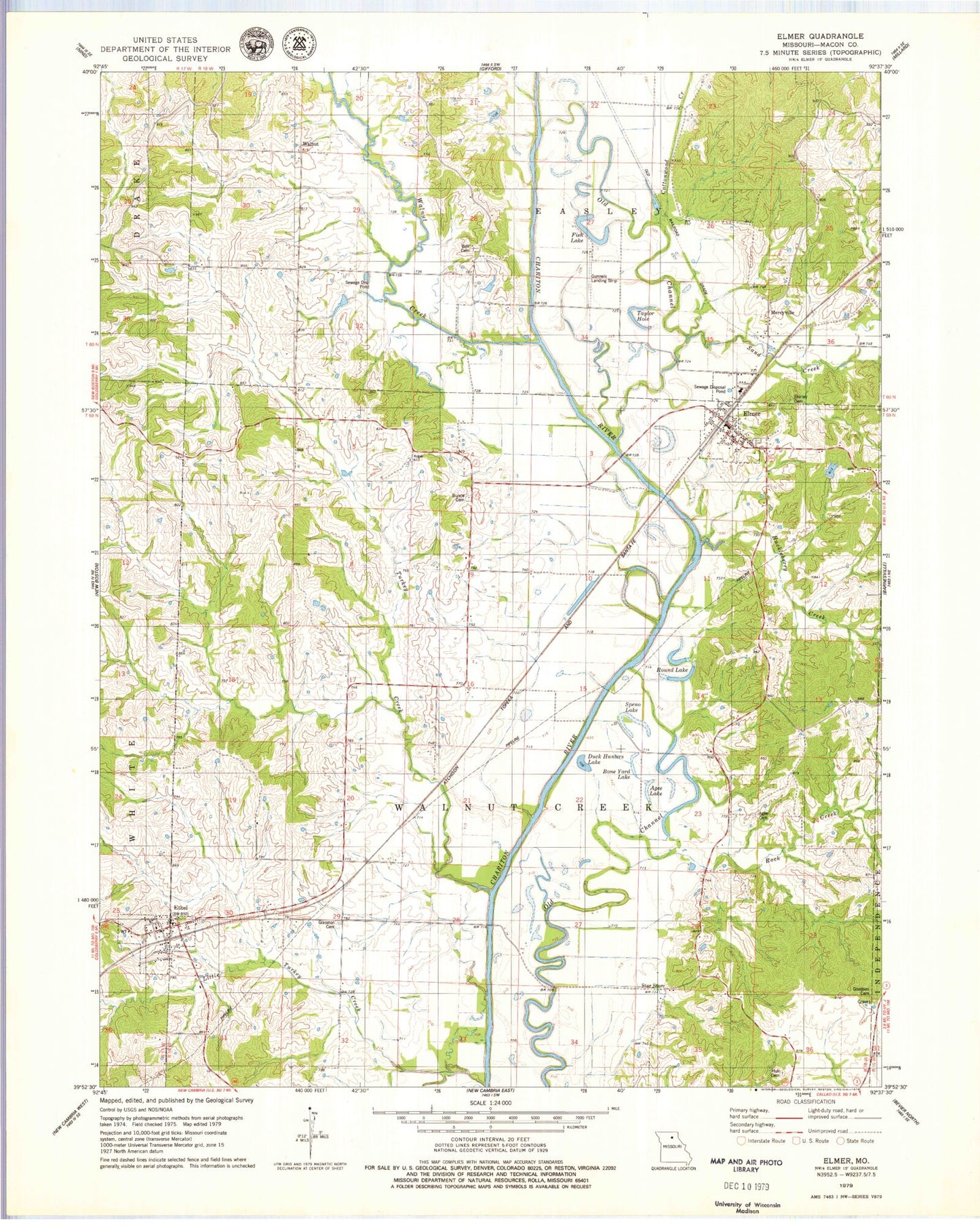
Classic USGS Elmer Missouri 7.5'x7.5' Topo Map
Couldn't load pickup availability
Historical USGS topographic quad map of Elmer in the state of Missouri. Map scale may vary for some years, but is generally around 1:24,000. Print size is approximately 24" x 27"
This quadrangle is in the following counties: Macon.
The map contains contour lines, roads, rivers, towns, and lakes. Printed on high-quality waterproof paper with UV fade-resistant inks, and shipped rolled.
Contains the following named places: Agee Cemetery, Agee Lake, Bell Cemetery, Bell School, Bone Yard Lake, Bunce Cemetery, Bunce School, City of Elmer, Cottonwood Creek, Diamond School, Duck Hunters Lake, Ellison, Elmer, Elmer Post Office, Elmer Rural Fire Association - Fire Department, Ethel, Ethel Post Office, Ethel Volunteer Fire Department, Fish Lake, Glasston Cemetery, Glasston School, Goff School, Goodson Cemetery, Gunnels Landing Strip, Huckleberry Creek, Hull Cemetery, Little Turkey Creek, Mercyville, Rock Creek, Rock Creek School, Round Lake, Sand Creek, Shirley Cemetery, Speno Lake, Star Store, Taylor Hole, Town of Ethel, Township of Easley, Township of Walnut Creek, Turkey Creek, Walnut, Walnut Creek, ZIP Code: 63538