
MyTopo
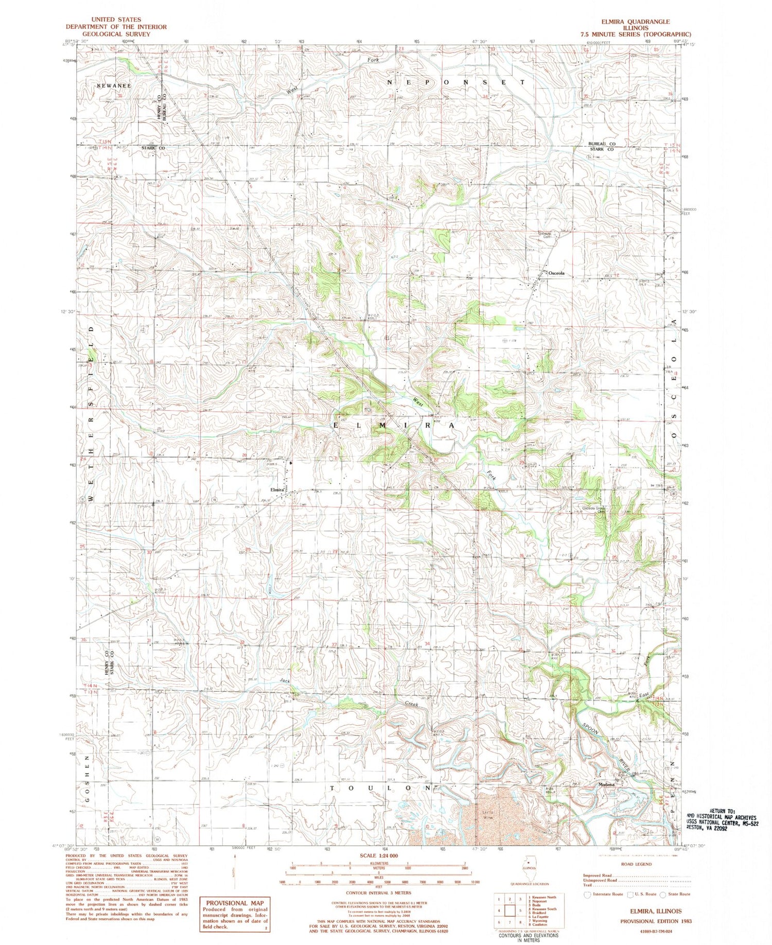
Classic USGS Elmira Illinois 7.5'x7.5' Topo Map
Couldn't load pickup availability
Historical USGS topographic quad map of Elmira in the state of Illinois. Map scale may vary for some years, but is generally around 1:24,000. Print size is approximately 24" x 27"
This quadrangle is in the following counties: Bureau, Henry, Stark.
The map contains contour lines, roads, rivers, towns, and lakes. Printed on high-quality waterproof paper with UV fade-resistant inks, and shipped rolled.
Contains the following named places: Allendale Conservation Club Lake, Allendale Conservation Club Lake Dam, East Fork Spoon River, Elmira, Elmira Cemetery, Elmira United Presbyterian Church, Holmes School, Jack Creek, Jack Creek School, Jackson Field, Lowell School, Modena, Mound School, North Star School, Osceola, Osceola Cemetery, Osceola Grove Cemetery, Osceola Grove School, Rist School, Township of Elmira, Waldron, West Fork Spoon River


