MyTopo
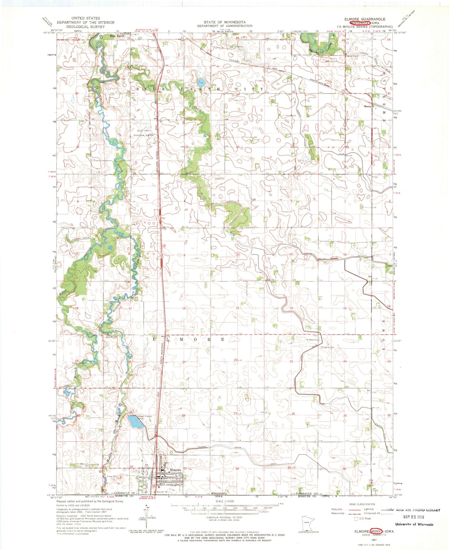
Classic USGS Elmore Minnesota 7.5'x7.5' Topo Map
Couldn't load pickup availability
Historical USGS topographic quad map of Elmore in the state of Minnesota. Map scale may vary for some years, but is generally around 1:24,000. Print size is approximately 24" x 27"
This quadrangle is in the following counties: Faribault, Kossuth.
The map contains contour lines, roads, rivers, towns, and lakes. Printed on high-quality waterproof paper with UV fade-resistant inks, and shipped rolled.
Contains the following named places: Blue Earth Municipal Airport, Browns Lake, City of Elmore, Coon Creek, County Ditch Number Eight, County Ditch Number Eighty, County Ditch Number Fortyone, County Ditch Number Twentysix, Dobson Cemetery, Elmore, Elmore City Volunteer Fire Department, Elmore Library, Elmore Police Department, Elmore Post Office, Faribault County United Clinics, Hesse Burying Grounds, Judicial Ditch Number Thirteen, Marna, Marna Post Office, Middle Branch Blue Earth River, Minn Iowa Golf Course, Moses Sailor First Settler Commemorative Monument, Riverview Cemetery, Saint Johns Cemetery, Saint Johns Church, Shiloh Lutheran Church, Sohn Dairy, State Line Wayside Park, Township of Elmore, Trinity Lutheran Church, United Methodist Church, Van Buren Cemetery, West Branch Blue Earth River, Wood Lake Park, ZIP Codes: 56013, 56027