MyTopo
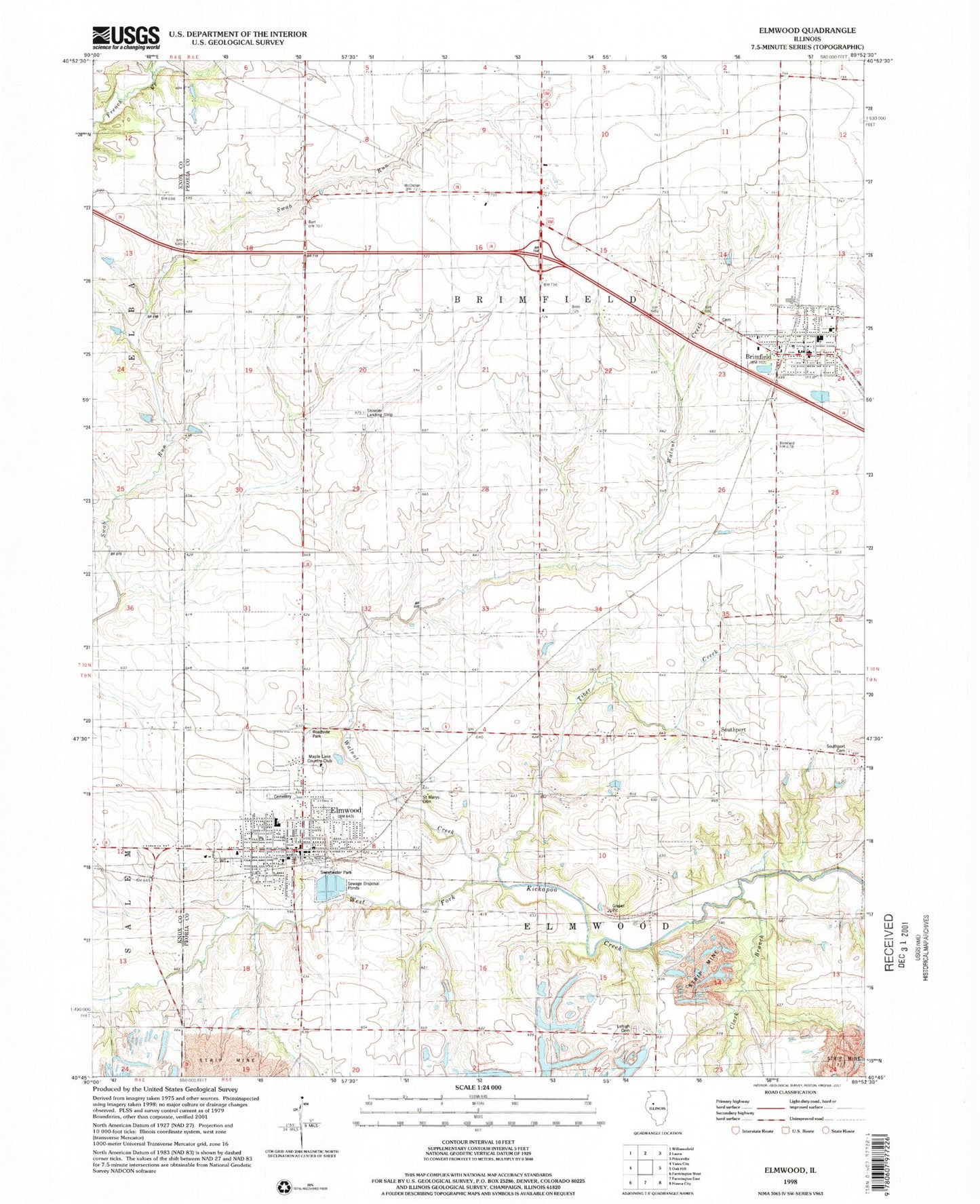
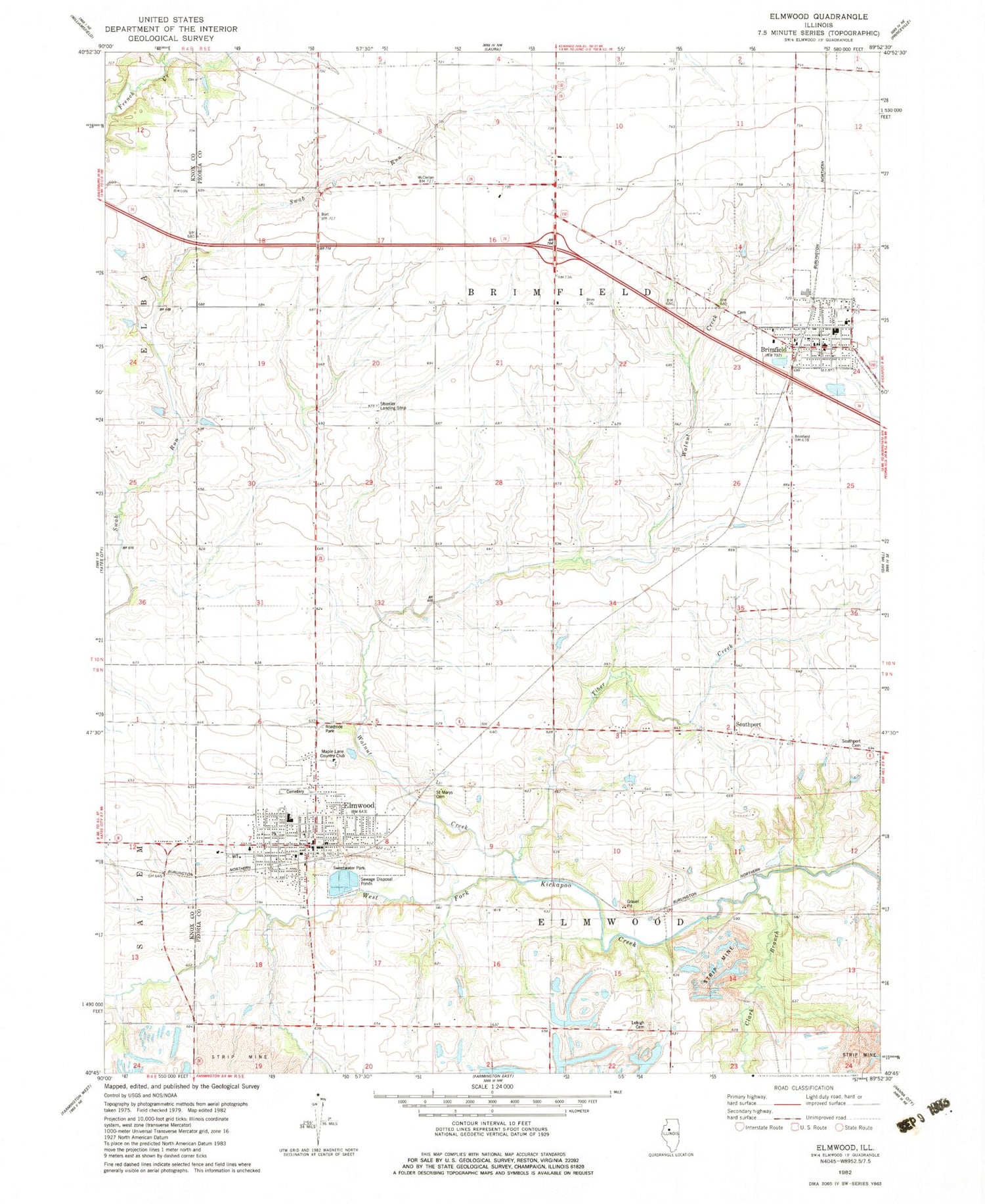
Classic USGS Elmwood Illinois 7.5'x7.5' Topo Map
Couldn't load pickup availability
Historical USGS topographic quad map of Elmwood in the state of Illinois. Map scale may vary for some years, but is generally around 1:24,000. Print size is approximately 24" x 27"
This quadrangle is in the following counties: Knox, Peoria.
The map contains contour lines, roads, rivers, towns, and lakes. Printed on high-quality waterproof paper with UV fade-resistant inks, and shipped rolled.
Contains the following named places: Bell School, Brimfield, Brimfield - Yates City - Elmwood Ambulance Service, Brimfield Community Fire Protection District Station 1, Brimfield Grade School, Brimfield High School, Brimfield Post Office, Brimfield Public Library, Brimfield Township Cemetery, Brimfield United Methodist Church, Burt School, City of Elmwood, Clark Branch, Crossroads Assembly of God Church, Elmwood, Elmwood Baptist Church, Elmwood City Hall, Elmwood Elementary School, Elmwood Fire Department, Elmwood High School, Elmwood Police Department, Elmwood Post Office, Elmwood Township Cemetery, First Presbyterian Church, Gibbs School, Lehigh Cemetery, Lehigh School, Maple Grove School, Maple Lane Country Club, Paradise Chapel School, Phelps School, Radley School, Reed School, Saint Josephs Catholic Church, Saint Marys Cemetery, Saint Patricks Catholic Church, Saint Pauls Lutheran Church, Shissler Farm Airport, Shissler Landing Strip, Southport, Southport Cemetery, Sweetwater Park, Tiber Creek, Township of Brimfield, Township of Elmwood, Union Church, Village of Brimfield, Walnut Creek, Whitten School, Wiley Library, ZIP Code: 61529