MyTopo
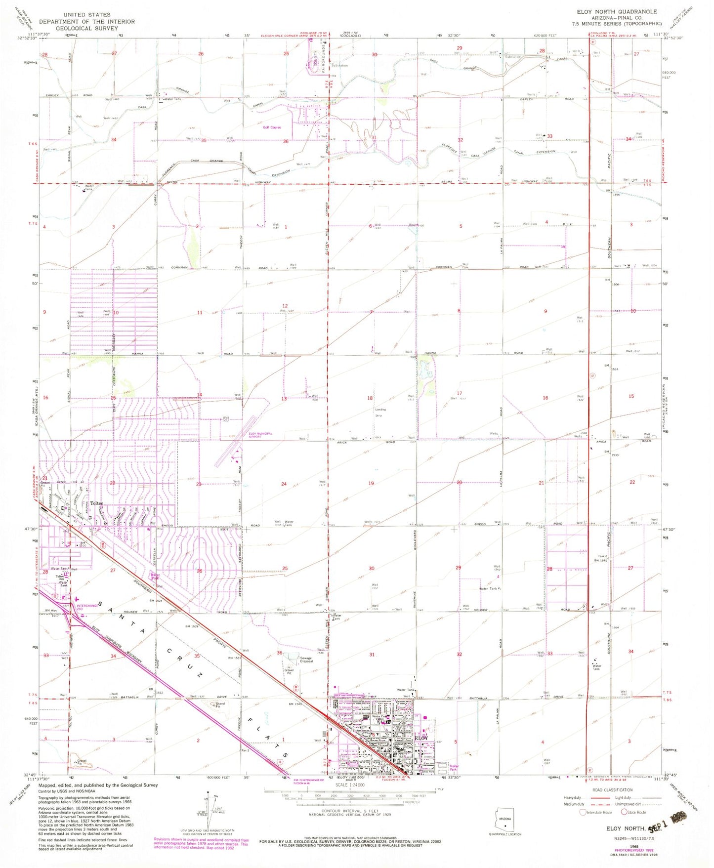
Classic USGS Eloy North Arizona 7.5'x7.5' Topo Map
Couldn't load pickup availability
Historical USGS topographic quad map of Eloy North in the state of Arizona. Map scale may vary for some years, but is generally around 1:24,000. Print size is approximately 24" x 27"
This quadrangle is in the following counties: Pinal.
The map contains contour lines, roads, rivers, towns, and lakes. Printed on high-quality waterproof paper with UV fade-resistant inks, and shipped rolled.
Contains the following named places: Casa Grande Canal, Central School, Church of Christ, City Park, Curiel Primary School, Desert Rose Baha'i Institute, Eloy, Eloy Aquatic Center, Eloy Fire District Station 522, Eloy Intermediate School, Eloy Junior High School, Eloy Landfill, Eloy Municipal Airport, Eloy Police Department, Eloy Post Office, Eloy Public Library, Eloy Railroad Station, Estrella Community Church, First Assembly of God, First United Methodist Church, First United Pentecostal Church, Florence Casa Grande Canal Extension, Grande Valley Ranch Golf Club, Iglesia Del Valle, Jones Park, McClellan Wash, North Park, Pinal County Eloy Health Department, Pinal County Fairgrounds, Red Rock Correctional Center, Saint Helen of the Cross Roman Catholic Church, Santa Cruz Valley Union High School, Southwest Gas Site Mini Park, Tierra Grande Golf Club, Toltec, Toltec Community Center, Toltec Elementary School, Toltec Evangelical Methodist Church, Toltec Mini Park, Toltec Railroad Station, Topaz Railroad Station, Trekell Park, Troy Thomas Community Center, Tumble Weed Park, Villa Oasis Interscholastic Center for Education, Washington Mini Park Site