
MyTopo
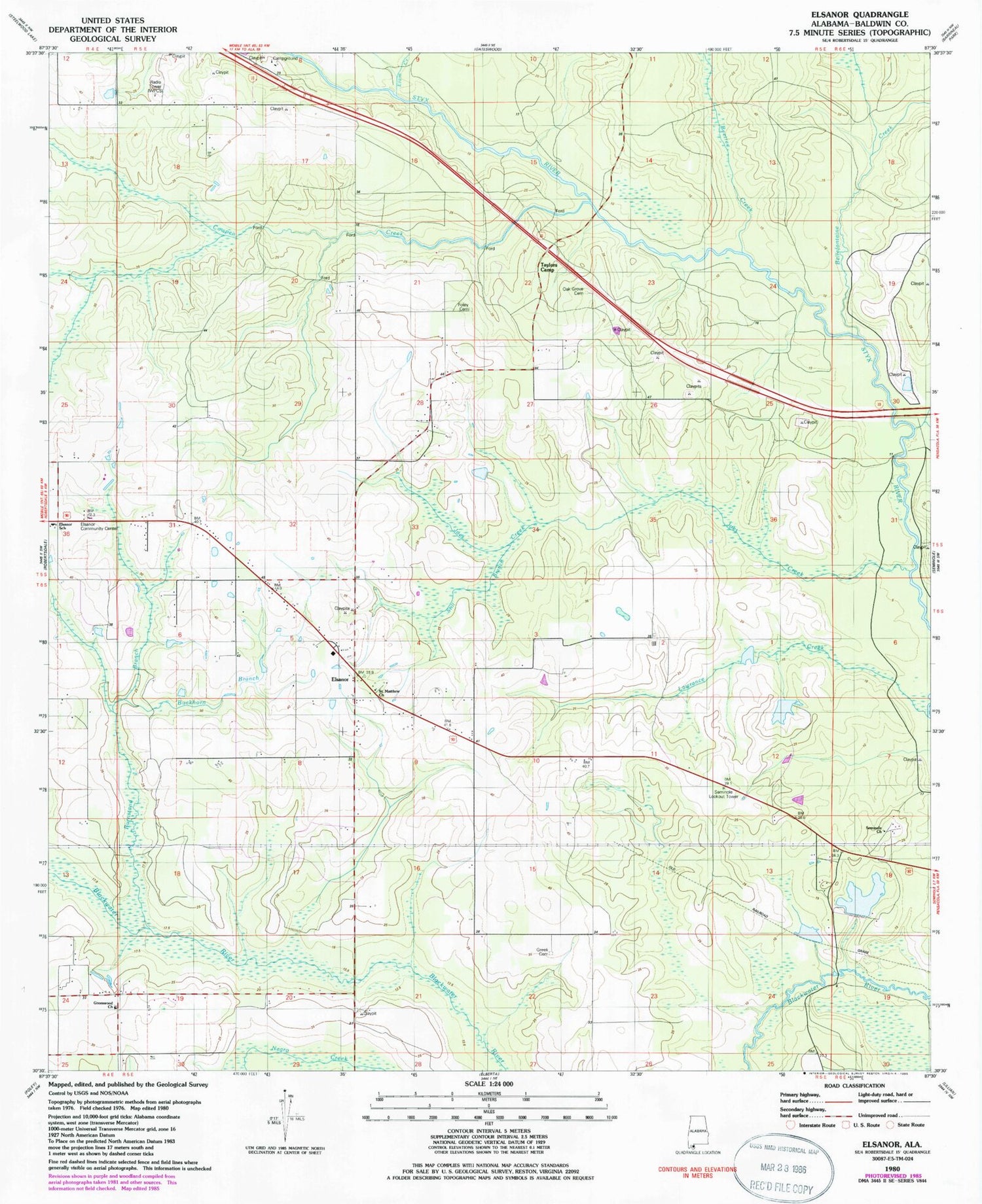
Classic USGS Elsanor Alabama 7.5'x7.5' Topo Map
Couldn't load pickup availability
Historical USGS topographic quad map of Elsanor in the state of Alabama. Map scale may vary for some years, but is generally around 1:24,000. Print size is approximately 24" x 27"
This quadrangle is in the following counties: Baldwin.
The map contains contour lines, roads, rivers, towns, and lakes. Printed on high-quality waterproof paper with UV fade-resistant inks, and shipped rolled.
Contains the following named places: Allen Spring Branch, Baldwin County Express Traveling Museum Headquarters, Bear Branch, Beetree Creek, Bellefontaine Creek, Bob Pace Dam, Buckhorn Branch, Burnstand Branch, Cook Lake, Cook Lake Dam, Cowpen Creek, Elam Creek, Elsanor, Elsanor Airport, Elsanor Community Center, Elsanor School, Elsanor Volunteer Fire and Rescue Department, Foley Cemetery, Greek Cemetery, Greenwood Church, Horsecollar Branch, Joes Creek, Lawrence Creek, Lees Ferry, Oak Grove Cemetery, Oak Grove Church, Pace Lake, Pecan Ponds Farm Airport, Saint Matthew Church, Seminole Church, Seminole Lookout Tower, Still Branch, Styx River Estates, Taylors Camp, Vick's Mobile Home Park, Wallace Field, Waterhole Branch, ZIP Code: 36567


