MyTopo
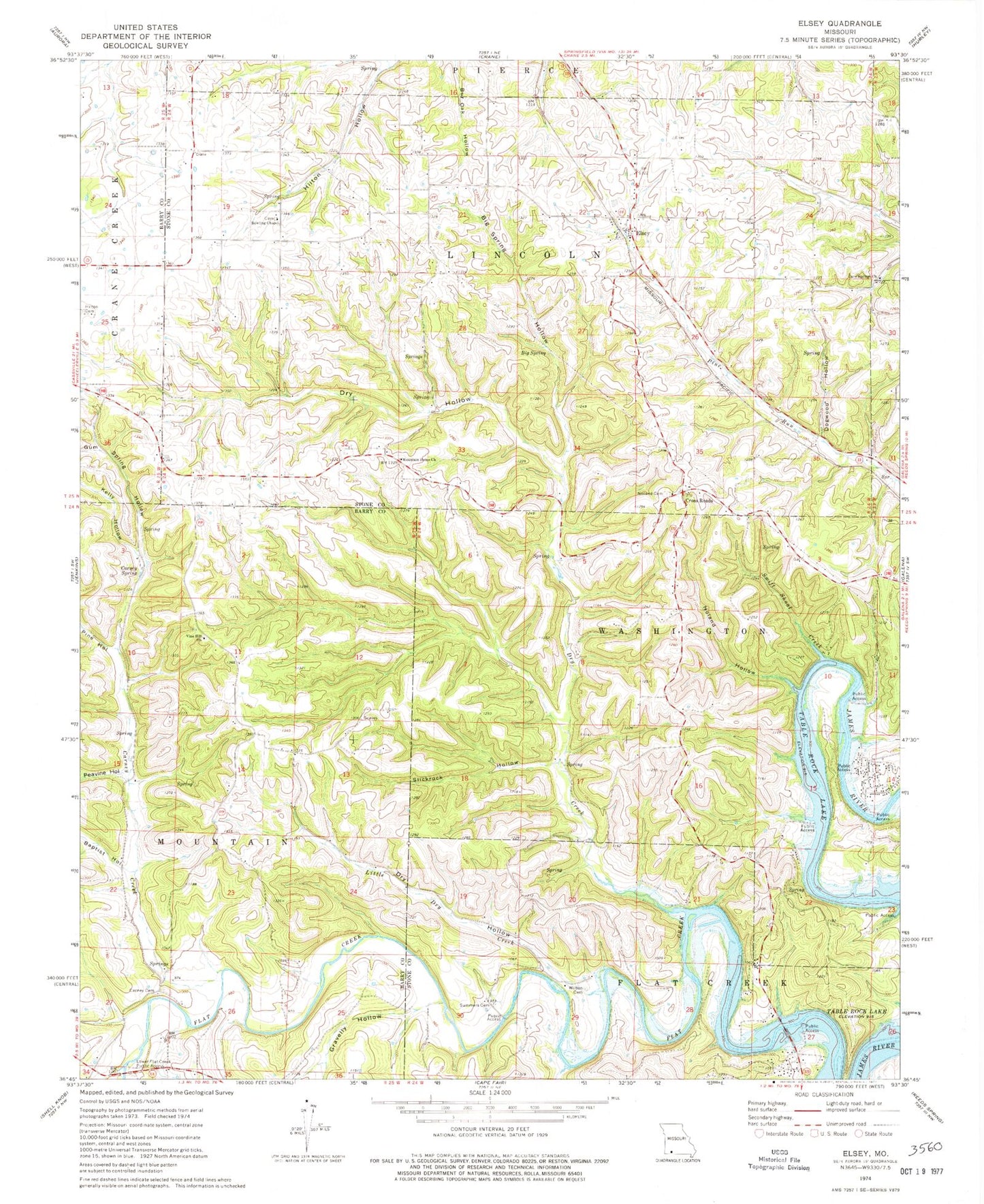
Classic USGS Elsey Missouri 7.5'x7.5' Topo Map
Couldn't load pickup availability
Historical USGS topographic quad map of Elsey in the state of Missouri. Typical map scale is 1:24,000, but may vary for certain years, if available. Print size: 24" x 27"
This quadrangle is in the following counties: Barry, Stone.
The map contains contour lines, roads, rivers, towns, and lakes. Printed on high-quality waterproof paper with UV fade-resistant inks, and shipped rolled.
Contains the following named places: Baptist Hollow, Big Spring, Big Spring Hollow, Bowling Chapel, Carney Cemetery, Carney Spring, Cave Springs Church, Dogwood Hollow, Dry Creek, Dry Hollow, Dry Hollow, Elsey, Gum Spring Hollow, Kelly Hollow, Little Dry Creek, Lower Flat Creek Public Access, Mountain Home Church, Noland Cemetery, Noland Hollow, Peavine Hollow, Pine Hollow, Slickrock Hollow, Summers Cemetery, Swift Shoal Creek, Vine Hill Church, Wilson Cemetery, Elsey School (historical), Carney Creek, Flat Creek (historical), Cross Roads, Cedar Bluff School (historical), Doland Church (historical), Doland School, Pleasant Hill School (historical), Cave Springs School (historical), Carney School (historical), Center School (historical), Builderback Hollow, Gravelly Hollow, Township of Mountain, Township of Lincoln, McCord Bend, Flat Creek Post Office, Village of McCord Bend, North Stone Northeast Barry County Fire District Station 25, North Stone Northeast Barry County Fire District Station 22, Caraway Camp (historical), Ashcraft Camp (historical), Horse Shoe Bend