MyTopo
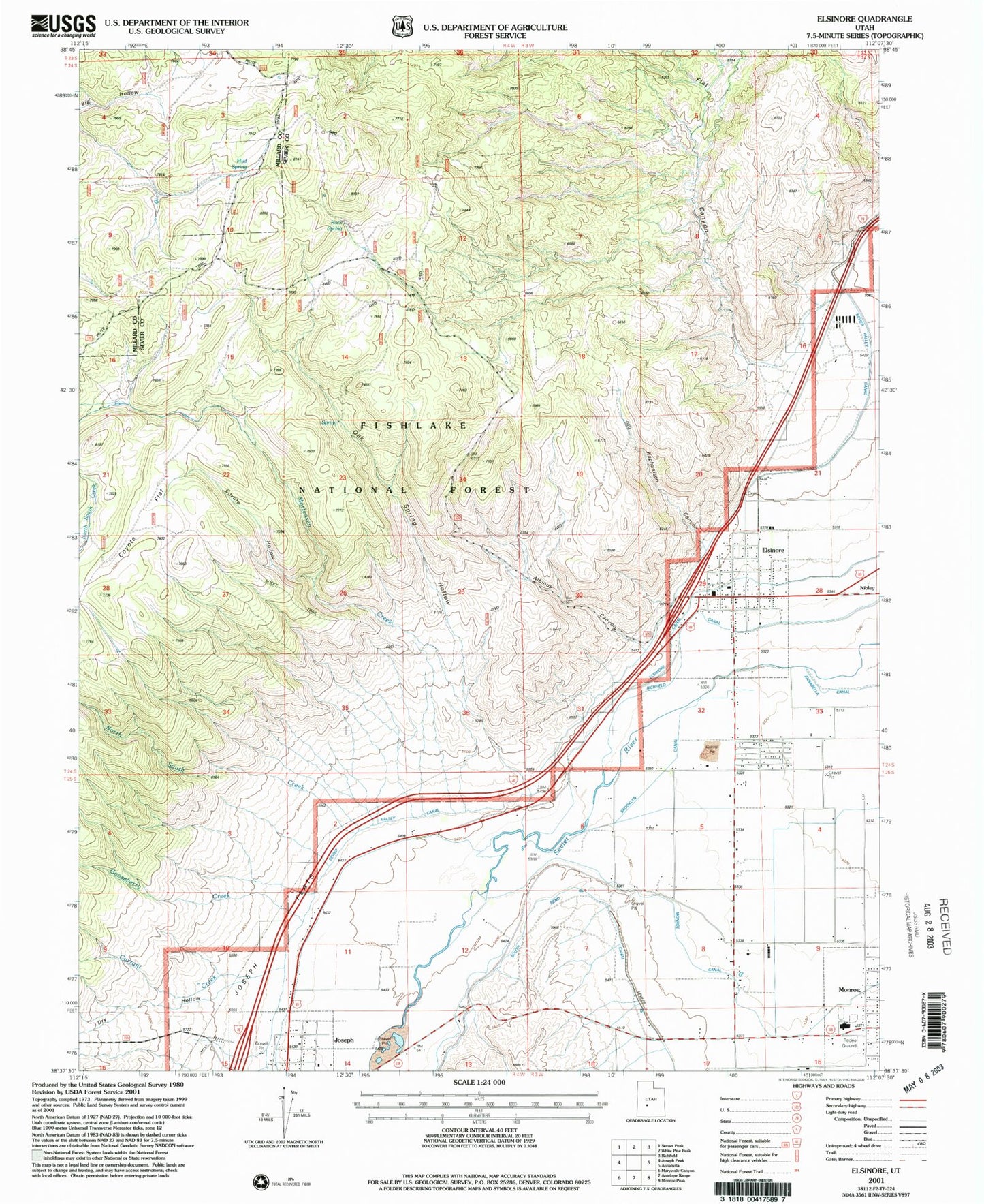
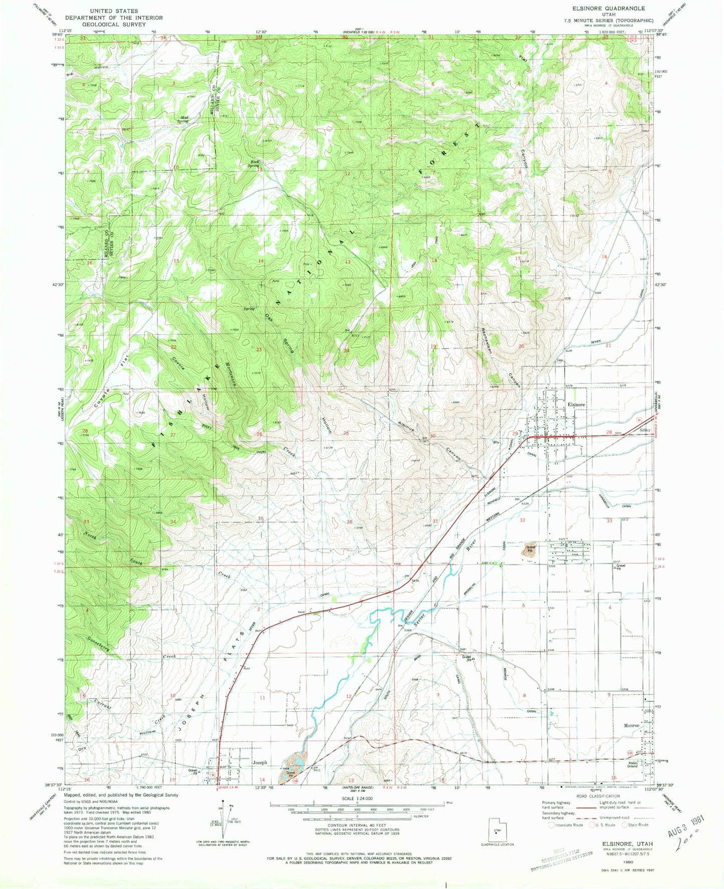
Classic USGS Elsinore Utah 7.5'x7.5' Topo Map
Couldn't load pickup availability
Historical USGS topographic quad map of Elsinore in the state of Utah. Map scale may vary for some years, but is generally around 1:24,000. Print size is approximately 24" x 27"
This quadrangle is in the following counties: Millard, Sevier.
The map contains contour lines, roads, rivers, towns, and lakes. Printed on high-quality waterproof paper with UV fade-resistant inks, and shipped rolled.
Contains the following named places: Albinus Canyon, Brooklyn Canal, Coyote Flat, Coyote Hollow, Coyote Hollow Creek, Currant Creek, Dry Hollow, Elsinore, Elsinore Cemetery, Elsinore Fire Department, Elsinore Post Office, Flat Canyon, Gooseberry Creek, Joseph, Joseph Flats, Monroe City Fire Department, Mortensen Creek, Mud Spring, North South Creek, Oak Spring Hollow, Raphaelsen Canyon, Rock Spring, Rocky Trail, Sevier Valley Canal, The Church of Jesus Christ of Latter Day Saints, Town of Elsinore, ZIP Codes: 84724, 84739