
MyTopo
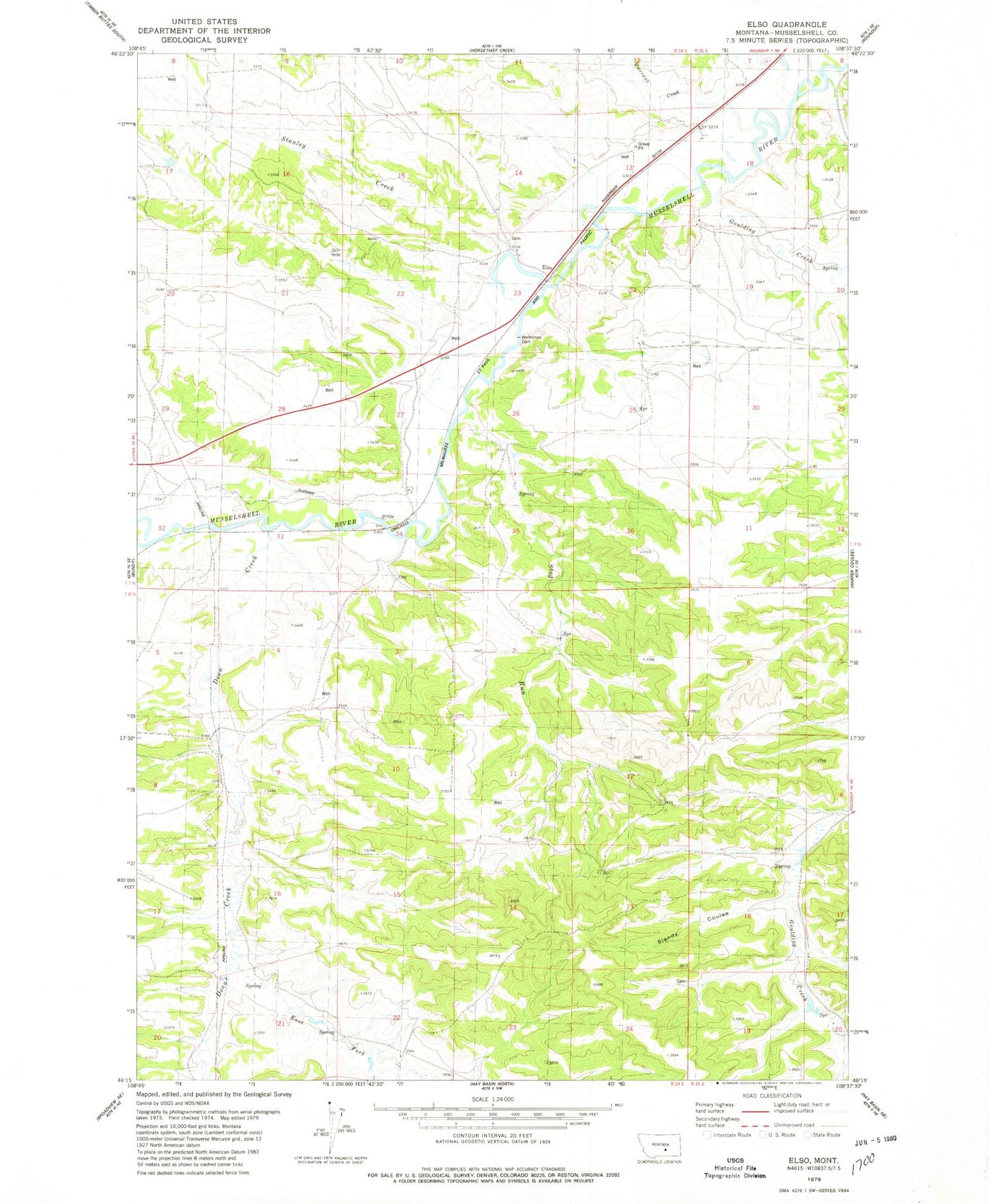
Classic USGS Elso Montana 7.5'x7.5' Topo Map
Couldn't load pickup availability
Historical USGS topographic quad map of Elso in the state of Montana. Map scale may vary for some years, but is generally around 1:24,000. Print size is approximately 24" x 27"
This quadrangle is in the following counties: Musselshell.
The map contains contour lines, roads, rivers, towns, and lakes. Printed on high-quality waterproof paper with UV fade-resistant inks, and shipped rolled.
Contains the following named places: 06N24E04DDAB01 Well, 06N24E08AABA01 Well, 06N24E14CDDB01 Well, 07N24E13AACC01 Well, 07N24E13BDAA01 Well, 07N24E13BDDD01 Well, 07N24E14ADDA01 Well, 07N24E15BAA_01 Well, 07N24E24DCCA01 Well, 07N24E24DDDD01 Well, 07N24E28ADBA01 Well, 07N25E19DDDA01 Well, 18N23E12CBC_01 Well, Barott Post Office, Currant Creek, Dean Creek, East Fork Dean Creek, Elso, Elso Post Office, Elso School, Goulding Creek, Naderman Dam, Road Coulee, Sjandy Coulee, Stag Run, Stanley Creek


