MyTopo
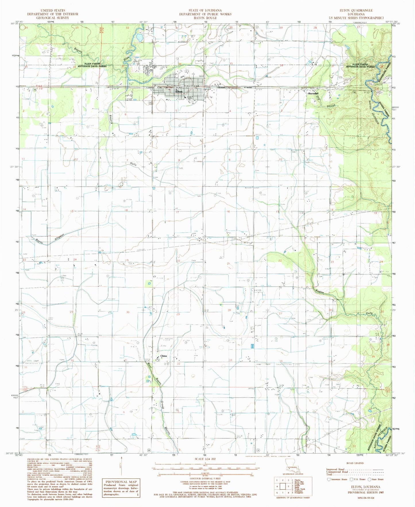
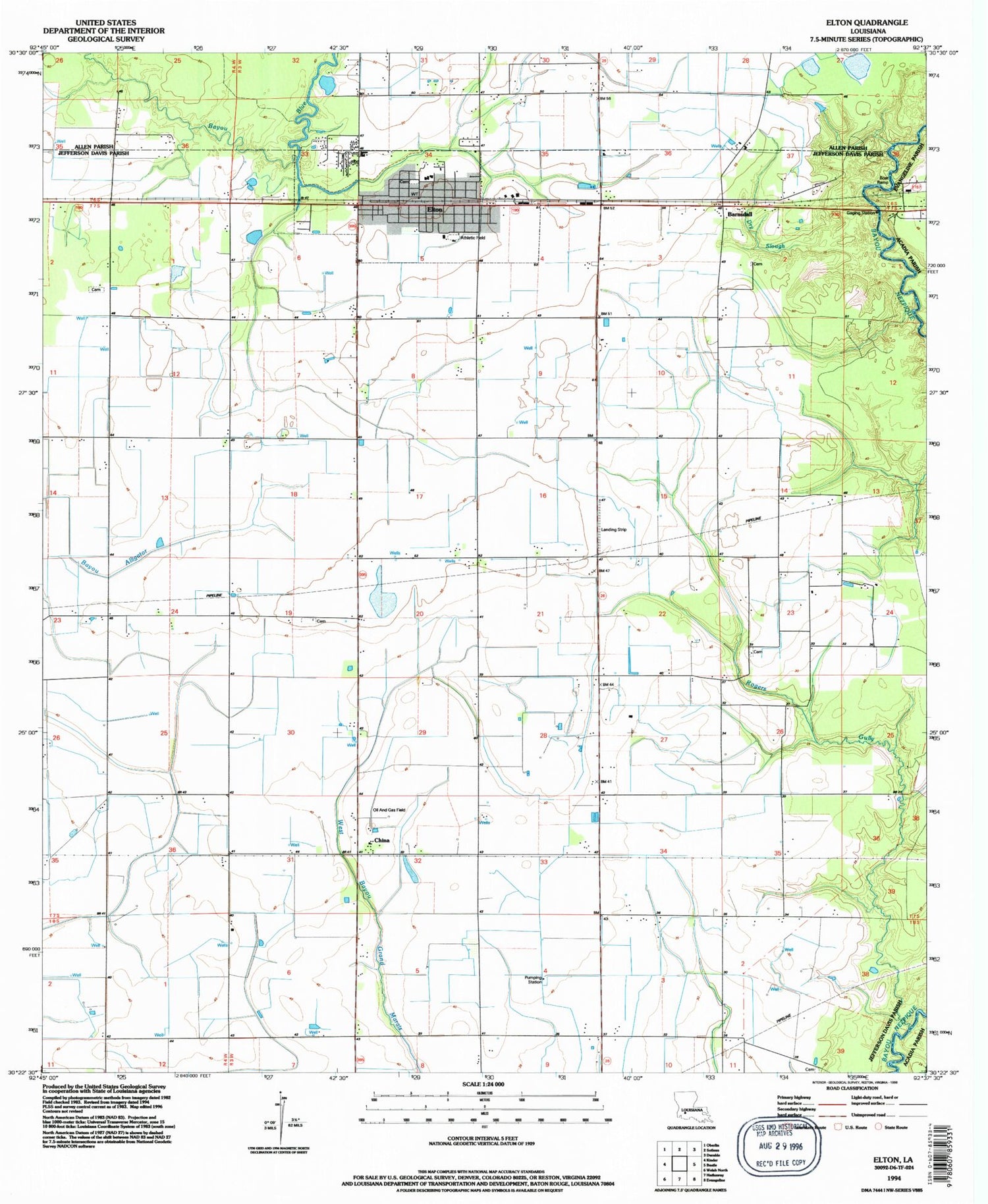
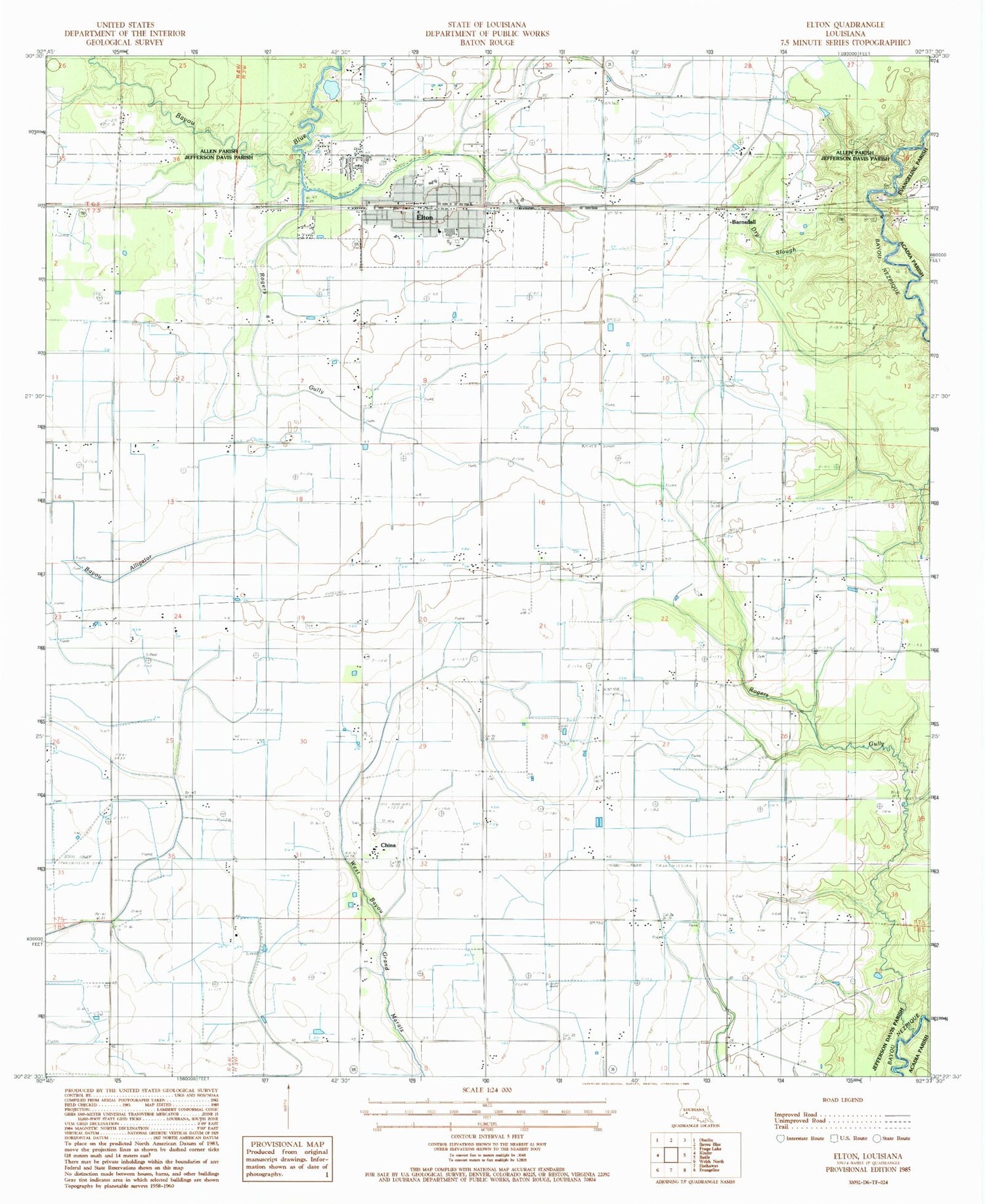
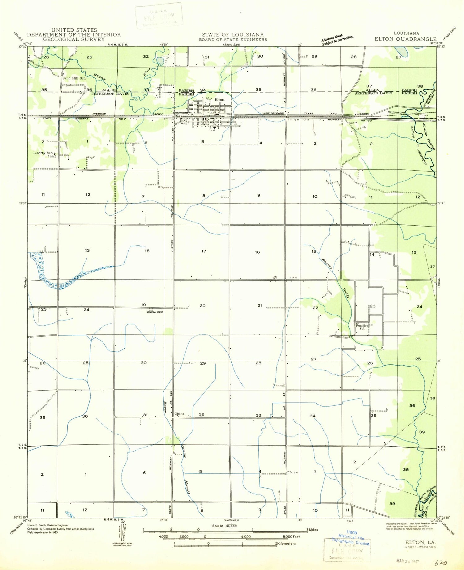
Classic USGS Elton Louisiana 7.5'x7.5' Topo Map
Couldn't load pickup availability
Historical USGS topographic quad map of Elton in the state of Louisiana. Map scale may vary for some years, but is generally around 1:24,000. Print size is approximately 24" x 27"
This quadrangle is in the following counties: Acadia, Allen, Evangeline, Jefferson Davis.
The map contains contour lines, roads, rivers, towns, and lakes. Printed on high-quality waterproof paper with UV fade-resistant inks, and shipped rolled.
Contains the following named places: Barnsdall, China, China Cemetery, China Gas Field, Chretien Cemetery, Dry Slough, Elton, Elton Elementary School, Elton Fire Department, Elton High School, Elton Police Department, Elton Post Office, Faith Deliverance Temple, First Baptist Church of Elton, Golden Chain Baptist Church, Greens Gully, Jefferson Davis Parish Library Elton Branch, Jefferson Davis Parish Wastewater Treatment Plant, Liberty Cemetery, Mount Pilgrim Baptist Church, Parish Governing Authority District 9, Rogers Bayou Gas Field, Rogers Gully, Saint Ann Church, Saint Joseph Catholic Church, Saint Pauls Catholic Church, South Elton Oil and Gas Field, Southeast China Gas Field, Tietjes Airport, Town of Elton, United Pentecostal Church, Ward Four, West Tepetate Oil and Gas Field, ZIP Code: 70532