MyTopo
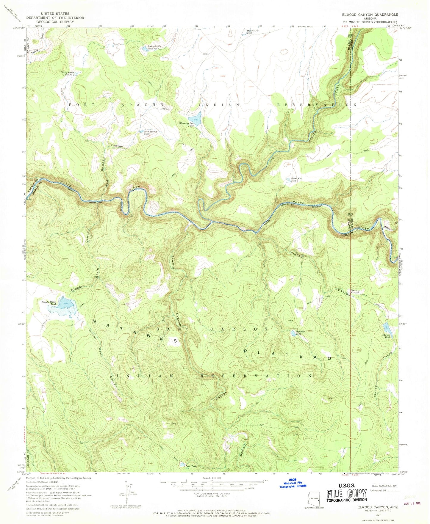
Classic USGS Elwood Canyon Arizona 7.5'x7.5' Topo Map
Couldn't load pickup availability
Historical USGS topographic quad map of Elwood Canyon in the state of Arizona. Typical map scale is 1:24,000, but may vary for certain years, if available. Print size: 24" x 27"
This quadrangle is in the following counties: Apache, Graham, Navajo.
The map contains contour lines, roads, rivers, towns, and lakes. Printed on high-quality waterproof paper with UV fade-resistant inks, and shipped rolled.
Contains the following named places: Bloody Basin Canyon, Bloody Basin Tank, Elwood Canyon, Elwood Tank, Elwood Windmill, Grass Flat Tank, Lower Grass Flat Tank, Mud Spring Canyon, Mud Spring Tank, Mudhole Tank, Natanes Plateau, Prairie Pit Tank, Rocky Basin Tank Number One, Rocky Basin Tank Number Two, Sawmill Canyon, Sawmill Creek, Turkey Creek, Weaning Pen Tank, Willow Creek, Bloody Basin Dam, Elwood Creek, Elwood Dam, Hookers Gap Dam, Big Bonito Creek