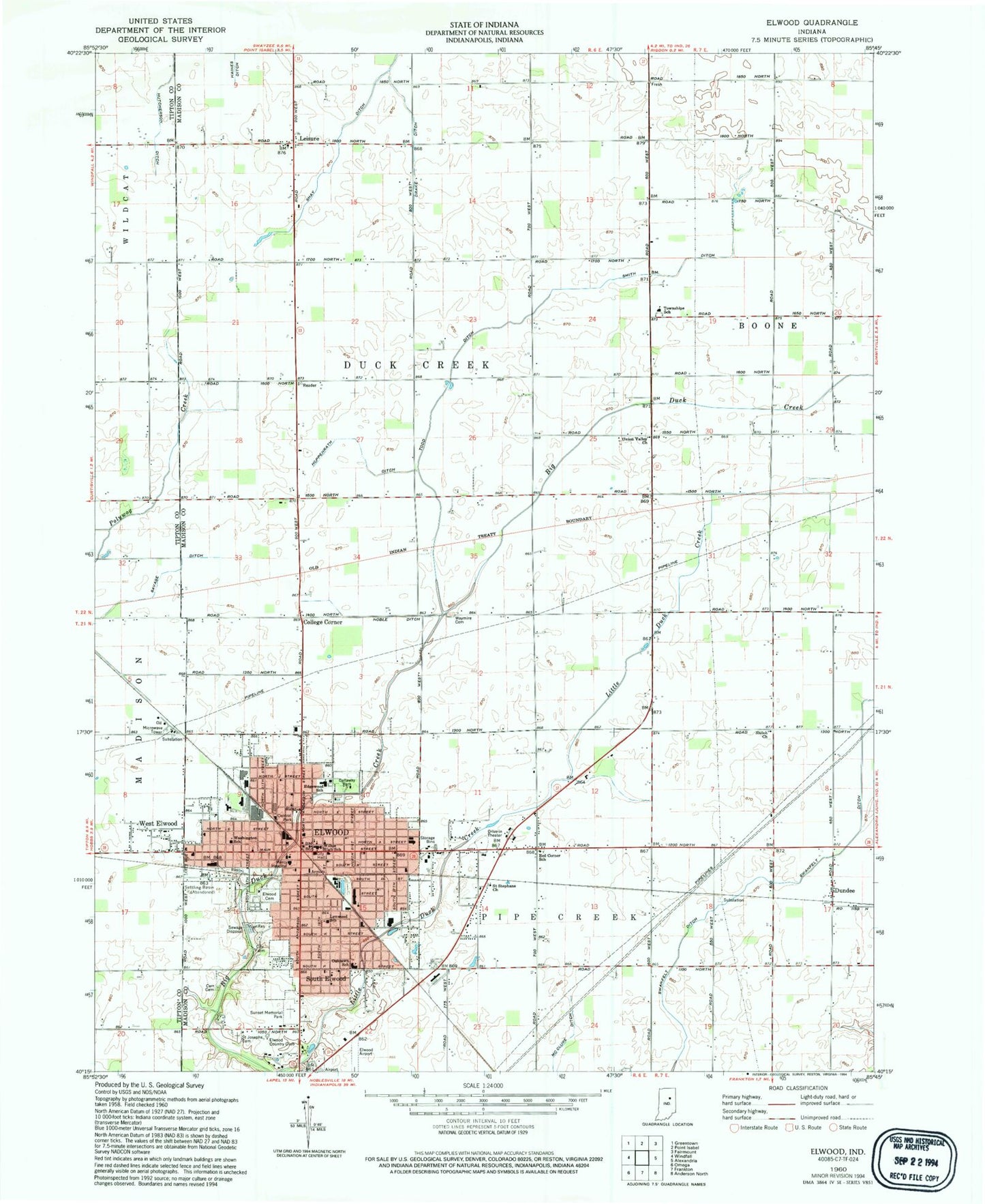
MyTopo
Classic USGS Elwood Indiana 7.5'x7.5' Topo Map
Couldn't load pickup availability
Historical USGS topographic quad map of Elwood in the state of Indiana. Map scale may vary for some years, but is generally around 1:24,000. Print size is approximately 24" x 27"
This quadrangle is in the following counties: Madison, Tipton.
The map contains contour lines, roads, rivers, towns, and lakes. Printed on high-quality waterproof paper with UV fade-resistant inks, and shipped rolled.
Contains the following named places: Callaway Park, City of Elwood, College Corner, Duck Creek Cemetery, Duck Creek Volunteer Fire Department, Dundee, Edgewood Elementary School, Elwood, Elwood Airport, Elwood Cemetery, Elwood Country Club, Elwood Fire Department, Elwood Junior High School, Elwood Police Department, Elwood Post Office, Haines Ditch, Hoppenrath Ditch, Leisure, Lynwood School, McCluret Ditch, Oakland Elementary School, Pipe Creek Township Volunteer Fire Department, Red Corner School, Saint Joseph Cemetery, Saint Stephans Church, Saint Vincent Mercy Hospital, Shay Ditch, Shiloh Church, Smith Ditch, South Elwood, Sunset Memorial Park, Swanfelt Ditch, Todd Ditch, Township of Duck Creek, Union Valley Church, Washington Elementary School, Waymire Cemetery, WBMP-FM (Elwood), West Drake Ditch, West Elwood, ZIP Code: 46036