MyTopo
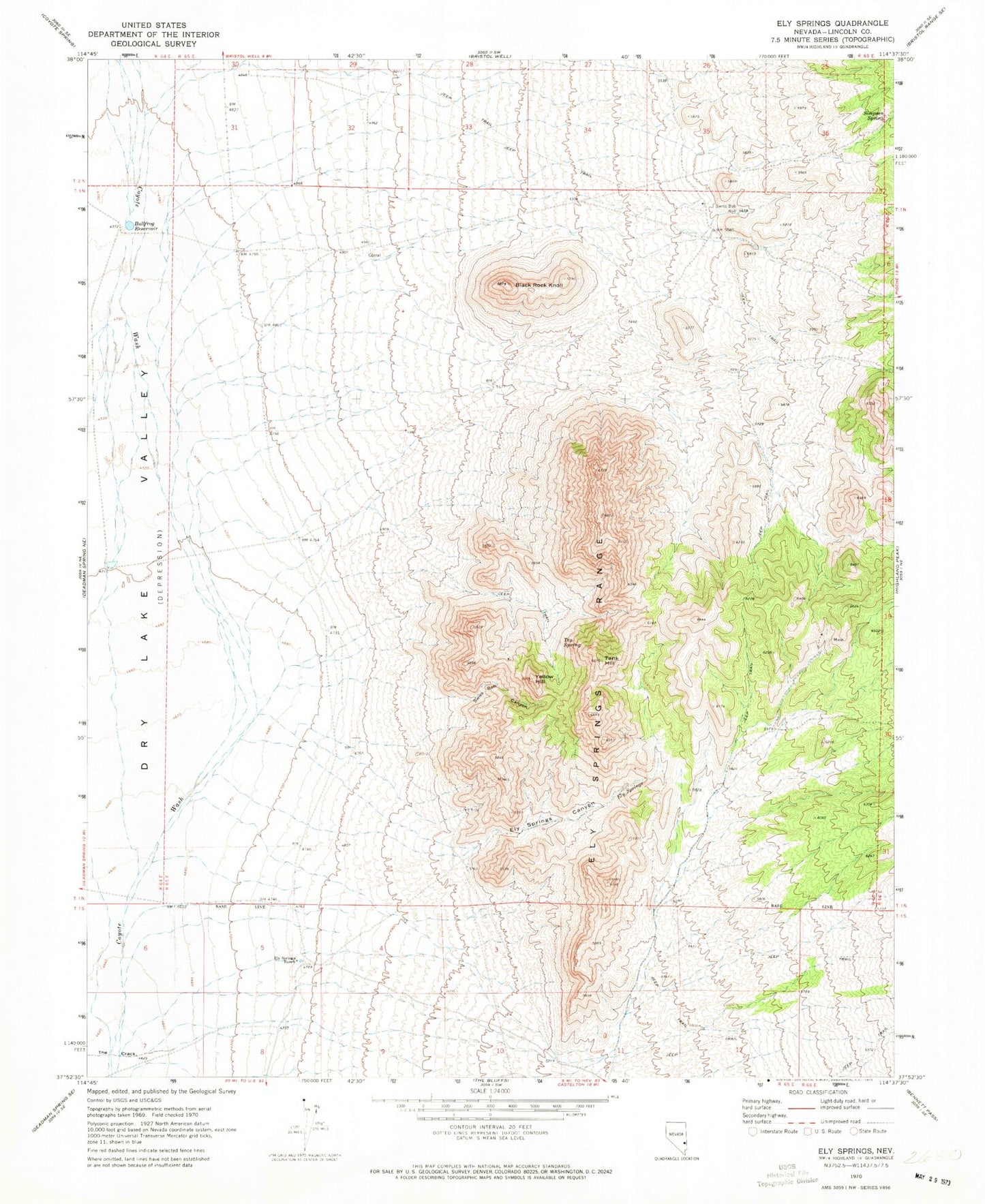
Classic USGS Ely Springs Nevada 7.5'x7.5' Topo Map
Couldn't load pickup availability
Historical USGS topographic quad map of Ely Springs in the state of Nevada. Map scale may vary for some years, but is generally around 1:24,000. Print size is approximately 24" x 27"
This quadrangle is in the following counties: Lincoln.
The map contains contour lines, roads, rivers, towns, and lakes. Printed on high-quality waterproof paper with UV fade-resistant inks, and shipped rolled.
Contains the following named places: Black Rock Knoll, Bullfrog Reservoir, Bullfrog Spring, Delmues Spring, El Rey Mine, Ely Springs, Ely Springs Canyon, Ely Springs Mining District, Ely Springs Ranch, Ely Springs Range, Iron Tank Spring, King Midas Mine, Mathews Mine, Reindeer Spring, Simpson Spring, Smith Spring, Swiss Bob Canyon, Swiss Bob Well, Tank Hill, Tex Spring, Thorley Reservoir, Yellow Hill