MyTopo
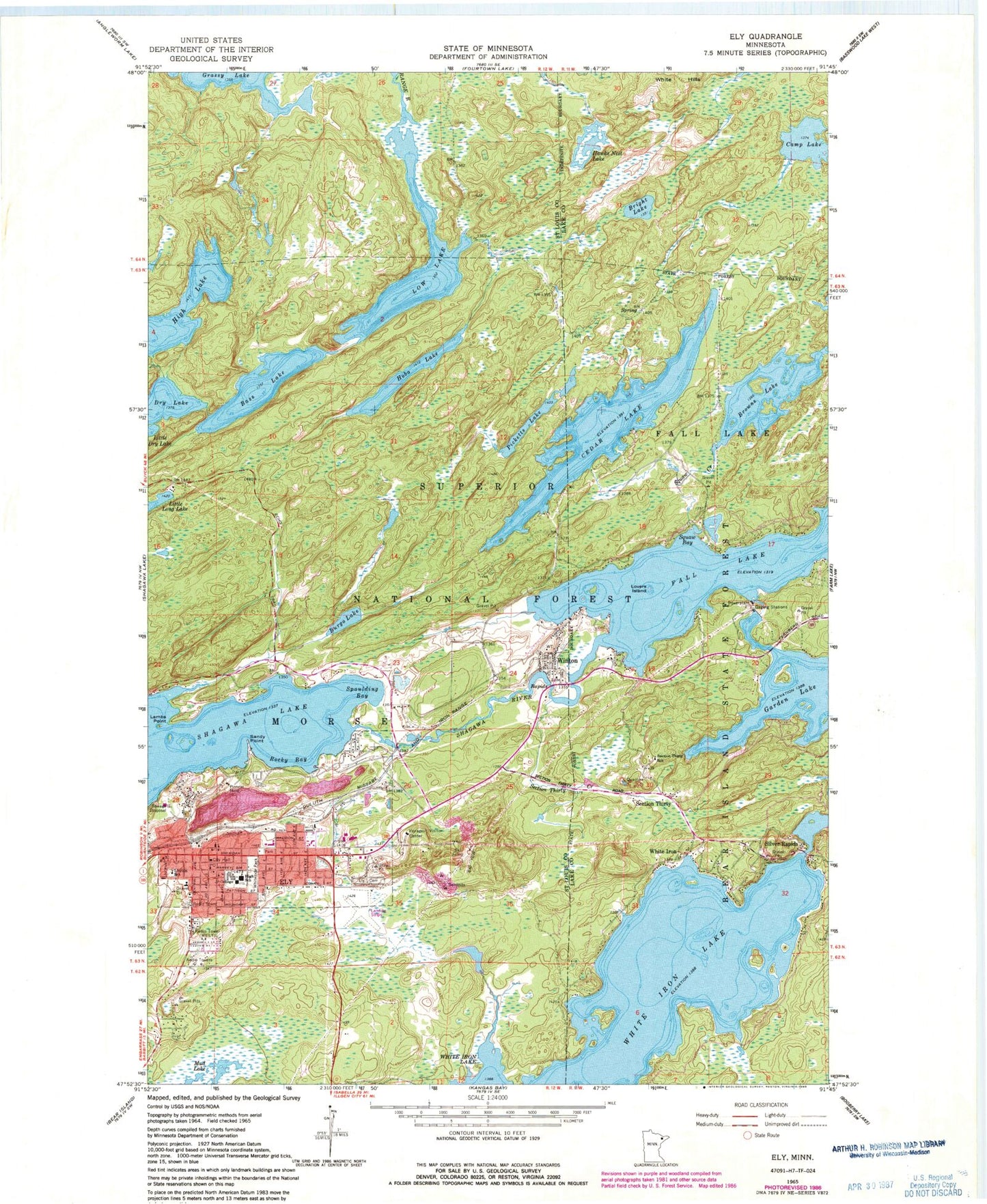
Classic USGS Ely Minnesota 7.5'x7.5' Topo Map
Couldn't load pickup availability
Historical USGS topographic quad map of Ely in the state of Minnesota. Typical map scale is 1:24,000, but may vary for certain years, if available. Print size: 24" x 27"
This quadrangle is in the following counties: Lake, St. Louis.
The map contains contour lines, roads, rivers, towns, and lakes. Printed on high-quality waterproof paper with UV fade-resistant inks, and shipped rolled.
Contains the following named places: Bright Lake, Browns Lake, Camp Lake, Hawks Nest Lake, Lovers Island, Section Thirty, Section Thirty School, Silver Rapids, Mist Bay, Fall Creek, White Hills, White Iron, WELY-AM (Ely), Ely Bloomenson Heliport, Bass Lake, Burgo Lake, Cedar Lake, Dry Lake, Ely, Ely Cemetery, Hobo Lake, Lambs Point, Lincoln School, Low Lake, Picketts Lake, Pioneer Mine, Rocky Bay, Sandy Point, Section Thirty Creek, Shagawa River, Spaulding Bay, Voyageur Vistor Center, Whiteside Park, Winton, Winton Dam, Garden Lake, Silver Rapids Lodge and Campground, Section Thirty Post Office (historical), Sellwood Post Office (historical), Winton Post Office (historical), Winton Station, Jehovahs Witnesses, Berean Baptist Church, Word Church, Praise Fellowship Center, First Presbyterian Church, Grace Lutheran Church, First Lutheran Church, United Methodist Church, Saint Anthonys Catholic Church, Ely Gospel Tabernacle Church, Ely Baptist Church, Ely Public Library, Northern Terrace Mobile Home Park, Duluth Clinic-Ely, Ely - Bloomenson Community Hospital, Ely Station (historical), Ely Post Office, Ely-Winton History Museum, Vermilion Community College, Ely Golf Club, Ely City Hall, Ely Fire Department, Ely Police Department, Saint Louis County Sheriff's Office, Trezona Trail, Miners Lake, City of Ely, City of Winton, Morse Fire Department, Ely Area Ambulance, Ely Police Department