MyTopo
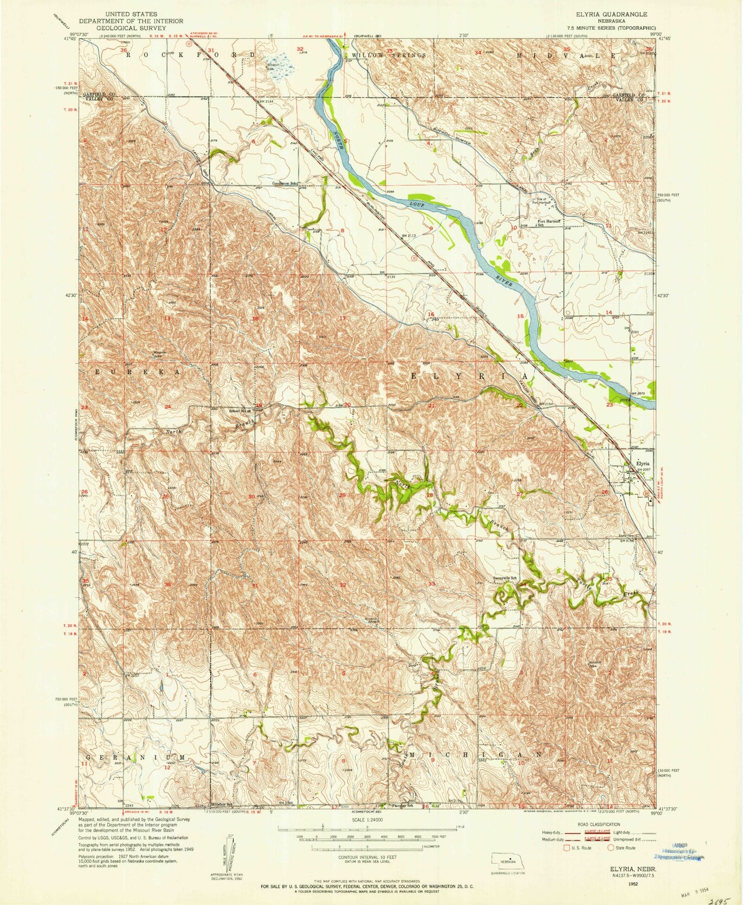
Classic USGS Elyria Nebraska 7.5'x7.5' Topo Map
Couldn't load pickup availability
Historical USGS topographic quad map of Elyria in the state of Nebraska. Map scale may vary for some years, but is generally around 1:24,000. Print size is approximately 24" x 27"
This quadrangle is in the following counties: Garfield, Valley.
The map contains contour lines, roads, rivers, towns, and lakes. Printed on high-quality waterproof paper with UV fade-resistant inks, and shipped rolled.
Contains the following named places: Bean Creek, Calamus Townsite Historical Marker, Elyria, Elyria Cemetery, Elyria Post Office, Elyria Public School, Fairplay School, Fort Hartsuff Historical Park, Fort Hartsuff School, Goodenow, Goodenow School, Hillsdale School, Larsen-Schwartzlander Dam, Larsen-Schwartzlander Reservoir, North Branch Turtle Creek, Saint Marys Catholic Church Historical Marker, School Number 48, South Branch Turtle Creek, Sunnyside School, Township of Elyria, Village of Elyria, ZIP Code: 68837