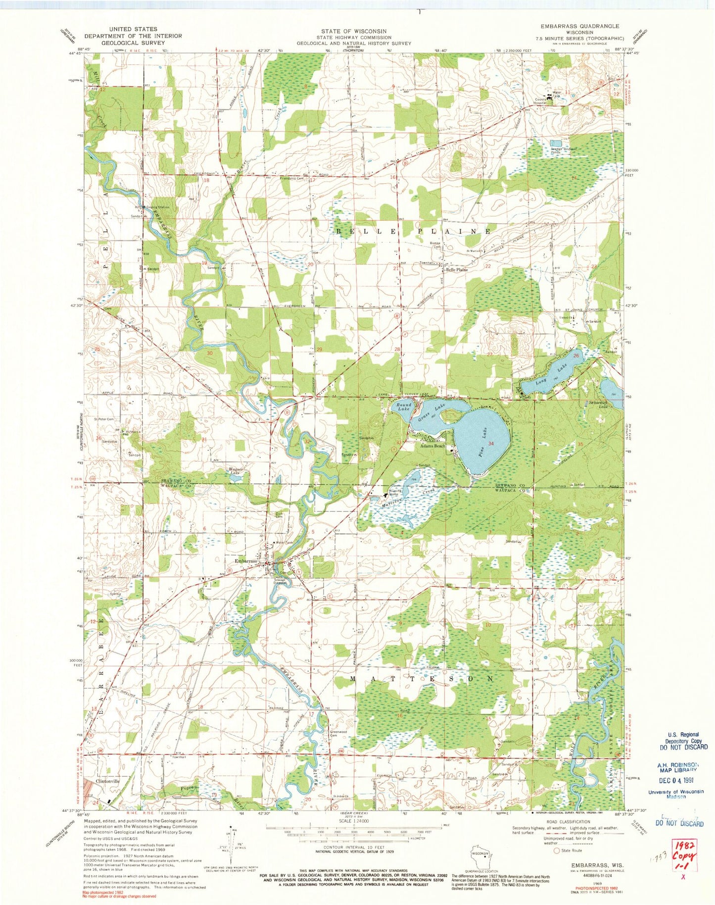
MyTopo
Classic USGS Embarrass Wisconsin 7.5'x7.5' Topo Map
Couldn't load pickup availability
Historical USGS topographic quad map of Embarrass in the state of Wisconsin. Map scale may vary for some years, but is generally around 1:24,000. Print size is approximately 24" x 27"
This quadrangle is in the following counties: Shawano, Waupaca.
The map contains contour lines, roads, rivers, towns, and lakes. Printed on high-quality waterproof paper with UV fade-resistant inks, and shipped rolled.
Contains the following named places: Adams Beach, Adams Beach Census Designated Place, Beaver Creek, Belle Plaine, Big Lake, Bomke Cemetery, Embarrass, Embarrass Post Office, Embarrass Volunteer Fire Department, Friendship Cemetery, Grass Lake, Greenwood Cemetery, Long Lake, Matteson Creek, Mill Creek, Pine Lake, Roosevelt School, Round Lake, Saint Johns Church, Saint Martin Church, Saint Peter Cemetery, Saint Peter Church, Schoenick Lake, Shawano Area Fire Department Station 3, Town of Belle Plaine, Town of Matteson, United Church, Village of Embarrass, Wagner Lake, Wolf River School, Woodland School, Zion Lutheran Cemetery, ZIP Codes: 54929, 54933