MyTopo
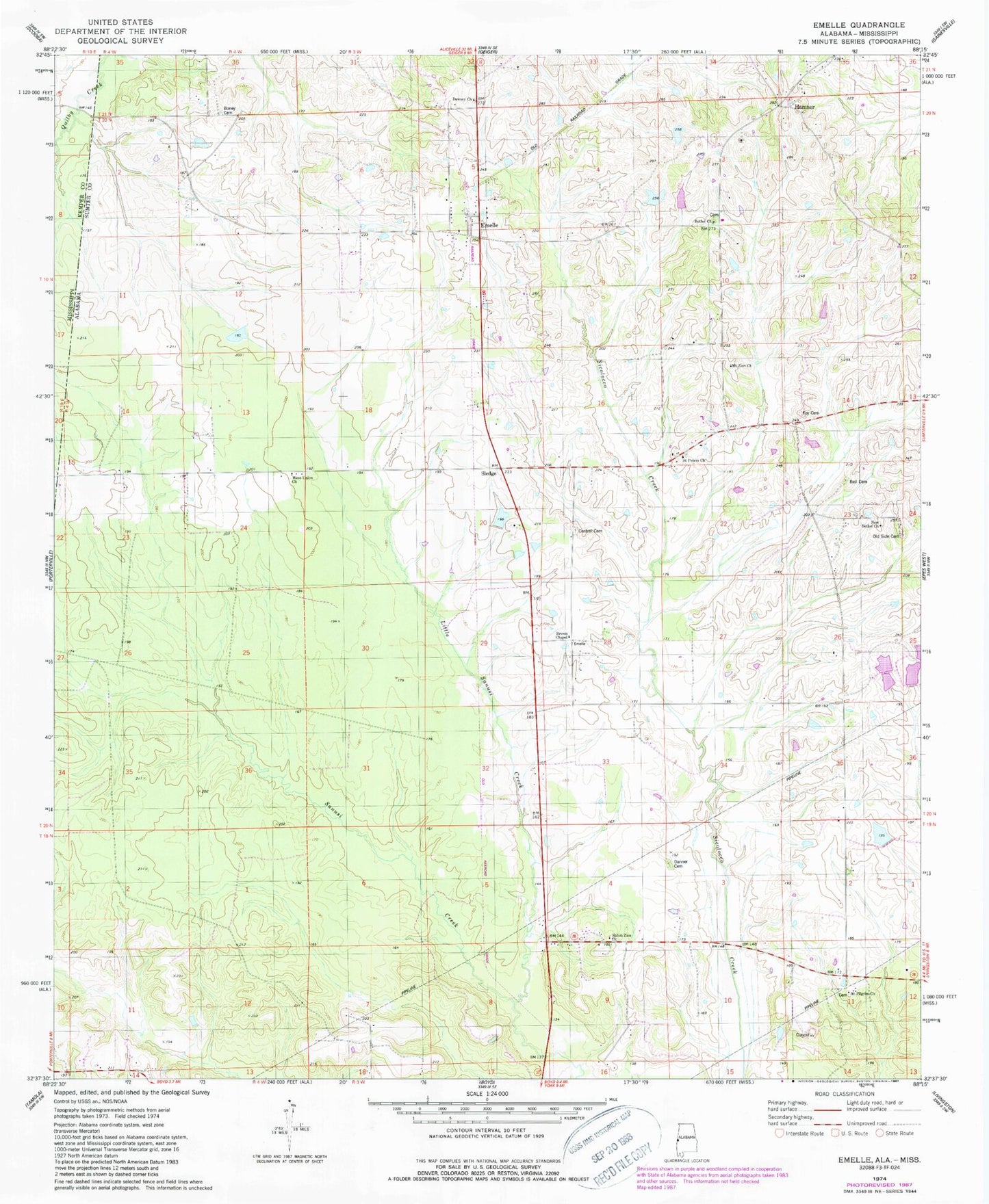
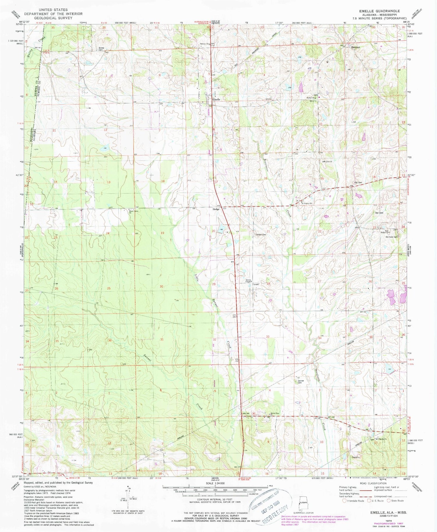
Classic USGS Emelle Alabama 7.5'x7.5' Topo Map
Couldn't load pickup availability
Historical USGS topographic quad map of Emelle in the state of Alabama. Map scale may vary for some years, but is generally around 1:24,000. Print size is approximately 24" x 27"
This quadrangle is in the following counties: Kemper, Sumter.
The map contains contour lines, roads, rivers, towns, and lakes. Printed on high-quality waterproof paper with UV fade-resistant inks, and shipped rolled.
Contains the following named places: Bell Cemetery, Bethel, Bethel Church, Boney Cemetery, Brown Chapel, C E Boyd Dam, C E Boyd Lake, Central Cemetery, Danner Cemetery, Dawsey Church, Emelle, Emelle Church, Emelle Post Office, Emelle Volunteer Fire Department, Grindstone Prairie, Hamner, Hutchenson Cemetery, Little Sanusi Creek, Looksookolo Creek, Mount Pilgrim Primitive Baptist Church, Mount Pilgrim School, Mount Zion Baptist Church, Mount Zion School, New Bethel Church, Old Side Cemetery, Roy Cemetery, Saint Peters Church, Shiloh Zion Baptist Church, Sledge, Sumter School, Sun Light Baptist Church, Town of Emelle, West Union Baptist Church