MyTopo
Classic USGS Emeralda Island Florida 7.5'x7.5' Topo Map
Couldn't load pickup availability
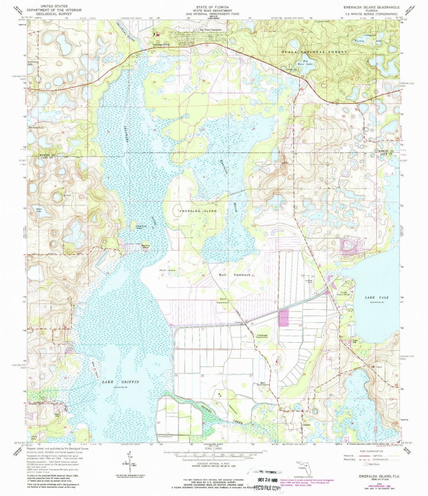
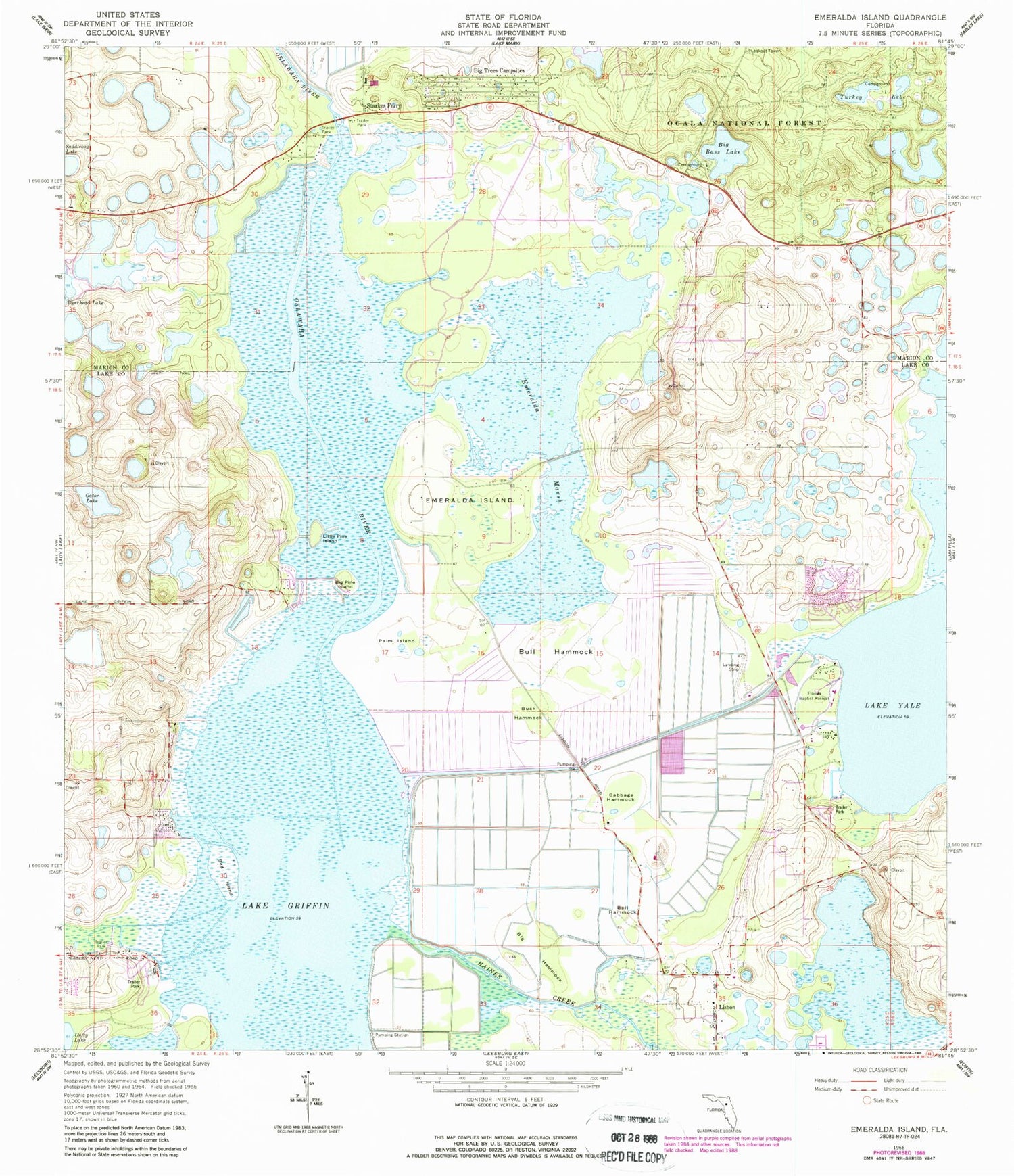
Historical USGS topographic quad map of Emeralda Island in the state of Florida. Typical map scale is 1:24,000, but may vary for certain years, if available. Print size: 24" x 27"
This quadrangle is in the following counties: Lake, Marion.
The map contains contour lines, roads, rivers, towns, and lakes. Printed on high-quality waterproof paper with UV fade-resistant inks, and shipped rolled.
Contains the following named places: Bell Hammock, Big Bass Lake, Big Hammock, Big Pine Island, Big Trees Campsites, Bird Island, Buck Hammock, Bull Hammock, Cabbage Hammock, Emeralda Island, Emeralda Marsh, Florida Baptist Retreat, Gator Lake, Little Pine Island, Palm Island, Starkes Ferry, Turkey Lake, Eagles Nest, Lake Yale Baptist Assembly, Emeralda, South Tower (historical), Big Bass Lake Recreation Site, Island Ponds, Island Ponds Recreation Site, Linadale, Eustis Muck Farms Incorporated Airport (historical), Fly'n R Ranch Airport (historical), Flying Exotics Airport (historical), Lisbon Church of God, North Lake Chapel, Lisbon Census Designated Place, Fishermans Wharf Mobile Home Park, Sunlake Estates Mobile Park, Sandpiper Mobile Home Manor, Pipers Fish Camp Marina, Blue Heron Cove Marina, Marion County Fire Rescue South Forest Station 6