
MyTopo
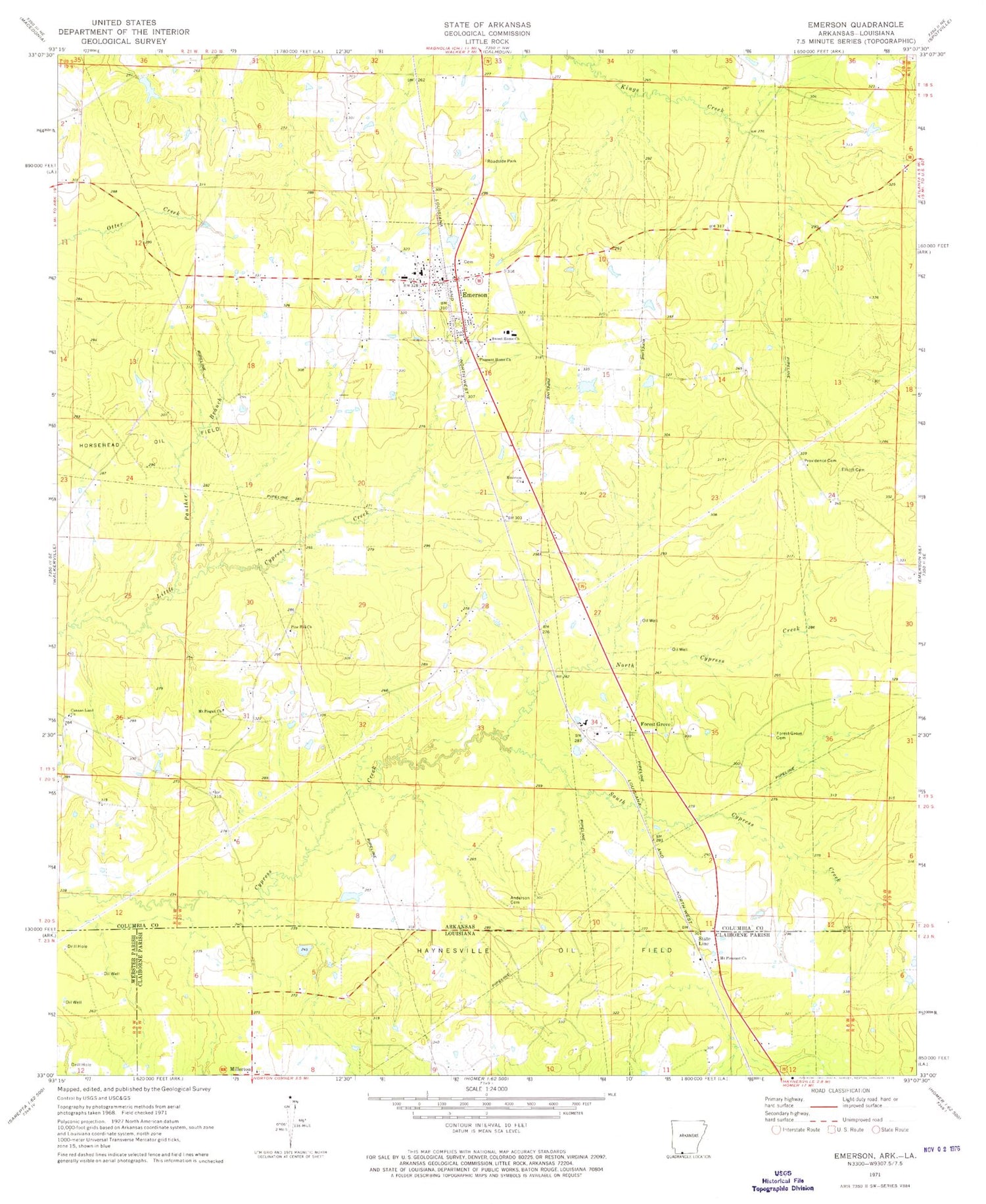
Classic USGS Emerson Arkansas 7.5'x7.5' Topo Map
Couldn't load pickup availability
Historical USGS topographic quad map of Emerson in the states of Arkansas, Louisiana. Map scale may vary for some years, but is generally around 1:24,000. Print size is approximately 24" x 27"
This quadrangle is in the following counties: Claiborne, Columbia, Webster.
The map contains contour lines, roads, rivers, towns, and lakes. Printed on high-quality waterproof paper with UV fade-resistant inks, and shipped rolled.
Contains the following named places: Anderson Cemetery, Canaan Land Church, Cross Roads Church, Elliott Cemetery, Emerson, Emerson Church, Emerson Elementary School, Emerson High School, Emerson Post Office, Emerson Volunteer Fire Department, Forest Grove, Forest Grove Cemetery, Forest Grove Church, Haynesville Oil Field, Hopewell School, Horsehead Oil Field, Millerton, Mohawk, Mount Pisgah United Methodist Church, Mount Pleasant Church, Mount Pleasant School, North Cypress Creek, Panther Branch, Pine Hill Church, Pisgah School, Pleasant Home Church, Providence Cemetery, Providence Church, Rucks Spur, Sale Lake, Sale Lake Dam, Soco, South Cypress Creek, State Line, State Line School, Sweet Home Church, Town of Emerson, Township of Emerson, Township of Moss, Wood School, ZIP Code: 71740


