MyTopo
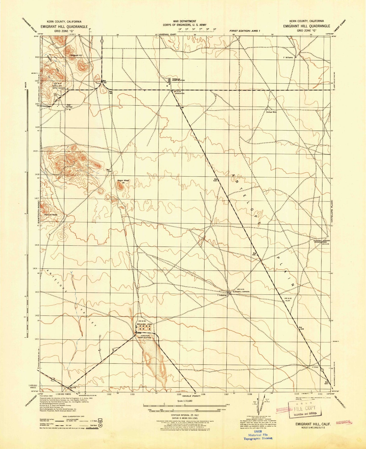
Classic USGS Emigrant Hill California 7.5'x7.5' Topo Map
Regular price
$16.95
Regular price
Sale price
$16.95
Unit price
per
Couldn't load pickup availability
Historical USGS topographic quad map of Emigrant Hill in the state of California. Map scale may vary for some years, but is generally around 1:24,000. Print size is approximately 24" x 27"
This quadrangle is in the following counties: Kern.
The map contains contour lines, roads, rivers, towns, and lakes. Printed on high-quality waterproof paper with UV fade-resistant inks, and shipped rolled.
Contains the following named places: Antelope Valley, Bitterwater Creek, Blackwells Corner Oil Field, Emigrant Hill, Hannah Ranch, Junction Pumping Station, Mount Vernon, Salt Spring, Temblor Pumping Station, Wagon Wheel Mountain, Welcome Valley, Wonderful Pistachios & Almonds Airport