
MyTopo
Classic USGS Emily Minnesota 7.5'x7.5' Topo Map
Couldn't load pickup availability
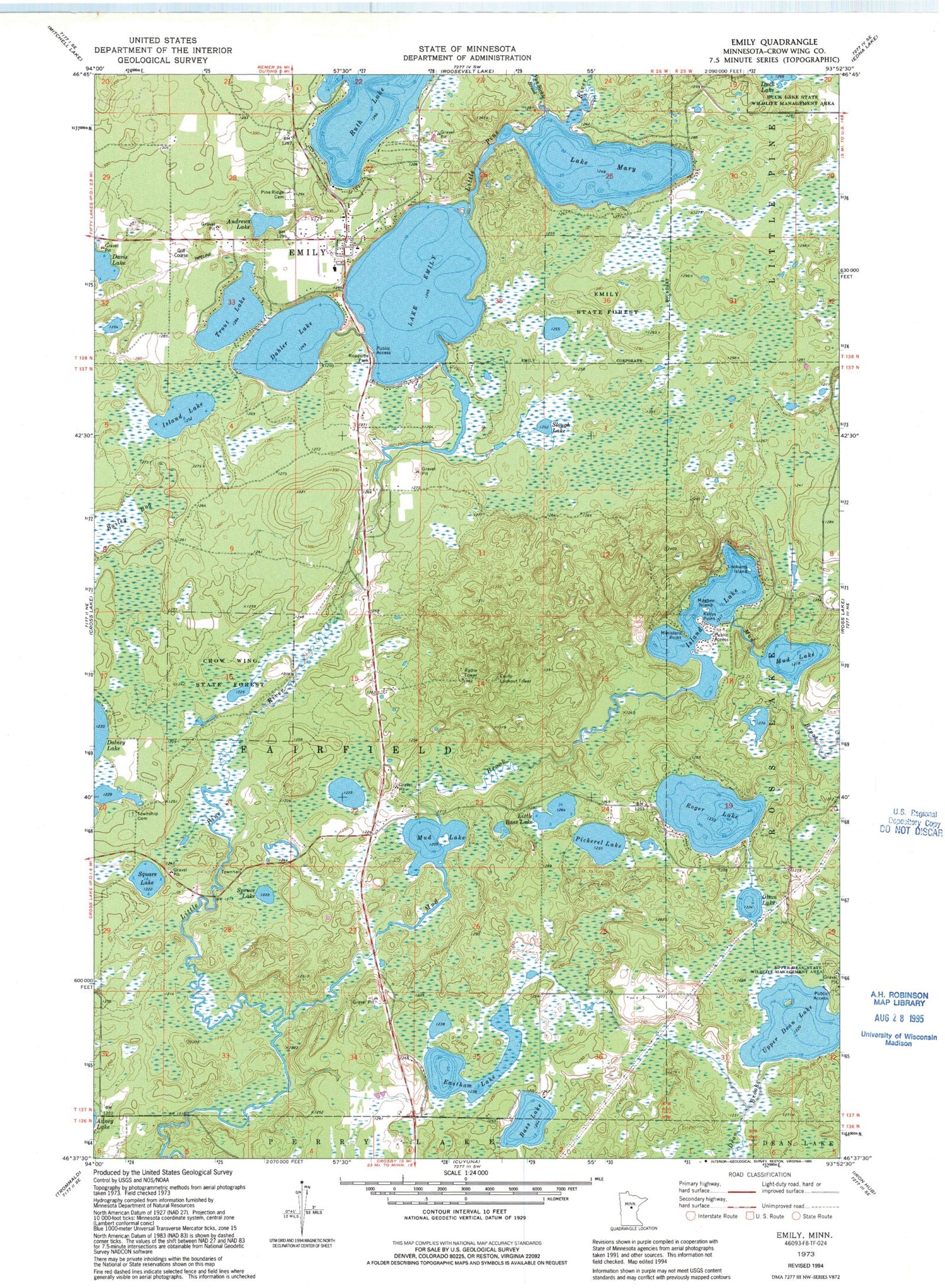
Historical USGS topographic quad map of Emily in the state of Minnesota. Typical map scale is 1:24,000, but may vary for certain years, if available. Print size: 24" x 27"
This quadrangle is in the following counties: Crow Wing.
The map contains contour lines, roads, rivers, towns, and lakes. Printed on high-quality waterproof paper with UV fade-resistant inks, and shipped rolled.
Contains the following named places: Andrews Lake, Bailey Bog, Bass Lake, Dahler Lake, Eastham Lake, Emily State Forest, Island Lake, Kellys Point, Little Bass Lake, Lookums Island, Magbee Island, Lake Mary, Ministers Point, Mud Brook, Mud Lake, Mud Lake, Olson Lake, Pickerel Lake, Pine Ridge Cemetery, Roger Lake, Slough Lake, Spruce Lake, Square Lake, Trout Lake, Upper Dean Lake, Upper Dean State Wildlife Management Area, Emily, Ruth Lake, Van Sickle Brook, Emily Lookout Tower, Township of Fairfield, Emily Lake Dam, Lake Emily, Island Lake Dam, Island Lake, Lake Emily Resort and Campground, Saint Emily Catholic Church, Emily City Hall, Emily Post Office, Fairfield Cemetery, Emily Greens Golf Course, Emily Wayside Park, Emily Volunteer Fire Department, Emily Police Department


