MyTopo
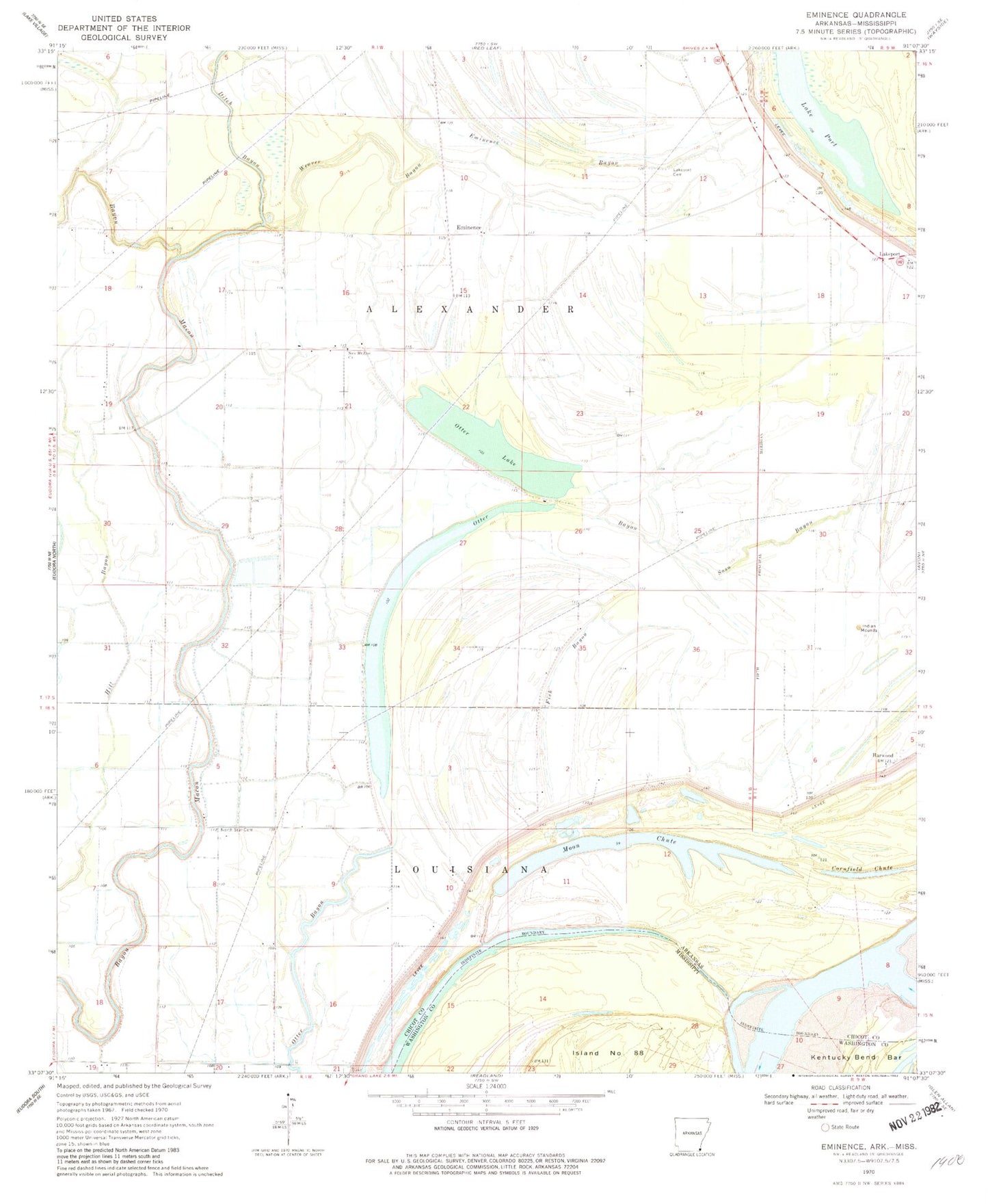
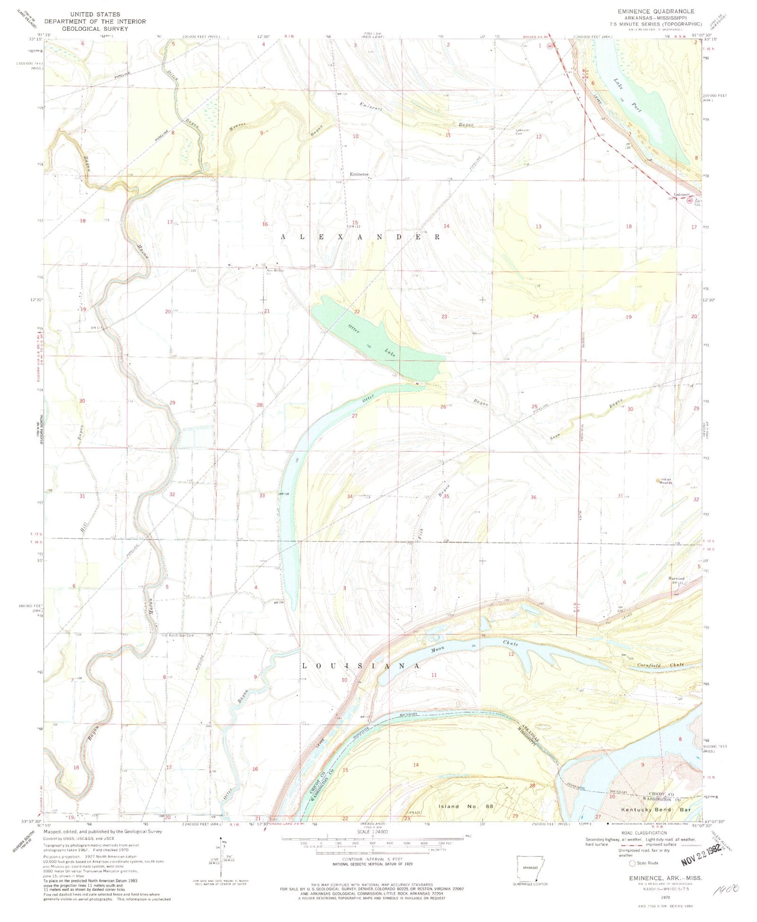
Classic USGS Eminence Arkansas 7.5'x7.5' Topo Map
Couldn't load pickup availability
Historical USGS topographic quad map of Eminence in the states of Arkansas, Mississippi. Map scale may vary for some years, but is generally around 1:24,000. Print size is approximately 24" x 27"
This quadrangle is in the following counties: Chicot, Washington.
The map contains contour lines, roads, rivers, towns, and lakes. Printed on high-quality waterproof paper with UV fade-resistant inks, and shipped rolled.
Contains the following named places: Daughters of Little Rock Church, Ditch Bayou, Eminence, Eminence Bayou, Fish Bayou, Grand Lake Revetment, Harwood, Howard Island, Island Number 87, King Solomon Church, Lake Port, Lakeport, Lakeport Cemetery, Matthews Bend, Moon Chute, Mosswood Landing, New Hope Church, New Mount Zion Church, North Star Cemetery, North Star Church, Otter Bayou, Otter Lake, Pilgrims Rest Church, Point Moore Landing, Scaife, Scaife School, Soso Bayou, Township of Alexander, Weaver Bayou, Worthington Point, Worthington Towhead