MyTopo
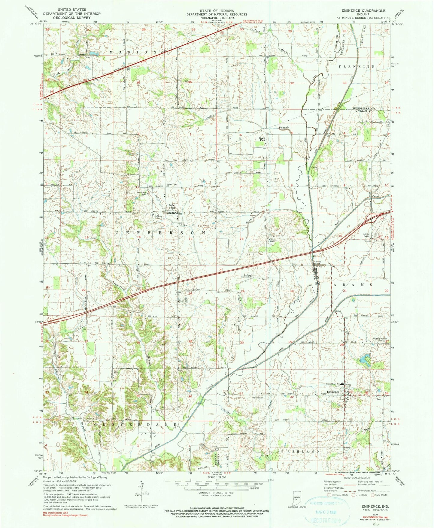
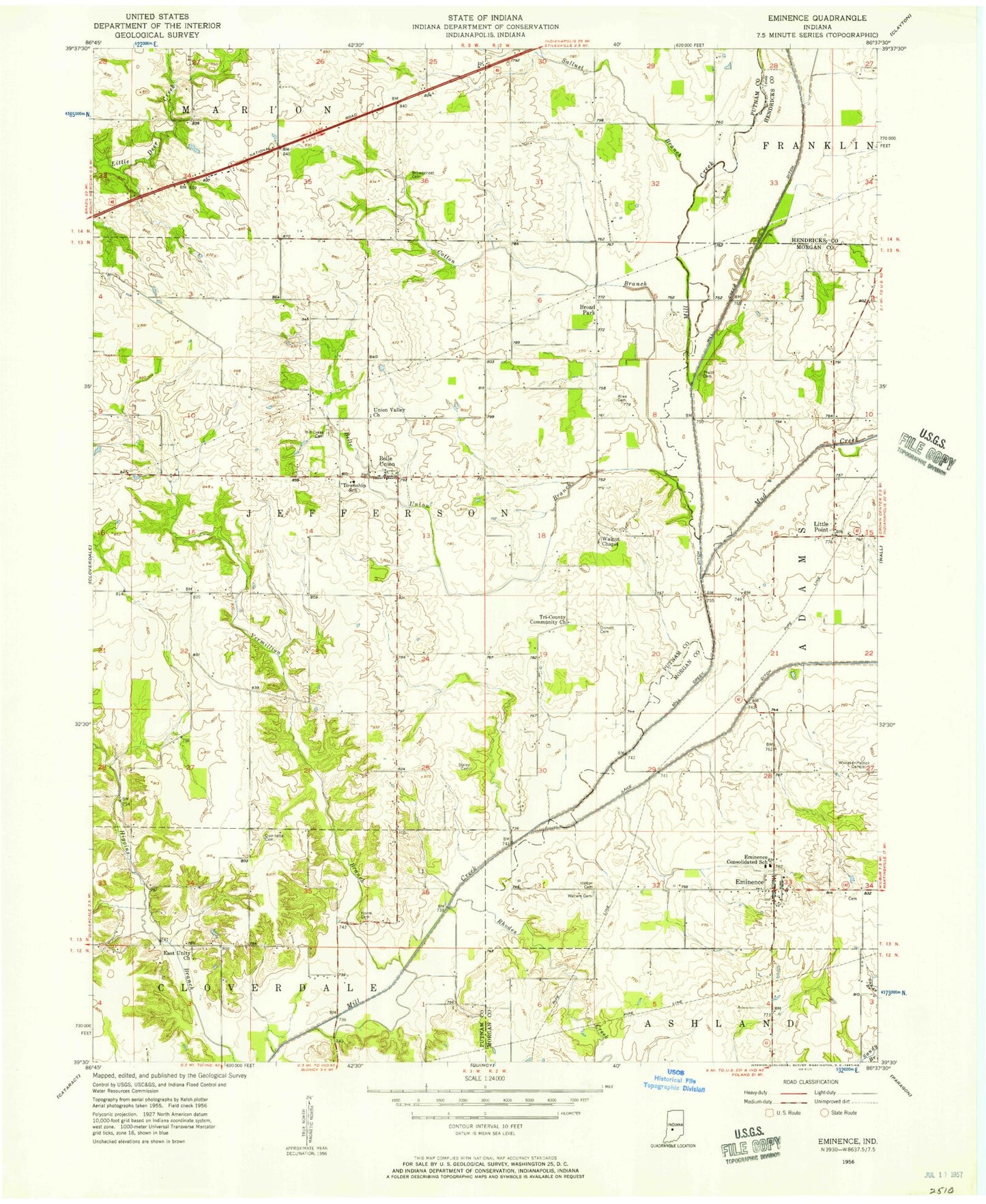
Classic USGS Eminence Indiana 7.5'x7.5' Topo Map
Couldn't load pickup availability
Historical USGS topographic quad map of Eminence in the state of Indiana. Map scale may vary for some years, but is generally around 1:24,000. Print size is approximately 24" x 27"
This quadrangle is in the following counties: Hendricks, Morgan, Putnam.
The map contains contour lines, roads, rivers, towns, and lakes. Printed on high-quality waterproof paper with UV fade-resistant inks, and shipped rolled.
Contains the following named places: A and A Township Fire Station 11, A and A Township Volunteer Fire Department, A and A Township Volunteer Fire Department Station 2, Belle Union, Belle Union Branch, Belle Union Branch Cemetery, Belle Union Elementary School, Board Park, Broad Park, Cotton Branch, Eminence, Eminence Consolidated School, Eminence Post Office, Jefferson Township Volunteer Fire Department, Little Point, Mill Creek Cemetery, Mill Creek Ditch, Mud Creek, Pam's Place Airport, Plum Creek, Rhodes Creek, Sallust Branch, Township of Jefferson, Tri-County Community Church, Union Branch, Union Valley Church, Vermillion Branch, Walnut Chapel, Walters Cemetery, Whispering Wind Lake, Whispering Wind Lake Dam, Whitaker - Patrick Cemetery, ZIP Code: 46125