MyTopo
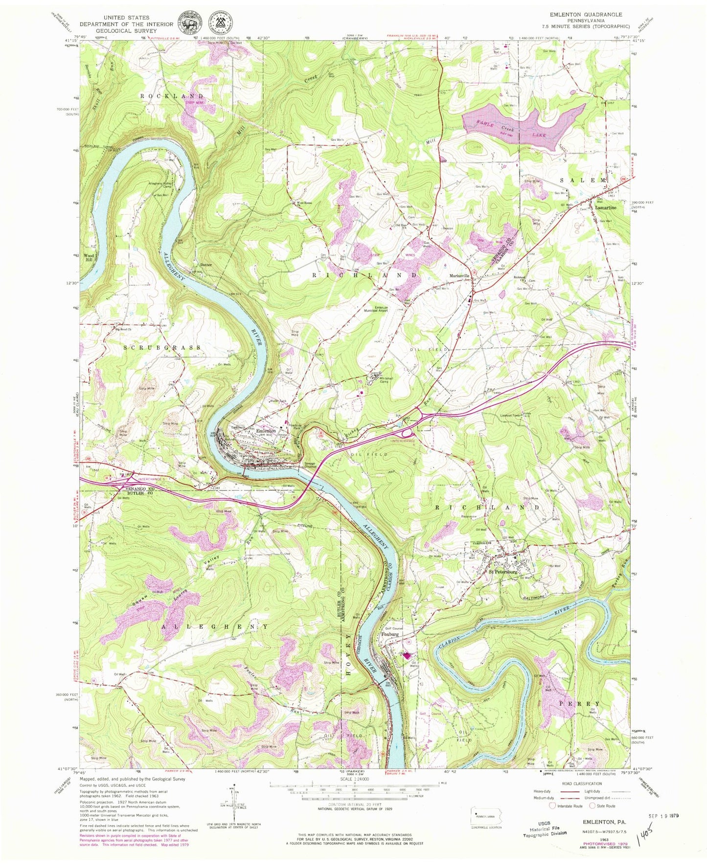
Classic USGS Emlenton Pennsylvania 7.5'x7.5' Topo Map
Couldn't load pickup availability
Historical USGS topographic quad map of Emlenton in the state of Pennsylvania. Typical map scale is 1:24,000, but may vary for certain years, if available. Print size: 24" x 27"
This quadrangle is in the following counties: Armstrong, Butler, Clarion, Venango.
The map contains contour lines, roads, rivers, towns, and lakes. Printed on high-quality waterproof paper with UV fade-resistant inks, and shipped rolled.
Contains the following named places: Allegheny Valley Camp, Big Bend Church, Emlenton, Fowler Run, Foxburg, Lamartine, Mariasville, Mill Creek, Old Zion Church, Richey Run, Richland Church, Squaw Valley, Turkey Run, West Home Church, Whitehall Camp, Lowrey Run, Hunts Cove Airport, Emlenton Municipal Airport (historical), Kahle Lake, Kahle Lake Dam, Wood Hill, Barricks Run, Alum Rock, Dotter, Keefer Mill, Foxburg Golf Course, Allegheny Clarion Valley High School, Saint Petersburg Elementary School, Emlenton Elementary School, Kahle Tower, Sandy Point, Hoodville, Distlers Corners, Saint Petersburg, Borough of Foxburg, Borough of Saint Petersburg, Township of Hovey, Township of Allegheny, Township of Richland, Township of Richland, Borough of Emlenton, Emlenton Fire Department Station 55, Saint Petersburg Volunteer Fire Company Station 650, Foxburg Volunteer Fire Department Station 550, Emlenton Area Ambulance Service, Emlenton Post Office, Foxburg Post Office, Lamartine Post Office, Saint Petersburg Post Office, Memorial Episcopal Church of Our Father Cemetery, Emlenton Borough Police Department, Richland Presbyterian Cemetery, Saint Petersburg Cemetery, Salem Lutheran Church Cemetery, Salem United Church of Christ Cemetery