MyTopo
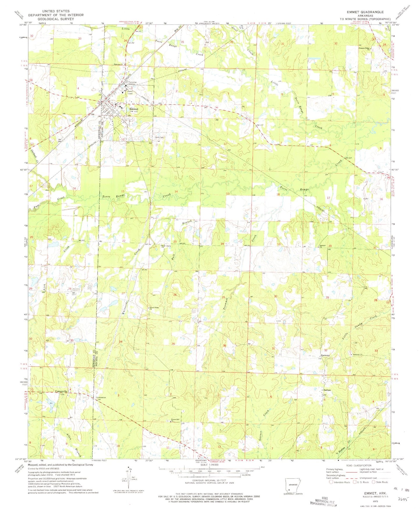
Classic USGS Emmet Arkansas 7.5'x7.5' Topo Map
Couldn't load pickup availability
Historical USGS topographic quad map of Emmet in the state of Arkansas. Map scale may vary for some years, but is generally around 1:24,000. Print size is approximately 24" x 27"
This quadrangle is in the following counties: Hempstead, Nevada.
The map contains contour lines, roads, rivers, towns, and lakes. Printed on high-quality waterproof paper with UV fade-resistant inks, and shipped rolled.
Contains the following named places: Antioch Church, Antioch School, Briant Cemetery African American, Bull Branch, Catfish Pond, Catfish Pond Dam, Centerville, City of Emmet, Clayton, Emmet, Emmet Elementary School, Emmet Fire Station, Emmet High School, Emmet Post Office, Ephesus Church, Ephesus Church Cemetery, Fairview Church, Forest Hill Church, Forest Hill Church Cemetery, Garland Creek, Harmony, Harmony Church Cemetery, Harmony United Methodist Church, KHPA-FM (Hope), Lick Creek, Little Terre Rouge Creek, Macedonia Church, May Creek, New Liberty Missionary Baptist Church, New Liberty School, Pate Creek, Pine Creek, Pleasant Ridge Church, Rocky Mound Pond, Rocky Mound Pond Dam, Rolling Hills Pond, Rolling Hills Pond Dam, Snell Cemetery, Steel Creek, Sutton, Sweet Home United Methodist Church, Township of Albany, Township of Emmet, Trammel Creek, Vickers Creek, Whiteside Creek, ZIP Code: 71835