
MyTopo
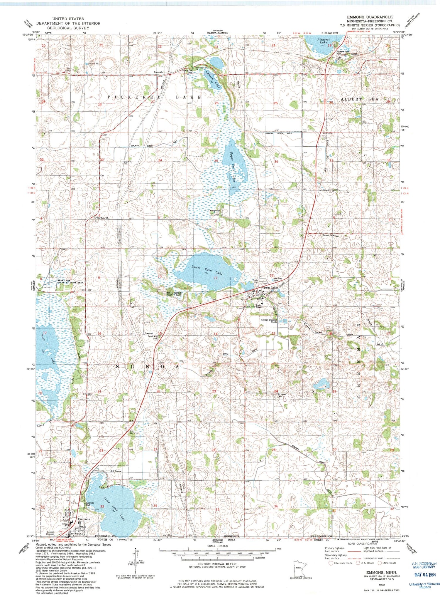
Classic USGS Emmons Minnesota 7.5'x7.5' Topo Map
Couldn't load pickup availability
Historical USGS topographic quad map of Emmons in the state of Minnesota. Map scale may vary for some years, but is generally around 1:24,000. Print size is approximately 24" x 27"
This quadrangle is in the following counties: Freeborn.
The map contains contour lines, roads, rivers, towns, and lakes. Printed on high-quality waterproof paper with UV fade-resistant inks, and shipped rolled.
Contains the following named places: Ann and Leo Donahue Wildlife Management Area, Arrowhead Golf and Country Club, Bear Lake, Bear Lake Church, Bear Lake Concordia Lutheran Cemetery, Bear Lake Dam, Bear Lake School, Bear Lake State Wildlife Management Area, Brush Hill Cemetery, Church Lake, City of Emmons, City of Twin Lakes, Clover School, Emmons, Emmons Fire Department, Emmons Lutheran Church, Emmons Post Office, Emmons Trailer Court, Everhart Lake, Flamme School, Flaten School, Freeborn County Waterfowl Production Area, Gateway Park, Glenville-Emmons Public School, Hayne School, Jeklyn School, Judicial Ditch Number Nine, KQPR-FM (Albert Lea), Lakeview Mobile Home Park, Lower Twin Lake, Lunder Church, Lunder Lutheran Cemetery, Oak Knoll School, Pickerel Lake Church, Pickerel Lake Park, Saint James Catholic Church, Saint James Cemetery, Shady Oak Cemetery, State Line Lake, Sunnyside School, Township of Nunda, Twin Lakes, Twin Lakes City Hall, Twin Lakes Fire Department, Twin Lakes Post Office, Twin Lakes School, Upper Twin Lake, White Woods County Park, ZIP Code: 56089


