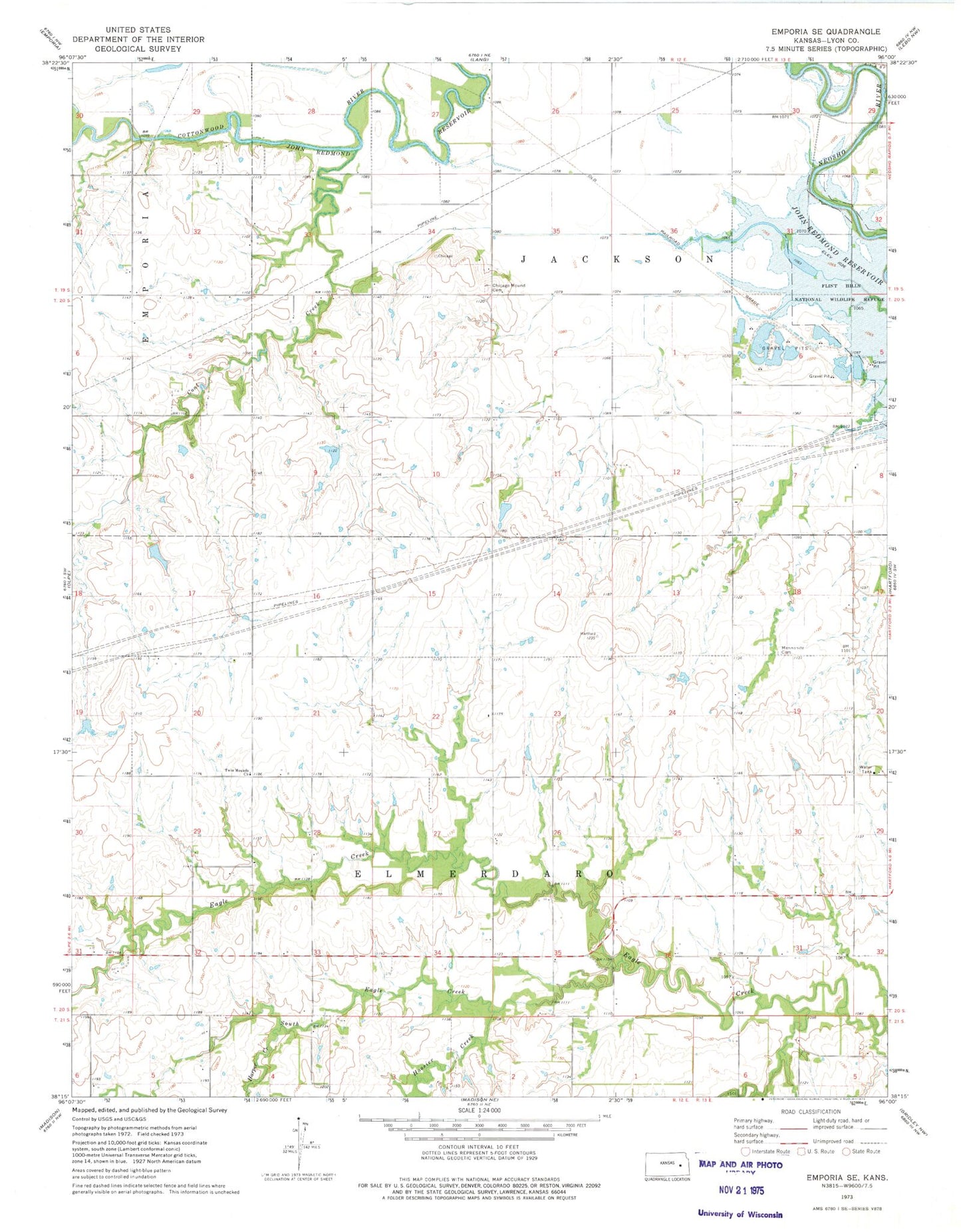
MyTopo
Classic USGS Emporia SE Kansas 7.5'x7.5' Topo Map
Regular price
$16.95
Regular price
Sale price
$16.95
Unit price
per
Couldn't load pickup availability
Historical USGS topographic quad map of Emporia SE in the state of Kansas. Map scale may vary for some years, but is generally around 1:24,000. Print size is approximately 24" x 27"
This quadrangle is in the following counties: Lyon.
The map contains contour lines, roads, rivers, towns, and lakes. Printed on high-quality waterproof paper with UV fade-resistant inks, and shipped rolled.
Contains the following named places: Chicago Mound Cemetery, Coal Creek, Dry Creek, Gardner Farms, Haag Farms, Harper Creek, Hoosier Creek, KANH - FM (Emporia), KVoe - FM (Emporia), Lazy H Farms, Mautz Farm, Mennonite Cemetery, South Eagle Creek, Twin Mounds Church, Wyckoff