MyTopo
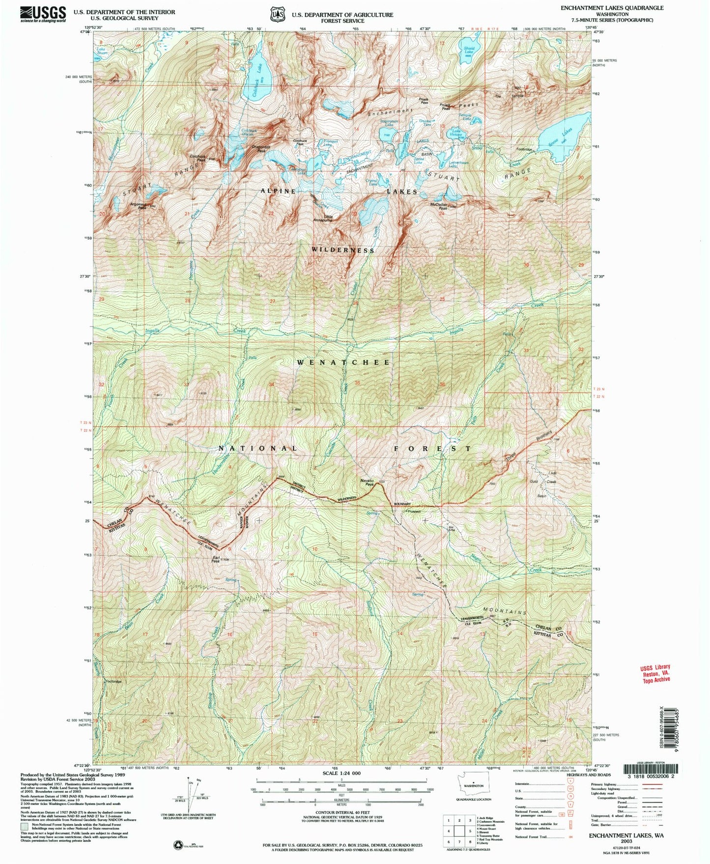
USGS Classic Enchantment Lakes Washington 7.5'x7.5' Topo Map
Couldn't load pickup availability
Historical USGS topographic quad map of Enchantment Lakes in the state of Washington. Scale: 1:24000. Print size: 24" x 27"
This quadrangle is in the following counties: Chelan, Kittitas.
The map contains contour lines, roads, rivers, towns, lakes, and grids including latitude / longitude and UTM / MGRS. Printed on high-quality waterproof paper with UV fade-resistant inks.
Contains the following named places: Cascade Creek, Colchuck Lake, Colchuck Trail, County Line Trail, Crystal Creek, Earl Peak, Enchantment Lakes, Enchantment Peaks, Falls Creek, Fourth Creek, Gold Creek Basin, Hardscrable Creek, Inspiration Lake, Isolation Lake, Lake Stuart Trail, Miller Peak Trail, Navaho Peak, Perfection Lake, Porcupine Creek, Shield Lake, Snow Creek Glacier, Snow Lakes, Sprite Lake, Stuart Range, Temple Lake, The Temple, Three Brothers, Tranquil Lake, Wenatchee Mountains, Dragontail Peak, Colchuck Glacier, Prusik Peak, Prusik Pass, Gnome Tarn, Lower Enchantment Lakes, Upper Enchantment Lakes, Leprechaun Lake, Argonaut Peak, Colchuck Peak, Little Annapurna, McClellan Peak, Enchantment Basin, Lake Viviane, Enchantment Pass, Colchuck Lake Dam, Colchuck Pass